Awala-Yalimapo

Last updated
Awala-Yalimapo
Awala-Yalimapo.jpg
Settlement of Yalimapo as seen from the beach of Plage des Hattes
Locator map of Awala-Yalimapo 2022.png
Location of the commune (in red) within French Guiana
Location of Awala-Yalimapo
Awala-Yalimapo
Coordinates: 5°44′28″N53°55′40″W / 5.7411°N 53.9278°W / 5.7411; -53.9278
Country France
Overseas region and department French Guiana
Arrondissement Saint-Laurent-du-Maroni
Intercommunality CC Ouest Guyanais
Government
  Mayor (20202026) Jean-Paul Féreira [1]
Area
1
187.4 km2 (72.4 sq mi)
Population
 (2022) [2]
1,549
  Density8.3/km2 (21/sq mi)
Time zone UTC−03:00
INSEE/Postal code
97361 /97319
1 French Land Register data, which excludes lakes, ponds, glaciers > 1 km2 (0.386 sq mi or 247 acres) and river estuaries.

Awala-Yalimapo (French pronunciation: [awalajalimapo] ) is a commune on the north coast of French Guiana, close to the border with Suriname. The seat of the commune is the settlement of Awala where the town hall is located. Other settlements in the commune are: Yalimapo, Ayawande, and Piliwa. The majority of the inhabitants are Kaliña Amerindian people. [3]

Contents

History

The Kalina people have been living along the Maroni River since before the European colonization. In 1596, Lawrence Kemys noted that Iaremappo, a big village, was located near the mouth of the river. European diseases reduced the number of Kalinas in the area to several hundred in the mid 19th century. In 1858, the Hattes penal colony was established in the region and operated until 1950. [4]

In the late 1940s, Amerindians from Pointe Isère founded the village of Awala. In 1950, families from Ayawande and Galibi in Suriname founded the village of Yalimapo. [4]

The commune of Awala-Yalimapo was created on 31 December 1988 by detaching its territory from the commune of Mana. The commune is a protected area for its ecology, flora, and fauna (ZNIEFF). [3]

In 1987, Jacques Chirac as Prime Minister established Zones of Collective Use Rights (ZDUC). [5] Since 1998, the commune has 1,593 hectares of communal land located in Point Isère to be used for fishing, hunting and subsistence farming. [6]

Nature

Leatherback Sea Turtle laying her eggs (2013) Sylvain and Jean watching the egg laying of a Leatherback Sea Turtle (Dermochelys coriacea) (10629903575).jpg
Leatherback Sea Turtle laying her eggs (2013)

Awala and Yalimapo are French Guiana's northernmost settlements, located just to the south of the région's northernmost point, the beach of Plage des Hattes, the world's largest leatherback turtle nesting site. [7] The Amana Nature Reserve has been established in 1998 to protect the turtles. The reserve covers 14,800 hectares. [8]

See also

Related Research Articles

<span class="mw-page-title-main">Aluku</span> Maroon nation in Suriname and French Guiana

The Aluku are a Bushinengue ethnic group living mainly on the riverbank in Maripasoula in southwest French Guiana. The group are sometimes called Boni, referring to the 18th-century leader, Bokilifu Boni.

<span class="mw-page-title-main">Saint-Laurent-du-Maroni</span> Subprefecture and commune in French Guiana, France

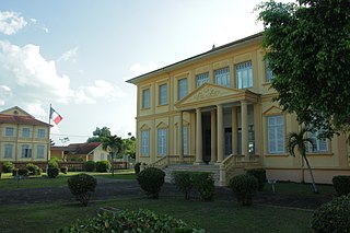
Saint-Laurent-du-Maroni is a commune of French Guiana, an overseas region and department of France located in South America. Saint-Laurent-du-Maroni is one of the three sub-prefectures of French Guiana and the seat of the Arrondissement of Saint-Laurent-du-Maroni. It is the second most populous city of French Guiana, with 50,250 inhabitants at the January 2021 census.

<span class="mw-page-title-main">Saint-Georges, French Guiana</span> Commune in French Guiana, France

Saint-Georges is a commune of French Guiana, an overseas region and department of France located in South America. It lies on the Oyapock River, opposite the Brazilian town of Oiapoque. The town contains a town hall, a French Foreign Legion detachment, and some hotels. Saint-Georges has been one of the three sub-prefectures of French Guiana and the seat of the Arrondissement of Saint-Georges since October 2022.

<span class="mw-page-title-main">Regina, French Guiana</span> Commune in French Guiana, France

Régina is a commune of French Guiana, an overseas region and department of France located in South America. With a land area of 12,130 km2 (4,680 sq mi), it is the second-largest commune of France. The town is named after the first merchant who settled in the area.

<span class="mw-page-title-main">Iracoubo</span> Commune in French Guiana, France

Iracoubo is a commune on the coast of French Guiana, an overseas region and department of France, located in South America.

<span class="mw-page-title-main">Sinnamary</span> Commune in French Guiana, France

Sinnamary is a town and commune on the coast of French Guiana, between Kourou and Iracoubo. Sinnamary was the second French settlement founded in French Guiana: the town was founded in 1664.

<span class="mw-page-title-main">Arrondissement of Saint-Laurent-du-Maroni</span> Arrondissement in French Guiana, France

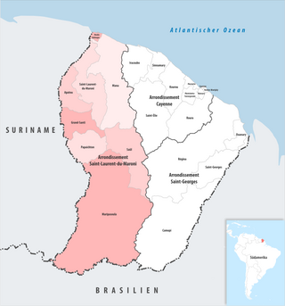
The arrondissement of Saint-Laurent-du-Maroni is an arrondissement of France in French Guiana department in French Guiana region. It has eight communes. Its population is 97,568 (2021), and its area is 40,945 km2 (15,809 sq mi).

<span class="mw-page-title-main">Remire-Montjoly</span> Commune in French Guiana, France

Remire-Montjoly is a commune of French Guiana, an overseas region and department of France located on the northeast coast of South America.

<span class="mw-page-title-main">Kalina people</span> Indigenous people native to the northern coastal areas of South America

The Kalina, also known as the Caribs or mainland Caribs and by several other names, are an Indigenous people native to the northern coastal areas of South America. Today, the Kalina live largely in villages on the rivers and coasts of Venezuela, Guyana, Suriname, French Guiana, and Brazil. They speak a Cariban language known as Carib. They may be related to the Island Caribs of the Caribbean, though their languages are unrelated.

<span class="mw-page-title-main">Mana, French Guiana</span> Commune in French Guiana, France

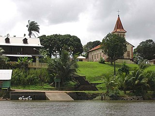
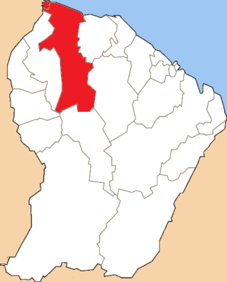
Mana is a commune and town in French Guiana. It was founded on 16 August 1828 by Sister Anne-Marie Javouhey. It borders the river Mana, from where it gets its name; and is nearby the river Maroni. Mana is the primary producer of rice in French Guiana, which it exports to Suriname.

<span class="mw-page-title-main">Maripasoula</span> Commune in French Guiana, France

Maripasoula, previously named Upper Maroni, is a commune of French Guiana, an overseas region and department of France located in South America. With a land area of 18,360 km2 (7,090 sq mi), Maripasoula is the largest commune of France. The commune is slightly larger than the country of Kuwait or the U.S. state of New Jersey.

<span class="mw-page-title-main">Roura</span> Commune in French Guiana, France

Roura is a commune of French Guiana, an overseas region and department of France located in South America. The city of Roura is bordered by Matoury and Montsinéry-Tonnegrande in the North, Kourou and Saint-Elie in the North West and West, and finally by Régina in the South and East.

<span class="mw-page-title-main">Papaichton</span> Commune in French Guiana, France

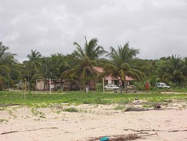
Papaichton is a commune in the overseas region and department of French Guiana. The village lies on the shores of the Lawa River. Papaichton is served by the Maripasoula Airport.

<span class="mw-page-title-main">Index of French Guiana–related articles</span>

Articles related to the French overseas department of Guiana(Région Guyane) include:

<span class="mw-page-title-main">French Guiana</span> Overseas department and region of France in South America

French Guiana is an overseas department and region of France located on the northern coast of South America in the Guianas and the West Indies. Bordered by Suriname to the west and Brazil to the east and south, French Guiana covers a total area of 84,000 km2 (32,000 sq mi) and a land area of 83,534 km2 (32,253 sq mi).As of January 2024, it is home to approximately 295,385 people.

<span class="mw-page-title-main">Canton of Mana</span> Former canton in French Guiana, France

The canton of Mana is one of the former cantons of the Guyane department in French Guiana. It was located in the arrondissement of Saint-Laurent-du-Maroni, and consisted of two communes. Its administrative seat was located in Mana. Its population was 10,661 in 2012.

<span class="mw-page-title-main">Communauté de communes de l'Ouest guyanais</span> Communauté de communes in French Guiana, France

The Communauté de communes de l'Ouest guyanais (CCOG) is a communauté de communes, an intercommunal structure in the French département d'outre-mer of French Guiana. It was created in 1995, and its seat is Mana. Its area is 40,945 km2, and its population was 94,677 in 2018.

<span class="mw-page-title-main">Amana Nature Reserve</span> Protected area in French Guiana

The Amana Nature Reserve is a nature reserve in French Guiana, France. It has been protected because it is one of the world's largest leatherback sea turtle nesting sites. It is part of the communes of Awala-Yalimapo and Mana.

Sainte-Rose-de-Lima is a village of Lokono Amerindians in the commune of Matoury in French Guiana. The village is located on the RN2 near Cayenne – Félix Eboué Airport. It is the largest settlement of Lokono in French Guiana.

References

  1. "Répertoire national des élus: les maires" (in French). data.gouv.fr, Plateforme ouverte des données publiques françaises. 13 September 2022.
  2. "Populations de référence 2022" (in French). The National Institute of Statistics and Economic Studies. 19 December 2024.
  3. 1 2 "Guyane, Historie". Petit Futé (in French). Retrieved 4 June 2020.
  4. 1 2 Johan Chevalier. "Awala Yalimapo". Une Saison en Guyane (in French). Retrieved 19 February 2021.
  5. "Un atlas des Zones de droits d'usage collectifs en Guyane". journals.openedition.org (in French). 2014. Retrieved 19 February 2021.
  6. Céline Barthon. "La gestion publique de la nature littorale, en quête de légitimité ? L'exemple du Conservatoire du Littoral sur les rivages guyanais". HAL (in French). p. 6. Retrieved 19 February 2021.
  7. "Mana, précurseurse depuis toujours". Le Jour du Seigneur (in French). Archived from the original on 4 June 2020. Retrieved 4 June 2020.
  8. "L'Amana Réserve naturelle nationale". L'Inventaire National du Patrimoine Naturel (in French). Retrieved 4 June 2020.