Apatou

Last updated
Apatou
Taxis pirogue apatou.JPG
Canoe taxis at Apatou
Blason de la ville d'Apatou en Guyane.svg
Apatou.PNG
Location of the commune (in red) within French Guiana
Location of Apatou
Apatou
Coordinates: 5°09′12″N54°20′10″W / 5.1533°N 54.336°W / 5.1533; -54.336
Country France
Overseas region and department French Guiana
Arrondissement Saint-Laurent-du-Maroni
Intercommunality Ouest Guyanais
Government
  Mayor (20212026) Moïse Edwin [1]
Area
1
2,020 km2 (780 sq mi)
Population
 (2021) [2]
9,818
  Density4.9/km2 (13/sq mi)
Time zone UTC−03:00
INSEE/Postal code
97360 /97317
1 French Land Register data, which excludes lakes, ponds, glaciers > 1 km2 (0.386 sq mi or 247 acres) and river estuaries.

Apatou (French pronunciation: [apatu] ) is a commune in French Guiana, an overseas region and department of France in South America. Apatou is home to Maroons of the Aluku, Paramacca, Ndyuka, and Saramaka tribes. [3]

Contents

History

The town of Apatou was founded in 1882 as Moutendé. [3] It was renamed after Captain Apatou of the Aluku. [4] In the late 19th century, Apatou was a guide for the explorer Jules Crevaux. On 7 September 1885, Jules Brunetti opened a Catholic mission in the village. [5] In 1891, Apatou mediated between France and the Colony of Suriname with regards to the border, and allied the Aluku with France. [4] He also united all the different tribes on the French side. [3]

Apatou was up to 1969 part of the Inini territory which allowed for an autonomous and self sufficient tribal system for the Maroons without clear borders. [6] Along with the commune, came a government structure, and francisation. Most importantly, it led to the concentration in bigger villages and the near abandonment of smaller settlements. [6]

The commune of Apatou was created on 12 November 1976 by detaching its territory from the commune of Grand-Santi-Papaichton (since then renamed Grand-Santi). [3]

Population

Historical population
YearPop.±% p.a.
1967 318    
1974 453+5.18%
1982 618+3.96%
1990 2,451+18.79%
1999 3,628+4.45%
2007 6,357+7.26%
2012 7,257+2.68%
2017 9,241+4.95%
Source: INSEE [7]

Transport

Apatou, 2004 Apatou French Guiana Jan 2004.JPG
Apatou, 2004

The villages in the commune could only to be reached by boat from the Maroni River. [3] In 2010, Route Nationale opened connecting Apatou with Saint-Laurent-du-Maroni, and the road network of French Guiana. The road was opened with the Tour of Guiana. [8] The road is scheduled to be extended to Maripasoula. Construction work on the section to Papaïchton is planned to begin in 2021. [9]

Sports

Apatou is home to ASC Agouado football team who play at the Stade de Moutendé. [10]

See also

Related Research Articles

<span class="mw-page-title-main">Aluku</span> Maroon nation in French Guiana and Suriname

The Aluku are a Bushinengue ethnic group living mainly on the riverbank in Maripasoula in southwest French Guiana. The group are sometimes called Boni, referring to the 18th-century leader, Bokilifu Boni.

The Music of French Guiana is a very rich and varied music of several styles and cultures coming from Europe, Africa and the Americas by the Amerindians due to its history and its multi-ethnic diversity.

<span class="mw-page-title-main">Saint-Laurent-du-Maroni</span> Subprefecture and commune in French Guiana, France

Saint-Laurent-du-Maroni is a commune of French Guiana, an overseas region and department of France located in South America. Saint-Laurent-du-Maroni is one of the three sub-prefectures of French Guiana and the seat of the Arrondissement of Saint-Laurent-du-Maroni. It is the second most populous city of French Guiana, with 50,250 inhabitants at the January 2021 census.
<span class="mw-page-title-main">Arrondissement of Saint-Laurent-du-Maroni</span> Arrondissement in French Guiana, France

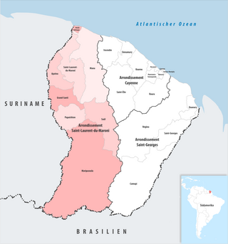
The arrondissement of Saint-Laurent-du-Maroni is an arrondissement of France in French Guiana department in French Guiana region. It has eight communes. Its population is 100,954 (2022), and its area is 40,945 km2 (15,809 sq mi).
<span class="mw-page-title-main">Grand-Santi</span> Commune in French Guiana, France

Grand-Santi is a commune of French Guiana, an overseas region and department of France located in South America. Most of the inhabitants are Ndyuka Maroons and Surinamese immigrants.

<span class="mw-page-title-main">Maripasoula</span> Commune in French Guiana, France

Maripasoula, previously named Upper Maroni, is a commune of French Guiana, an overseas region and department of France located in South America. With a land area of 18,360 km2 (7,090 sq mi), Maripasoula is the largest commune of France. The commune is slightly larger than the country of Kuwait or the U.S. state of New Jersey.

Cormotibo is a village in western French Guiana, close to the border with Suriname, it is inhabited by Aluku Maroons. The village has been founded by Hervé Tolinga, the son of the granman.

<span class="mw-page-title-main">Papaichton</span> Commune in French Guiana, France

Papaichton is a commune in the overseas region and department of French Guiana. The village lies on the shores of the Lawa River. Papaichton is served by the Maripasoula Airport.
<span class="mw-page-title-main">Wayana</span> Indigenous people located in the Guiana highlands

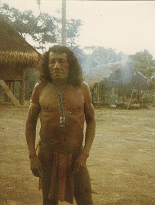
The Wayana are a Carib-speaking people located in the southeastern part of the Guiana highlands, a region divided between Brazil, Suriname, and French Guiana. In 1980, when the last census took place, the Wayana numbered some 1,500 individuals, of which 150 in Brazil, among the Apalai, 400 in Suriname, and 1,000 in French Guiana, along the Maroni River. About half of them still speak their original language.

<span class="mw-page-title-main">Index of French Guiana–related articles</span>

Articles related to the French overseas department of Guiana(Région Guyane) include:

<span class="mw-page-title-main">French Guiana</span> Overseas department and region of France in South America

French Guiana is an overseas department and region of France located on the northern coast of South America in the Guianas and the West Indies. Bordered by Suriname to the west and Brazil to the east and south, French Guiana covers a total area of 84,000 km2 (32,000 sq mi) and a land area of 83,534 km2 (32,253 sq mi), and is inhabited by 295,385 people.

<span class="mw-page-title-main">Guiana Amazonian Park</span> French national park in French Guiana

Guiana Amazonian Park is the largest national park of France, aiming at protecting part of the Amazonian forest located in French Guiana which covers 41% of the region. It is the largest park in France as well as the largest park in the European Union and one of the largest national parks in the world.

<span class="mw-page-title-main">Montagne d'Or mine</span> Mine in Saint-Laurent-du-Maroni, French Guiana

The Montagne d'Or mine is one of the largest gold mine projects in French Guiana, an overseas region of France. The mine is located in the north-west of the country in the Arrondissement of Saint-Laurent-du-Maroni. The mine has estimated reserves of 5,370,000 troy ounces (167,000 kg) of gold.

<span class="mw-page-title-main">Canton of Maripasoula</span> Former canton in French Guiana, France

The canton of Maripasoula is one of the former cantons of the Guyane department in French Guiana. It was located in the arrondissement of Saint-Laurent-du-Maroni and consisted of five communes. Its administrative seat was located in Maripasoula. Its population was 29,504 in 2012.

<span class="mw-page-title-main">Communauté de communes de l'Ouest guyanais</span> Communauté de communes in French Guiana, France

The Communauté de communes de l'Ouest guyanais (CCOG) is a communauté de communes, an intercommunal structure in the French département d'outre-mer of French Guiana. It was created in 1995, and its seat is Mana. Its area is 40,945 km2, and its population was 94,677 in 2018.

<span class="mw-page-title-main">Apatou (captain)</span> Aluku explorer and captain in French Guiana (1833–1908)

Apatou was a guide, and Captain of the Aluku Maroons in French Guiana. Apatou founded the village of Moutendé which has been renamed Apatou. He mediated between France and Suriname with regards to the border, and allied the Aluku with France.

<span class="mw-page-title-main">Boniville</span> Village in French Guiana, France

Boniville is a village of Aluku Maroons in the commune of Papaïchton located on the Lawa River in French Guiana.

<span class="mw-page-title-main">Cottica Mountain</span> Mountain in French Guiana

Cottica Mountain is a 744-metre high (2,441 ft) mountain near the Lawa River in the commune of Papaichton in French Guiana, France.

<span class="mw-page-title-main">France–Suriname relations</span> Bilateral relations

Diplomatic relations between France and Suriname were established on 25 August 1976. Suriname and the French overseas department of French Guiana share a common border of 520 kilometres (320 mi). Suriname operates an embassy in Paris, a consulate in Cayenne, and an honorary consulate in Saint-Laurent-du-Maroni. France operates an embassy in Paramaribo, a consulate in Georgetown, Guyana, and an honorary consulate in Albina.

Nouveau Wakapou, also Nouveau Wacapou, is an Aluku maroon village situated on the Lawa River in French Guiana. The village is located across the Surinamese gold mining village of Benzdorp.

References

  1. "Répertoire national des élus: les maires" (in French). data.gouv.fr, Plateforme ouverte des données publiques françaises. 4 May 2022.
  2. "Populations légales 2021" (in French). The National Institute of Statistics and Economic Studies. 28 December 2023.
  3. 1 2 3 4 5 "Guide Apatou". Petit Futé (in French). Retrieved 6 June 2020.
  4. 1 2 "The explorer as hero: 'Le Fidèle Apatou' in the French wilderness". New West Indian Guide / Nieuwe West-Indische Gids. 78 (3–4): 197–227. 1 January 2004. doi: 10.1163/13822373-90002512 . Retrieved 6 June 2020.
  5. Moomou, Jean (2009). "La mission du père Brunetti chez les Boni de la Guyane française à la fin du xixe siècle". Histoire et missions chrétiennes (in French). 12 (2009/4): 115–144.{{cite journal}}: Cite journal requires |journal= (help)
  6. 1 2 "The Aluku and the Communes in French Guiana". Cultural Survival. Retrieved 6 June 2020.
  7. Population en historique depuis 1968, INSEE
  8. "La route d'Apatou raccommodée". Guyane la Première (in French). Retrieved 6 June 2020.
  9. "Route Maripasoula-Papaichton : 1 million d'euros par kilomètre". France Guyane (in French). Retrieved 10 August 2020.
  10. "ASC Agouado". Soccer Way. Retrieved 5 September 2020.