Inini

Last updated

Territory of Inini
Territoire de l'Inini
1930–1946
Flag of France.svg
Flag
Arrondissement de l'Inini (1952).png
Inini (green) and French Guiana (beige)
Status French colony
CapitalSaint-Élie
Common languages French
Historical era Interbellum  · World War II
 Separated from French Guiana
6 June 1930
 Reintegrated
19 March 1946
Population
 1946 [1]
5,024
Currency French franc
Preceded by
Succeeded by
Flag of France.svg French Guiana
French Guiana Flag of France.svg

Inini was an inland territory of French Guiana, administered separately between 6 June 1930 [2] and 19 March 1946, after which all of French Guiana became a department of France. [3] The territory remained governed as a special entity, until 17 March 1969 when it was dissolved into communes, and subject to regular government. [4] Its capital was Saint-Élie. [5] The population of the territory consisted of Amerindians, Maroons, and gold prospectors. [4] The district was named after the river Inini, a major river in the interior of French Guiana which runs east to west, unlike the other major rivers which run south to north. [6]

Contents

History

The purpose of the colony was to develop the interior separately from the coastal area around Cayenne. The colony came into effect on 6 June 1930, [2] and was mainly a military affair. [7] The territory was ruled by decree first by the Governor of French Guiana and later by the Prefect. [8] Initially only three services were offered: water management, forest management, and mines. [9]

Prison of the Annamites (2005) Annamite prison bagne.jpg
Prison of the Annamites (2005)

In 1930, a total of seven military officers and nine gendarmes were stationed in the territory. [10] The main focus was on the legal gold mining companies, and the difficult access to the mines in the jungle. [11] In 1931, a labour force consisting of 535 Annamite prisoners who had revolted against French rule in Indochina were brought in to make the territory accessible. [12] Senegalese Tirailleurs were used to guard and oversee the prisoners. [13] In 1936, the Governor informed Paris that the project was successful, because the interior could soon be opened for colonisation. In 1937, the prisoners at Camp Crique Anguille revolted. [14]

In 1941, American troops were stationed in Suriname to protect the colony and its bauxite industry, which was primarily American-owned. [15] One year later, Brazil declared war on Germany. [16] Inini was part of Vichy France, an ally of Nazi Germany, and now found itself squeezed between two hostile countries, therefore the main efforts of the administration was guarding the borders until 16 March 1943 [17] when Inini sided with Free France. [10] On 6 December 1944, the prisoner camps were abandoned and the Annamites returned to the normal prisons. The first group was released in July 1946, however the last group had to wait until August 1953. [17]

The plan to develop the territory did not work out, owing to the difficulties of railroad construction in the interior. The ruins of the three prisons used may still be seen. [18] In 1944, the Brazzaville Conference was held among Free French leaders which promised all citizens of France's colonies equal rights with French citizens after the war. [19] Therefore, on 19 March 1946 all of French Guiana became a department of France, [3] however Inini would be administrated separately, because it was lacking basic services like health care and education. On 17 March 1969, the territory was dissolved into communes, and subject to regular democratic government. [4]

Postage stamps

A 1932 stamp of Inini Inini SW 06 - 1932.JPG
A 1932 stamp of Inini

During this period, the postage stamps of French Guiana were overprinted with several variations on "TERRITOIRE DE L'ININI" and the omnibus issues for the Colonial Arts Exhibition in 1937 and the New York World's Fair in 1939 included stamps inscribed "ININI". Despite the limited audience, the stamps of Inini are commonly available at minimal prices today. [20]

See also

Related Research Articles

<span class="mw-page-title-main">History of French Guiana</span> Aspect of history

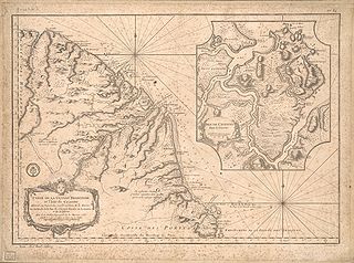
The history of French Guiana dates back to the period prior to European colonization. Prior to the arrival of the first Europeans, there was no written history in the territory. It was originally inhabited by a number of Native American peoples, among them the Kalina (Caribs), Arawak, Galibi, Palikur, Teko, Wayampi, and Wayana. The first Europeans arrived in the expeditions of Christopher Columbus, shortly before 1500.

<span class="mw-page-title-main">Saint-Laurent-du-Maroni</span> Subprefecture and commune in French Guiana, France

Saint-Laurent-du-Maroni is a commune of French Guiana, an overseas region and department of France located in South America. Saint-Laurent-du-Maroni is one of the three sub-prefectures of French Guiana and the seat of the Arrondissement of Saint-Laurent-du-Maroni. It is the second most populous city of French Guiana, with 50,250 inhabitants at the January 2021 census.

<span class="mw-page-title-main">Saül, French Guiana</span> Commune in French Guiana, France

Saül is a commune of French Guiana, an overseas region and department of France located in South America. It is the most sparsely populated commune of French Guiana.

<span class="mw-page-title-main">Montsinéry-Tonnegrande</span> Commune in French Guiana, France

Montsinéry-Tonnegrande is a commune of French Guiana, an overseas region and department of France located in South America.

<span class="mw-page-title-main">Arrondissements of the Guyane department</span>

The 3 arrondissements of the Guyane department are:

  1. Arrondissement of Cayenne, with 10 communes. The population of the arrondissement was 177,716 in 2019.
  2. Arrondissement of Saint-Laurent-du-Maroni, with 8 communes. The population of the arrondissement was 96,757 in 2019.
  3. Arrondissement of Saint-Georges, with 4 communes. The population of the arrondissement was 7,205 in 2019. This arrondissement was created by a government decree of October 26, 2022.
<span class="mw-page-title-main">Arrondissement of Cayenne</span> Arrondissement in French Guiana, France

The arrondissement of Cayenne is an arrondissement of France in French Guiana department in French Guiana region. It has 10 communes. Its population is 181,520 (2020), and its area is 17,029 km2 (6,575 sq mi). It is the smallest of the three arrondissements in French Guiana, but also its most populated.

<span class="mw-page-title-main">Saint-Élie</span> Commune in French Guiana, France

Saint-Élie is a commune of French Guiana, an overseas department and region of France in South America. In 1930, Saint-Élie became capital of the Inini territory. From 1953 onward, the commune was called Centre. In 1969, it was renamed to Saint-Élie.

<span class="mw-page-title-main">Ouanary</span> Commune in French Guiana, France

Ouanary is a commune of French Guiana, an overseas region and department of France located in South America. Ouanary lies at the mouth of the river Oiapoque. Ouanary is the least populated commune of French Guiana. The settlement of Ouanary is accessible only by boat, helicopter, or light aircraft at Ouanary Airport, a 750 metres (2,460 ft) dirt runway.

<span class="mw-page-title-main">Apatou</span> Commune in French Guiana, France

Apatou is a commune in French Guiana, an overseas region and department of France in South America. Apatou is home to Maroons of the Aluku, Paramacca, Ndyuka, and Saramaka tribes.

<span class="mw-page-title-main">Inini (river)</span> River in Saül & Maripasoula, French Guiana

The Inini or Grand Inini is a river in western French Guiana. It is a tributary of the Lawa, the upper course of the Maroni. The river is 215 km (134 mi) long and non-navigable. The Inini is the only major river in French Guiana which runs east to west, unlike the other major rivers which run south to north. In the beginning of the 20th century, it was the site of a gold rush, and the gold prospectors have become active in the region again since the 1990s. The Inini territory which has existed between 1930 and 1946 was named after this river.

<span class="mw-page-title-main">Papaichton</span> Commune in French Guiana, France

Papaichton is a commune in the overseas region and department of French Guiana. The village lies on the shores of the Lawa River. Papaichton is served by the Maripasoula Airport.

<span class="mw-page-title-main">Wayana</span> Indigenous people located in the Guiana highlands

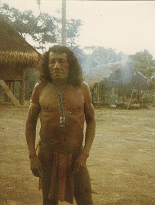
The Wayana are a Carib-speaking people located in the southeastern part of the Guiana highlands, a region divided between Brazil, Suriname, and French Guiana. In 1980, when the last census took place, the Wayana numbered some 1,500 individuals, of which 150 in Brazil, among the Apalai, 400 in Suriname, and 1,000 in French Guiana, along the Maroni River. About half of them still speak their original language.

<span class="mw-page-title-main">Index of French Guiana–related articles</span>

Articles related to the French overseas department of Guiana(Région Guyane) include:

<span class="mw-page-title-main">French Guiana</span> Overseas department of France in South America

French Guiana is an overseas department of France located on the northern coast of South America in the Guianas. Bordered by Suriname to the west and Brazil to the east and south, French Guiana covers a land area of 83,534 km2 (32,253 sq mi), and is inhabited by 295,385 people.

<i>Tirailleurs indochinois</i> Military unit

The Tirailleurs indochinois were soldiers of several regiments of local ethnic Indochinese infantry organized as Tirailleurs by the French colonial authorities, initially in Vietnam from 15 March 1880. The most notable, and first established, of these units were the Tonkinese Rifles.

<span class="mw-page-title-main">COVID-19 pandemic in French Guiana</span> Ongoing COVID-19 viral pandemic in French Guiana, France

The COVID-19 pandemic was confirmed to have reached the French overseas department and region of French Guiana. The first five cases were found on 4 March and the first death was announced on 20 April 2020. On 30 April, the territory was green listed, because the pandemic appeared to be under control except for Saint-Georges. In June, the virus started circulating all over the territory.

Charvein is a village in the Mana commune of Saint-Laurent-du-Maroni in French Guiana. Charvein was the location of Camp Charvein, one of the most notorious camps of the Prison of St-Laurent-du-Maroni. From 1989 until 1992, Charvein was the location of a Surinamese refugee camp.

<span class="mw-page-title-main">Prison of the Annamites</span> Former prison camp in French Guiana

Prison of the Annamites is a former prison in the commune of Montsinéry-Tonnegrande in French Guiana. The prison was built for Annamite prisoners who had revolted against French rule. The purpose of the prison was to develop the Inini territory. The prison was in operation between 1931 and 1944.

<span class="mw-page-title-main">Suriname during World War II</span>

The history of Suriname during World War II was mainly focused on protecting the bauxite industry and guarding the borders with French Guiana which was part of Vichy France. From November 1941 onwards, 2,000 American troops were stationed in Suriname who transformed Airstrip Zanderij into a major airport, and constructed defensive works. No actual battles took place in Suriname. There was a political crisis in 1943, because Governor Johannes Kielstra used the state of emergency to imprison political opponents.

References

  1. "Vous qui voulez venir en Guyane". University of Florida (in French). 1953. pp. 28–29. Retrieved 3 August 2020. 1946 census data. On page 29, it was noted that there were an estimated 4,000 foreigners in the country who mainly worked in the interior, i.e. the illegal gold prospectors were not included in the statistics
  2. 1 2 "Création de territoire en Guyane française". Journal officiel de la Guyane française via Bibliothèque Nationale de France (in French). 6 June 1930. Retrieved 6 June 2020.
  3. 1 2 "Loi n° 46-451 du 19 mars 1946 tendant au classement comme départements français de la Guadeloupe, de la Martinique, de la Réunion et de la Guyane française". Government of the French Republic (in French). 19 March 1946. Retrieved 6 June 2020.
  4. 1 2 3 Thabouillot, Gérard (24 August 2023). Le territoire de l'Inini : 1930-1969 (in French). Ibis rouge éditions. ISBN   9782375205051 . Retrieved 6 June 2020.{{cite book}}: |website= ignored (help)
  5. "South America 1930: Vargas Revolution". Omni Atlas. Retrieved 4 June 2020.
  6. "Au temps de l'Inini". Un Témoin en Guyane (in French). Retrieved 3 August 2020.
  7. Thabouillot 2011, p. 43.
  8. "Colloque : le territoire de l'Inini (1930-1969)". Blada. Retrieved 3 August 2020.
  9. Thabouillot 2011, p. 44.
  10. 1 2 Thabouillot 2011, p. 48.
  11. "Industrial Railways in French Guiana, 2014". International Steam. Retrieved 4 June 2020.
  12. Donet-Vincent 2001, p. 215.
  13. Donet-Vincent 2001, p. 217.
  14. Donet-Vincent 2001, p. 218.
  15. "Wereldoorlog in de West - Suriname, de Nederlandse Antillen en Aruba 1940-1945". Verzetsmuseum (in Dutch). Retrieved 3 August 2020.
  16. "1942: Brazil Declares War on Hitler's Germany". History.info. 21 August 2019. Retrieved 3 August 2020.
  17. 1 2 Donet-Vincent 2001, p. 220.
  18. Donet-Vincent, Danielle (1 January 2006). "Les "bagnes" des Indochinois en Guyane (1931-1963)". Criminocorpus, Revue Hypermédia (in French). doi: 10.4000/criminocorpus.182 . S2CID   247825093 . Retrieved 6 June 2020.
  19. "Les chemins politiques, de Brazzaville à la Communauté (1944-1958)". Institut national de l'audiovisuel (in French). Retrieved 5 August 2020.
  20. "Le territoire de l'Inini". France Philatelie (in French). 8 September 2016. Retrieved 6 June 2020.

Bibliography

3°N53°W / 3°N 53°W / 3; -53