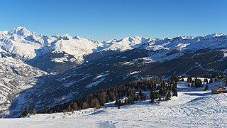
Chambéry is a city in the department of Savoie, located in the Auvergne-Rhône-Alpes region in eastern France.

The arrondissement of Chambéry is an arrondissement of France in the Savoie department in the Auvergne-Rhône-Alpes region. It has 155 communes.
The following is a list of the 19 cantons of the Savoie department, in France, following the French canton reorganisation which came into effect in March 2015:
The Canton of Montmélian is a canton located within the Savoie department of France.
Saint-Alban is a French place-name that may refer to:

Mouxy is a commune in the Savoie department in the Auvergne-Rhône-Alpes region in south-eastern France.

The Chateau de Monterminod is a medieval castle located in the city of Saint-Alban-Leysse in the Savoy region of France, approximately 80 miles west of Geneva, Switzerland. The chateau dominates the "hameau du Villaret", and its location on top of a hill makes it highly noticeable from miles away.
The canton of Aix-les-Bains-1 is an administrative division of the Savoie department, southeastern France. It was created at the French canton reorganisation which came into effect in March 2015. Its seat is in Aix-les-Bains.
The canton of Bourg-Saint-Maurice is an administrative division of the Savoie department, southeastern France. Its borders were modified at the French canton reorganisation which came into effect in March 2015. Its seat is in Bourg-Saint-Maurice.
The canton of Moûtiers is an administrative division of the Savoie department, southeastern France. Its borders were modified at the French canton reorganisation which came into effect in March 2015. Its seat is in Moûtiers.
The canton of Saint-Jean-de-Maurienne is an administrative division of the Savoie department, southeastern France. Its borders were modified at the French canton reorganisation which came into effect in March 2015. Its seat is in Saint-Jean-de-Maurienne.
The canton of Albertville-1 is an administrative division of the Savoie department, southeastern France. It was created at the French canton reorganisation which came into effect in March 2015. Its seat is in Albertville.

The canton of Bugey savoyard is an administrative division of the Savoie department, southeastern France. It was created at the French canton reorganisation which came into effect in March 2015. Its seat is in Yenne.
The canton of Chambéry-1 is an administrative division of the Savoie department, southeastern France. It was created at the French canton reorganisation which came into effect in March 2015. Its seat is in Chambéry.
The canton of Le Pont-de-Beauvoisin is an administrative division of the Savoie department, southeastern France. Its borders were modified at the French canton reorganisation which came into effect in March 2015. Its seat is in Le Pont-de-Beauvoisin.
The canton of La Ravoire is an administrative division of the Savoie department, southeastern France. Its borders were not modified at the French canton reorganization which came into effect in March 2015. Its seat is in La Ravoire.
The canton of Saint-Pierre-d'Albigny is an administrative division of the Savoie department, southeastern France. Its borders were modified at the French canton reorganisation which came into effect in March 2015. Its seat is in Saint-Pierre-d'Albigny.
The canton of Bonneville is an administrative division of the Haute-Savoie department, southeastern France. Its borders were modified at the French canton reorganisation which came into effect in March 2015. Its seat is in Bonneville.
The canton of Rumilly is an administrative division of the Haute-Savoie department, southeastern France. Its borders were modified at the French canton reorganisation which came into effect in March 2015. Its seat is in Rumilly.
The canton of Saint-Laurent-en-Grandvaux is an administrative division of the Jura department, eastern France. Its borders were modified at the French canton reorganisation which came into effect in March 2015. Its seat is in Saint-Laurent-en-Grandvaux.


