Thurston Island is an ice-covered, glacially dissected island, 215 km (134 mi) long, 90 km (56 mi) wide and 15,700 km2 (6,062 sq mi) in area, lying a short way off the northwest end of Ellsworth Land, Antarctica. It is the third largest island of Antarctica, after Alexander Island and Berkner Island.

Ebbe Glacier is a tributary glacier about 60 nautical miles long, draining northwest from the Homerun Range and the Robinson Heights, and then west-northwest between the Everett Range and the Anare Mountains into Lillie Glacier, Victoria Land, Antarctica. This feature saddles with Tucker Glacier, the latter draining southeast to the Ross Sea. The glacier lies situated on the Pennell Coast, a portion of Antarctica lying between Cape Williams and Cape Adare. Robertson Glacier is a tributary glacier to Ebbe Glacier.

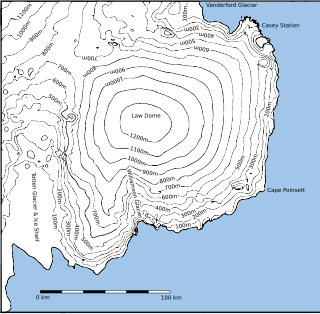
The Greenwell Glacier is a major tributary glacier, 45 nautical miles long, draining northwest between the Mirabito Range and the Everett Range to enter Lillie Glacier below Mount Works, in northwest Victoria Land, Antarctica. This geographical feature was first mapped by the United States Geological Survey from surveys and from U.S. Navy aerial photography, 1960–63, and was so named by the Advisory Committee on Antarctic Names for Commander Martin D. Greenwell, U.S. Navy, Commander of Antarctic Squadron Six (VX-6), 1961–62. The glacier lies situated on the Pennell Coast, a portion of Antarctica lying between Cape Williams and Cape Adare.
Gair Glacier is a tributary glacier, 10 nautical miles long, rising close southeast of Mount Supernal in the Mountaineer Range and flowing east-northeast to enter Mariner Glacier just north of Bunker Bluff in Victoria Land, Antarctica. It was named by the New Zealand Geological Survey Antarctic Expedition (NZGSAE) 1962–63, for geologist H.S. Gair, leader that season of the NZGSAE northern field party.
Haffner Glacier is a small glacier discharging into Berg Bay along the north coast of Victoria Land, Antarctica. It was first charted by the British Antarctic Expedition, 1898–1900, under Carsten. E. Borchgrevink, who named it for Colonel Haffner, Director of the Government Survey of Norway. This glacier lies situated on the Pennell Coast, a portion of Antarctica lying between Cape Williams and Cape Adare.
Decker Glacier is a steep, narrow glacier that drains the northeast slopes of Mount Newall in the Asgard Range, Victoria Land. It was named by the Advisory Committee on Antarctic Names for Chief Aviation Machinist's Mate William D. Decker, U.S. Navy, of Squadron VXE-6, who died at McMurdo Station on October 11, 1971.

Posadowsky Glacier is a glacier about 9 nautical miles long, flowing north to Posadowsky Bay immediately east of Gaussberg. Posadowsky Bay is an open embayment, located just east of the West Ice Shelf and fronting on the Davis Sea in Kaiser Wilhelm II Land. Kaiser Wilhelm II Land is the part of East Antarctica lying between Cape Penck, at 87°43'E, and Cape Filchner, at 91°54'E, and is claimed by Australia as part of the Australian Antarctic Territory. Other notable geographic features in this area include Drygalski Island, located 45 mi NNE of Cape Filchner in the Davis Sea, and Mirny Station, a Russian scientific research station.
Anderton Glacier is a tributary glacier, 7 nautical miles (13 km) long, descending the south slopes of the Eisenhower Range to enter Reeves Glacier between Mount Matz and Andersson Ridge, in Victoria Land, Antarctica. The glacier is situated on the Pennell Coast, a portion of Antarctica lying between Cape Williams and Cape Adare. It was mapped by the United States Geological Survey from surveys and from U.S. Navy air photos, 1955–63, and was named by the Advisory Committee on Antarctic Names for Peter W. Anderton, a glaciologist at McMurdo Station, summer 1965–66.
Arthur Glacier is a valley glacier in Antarctica. It is about 25 nautical miles (50 km) long, and flows west to Sulzberger Ice Shelf between the Swanson Mountains on the north and Mount Rea and Mount Cooper on the south, in the Ford Ranges of Marie Byrd Land. It was discovered by members of West Base of the United States Antarctic Service, in aerial flights and from ground surveys in November–December 1940. It was named by the Advisory Committee on Antarctic Names for Rear Admiral Arthur C. Davis, a leader in aviation in the U.S. Navy.
Ball Glacier is a glacier 7 nautical miles (13 km) long with the head located between Mount Lister and Mount Hooker on the east side of the Royal Society Range. The glacier flows northeast between Craw Ridge and Tasman Ridge into Blue Glacier. It was named by the New Zealand Geographic Board after Gary Ball, a New Zealand mountaineer who climbed Mount Lister with an Italian field party, 1976–77, and camped on this glacier; he was field assistant with R.H. Findlay’s New Zealand Antarctic Research Program party to this area, 1980–81.

Elliott Glacier is a small channel glacier that drains northward to the Budd Coast of Antarctica, midway between Cape Hammersly and Cape Waldron. It was delineated from aerial photographs taken by U.S. Navy Operation Highjump (1946–47), and named by the Advisory Committee on Antarctic Names after Samuel Elliott, a midshipman on the sloop Vincennes during the United States Exploring Expedition (1838–42) under Lieutenant Charles Wilkes.

Français Glacier is a glacier 4 nautical miles (7 km) wide and 12 nautical miles (22 km) long, flowing north-northeast from the continental ice to the Antarctic coast close west of Ravin Bay. Though no glaciers were noted on Captain Jules Dumont d'Urville's chart of this coast, the close correlation of his "Baie des Ravins" feature and narrative description with the indentation of the coast near the mouth of this glacier suggests first sighting of this feature by the French Antarctic Expedition, 1837–40. During December 1912 members of the Main Base Party of the Australasian Antarctic Expedition (AAE) camped on the upland slopes close east of the glacier, but no reference was made to the glacier in the AAE reports, though a clear view and unpublished sketch were obtained of the distant coast to the northwest.
The Gateway Hills are a prominent pair of hills, 2,000 metres (6,600 ft) high, immediately west of Husky Pass at the head of Sledgers Glacier, in the Bowers Mountains of Victoria Land, Antarctica. They were so named by the New Zealand Antarctic Place-Names Committee in 1983 on a proposal by geologist M.G. Laird because the hills bound the southern entrance to adjacent Sledgers Glacier. These hills lie situated on the Pennell Coast, a portion of Antarctica lying between Cape Williams and Cape Adare respectively.
Gibbs Glacier is a glacier, 15 nautical miles (28 km) long, flowing southeast into the northern part of Mercator Ice Piedmont on the east side of the Antarctic Peninsula. This feature together with Neny Glacier, which flows northwest, occupy a transverse depression between Mercator Ice Piedmont and Neny Fjord on the west side of the Antarctic Peninsula. Gibbs Glacier was photographed from the air and first mapped by the United States Antarctic Service, 1939–41, and the Ronne Antarctic Research Expedition, 1947–48. It was named by the UK Antarctic Place-Names Committee for Peter M. Gibbs of the Falkland Islands Dependencies Survey, a surveyor at Horseshoe Island, 1957, and leader at Stonington Island, 1958, who was responsible for the first ground survey of the glacier.
Cape Harrisson is a point just northward of the Possession Rocks at the junction of Northcliffe Glacier and Denman Glacier. It was discovered by the Australasian Antarctic Expedition (1911–14) under Sir Douglas Mawson, who named the feature for Charles T. Harrisson, biologist and artist at the expedition's Western Base. The spelling Harrisson is approved in this toponym, and also in Harrisson Ice Rises, on the basis of the honoree's signature on several of his paintings included in Mawson's The Home of the Blizzard.

Hektoria Glacier is a glacier flowing south from the area around Mount Johnston between Mount Quandary and Zagreus Ridge into Vaughan Inlet next west of Brenitsa Glacier and east of Green Glacier, on the east coast of the Antarctic Peninsula.
Cape Hoadley is a prominent rock coastal outcrop forming the west portal of the valley occupied by Scott Glacier in East Antarctica. It was discovered by the Western Base Party of the Australasian Antarctic Expedition under Mawson in November 1912, and named by him for C.A. Hoadley, a geologist with the party.
Hill Glacier is a broad glacier that drains the west-central part of Spaatz Island, Antarctica, at the south side of Ronne Entrance. It was mapped by the United States Geological Survey (USGS) from surveys and U.S. Navy aerial photographs, 1961–66, and was named by the Advisory Committee on Antarctic Names for Lennie J. Hill, a USGS topographic engineer who was a member of the Marie Byrd Land Survey Party, 1967–68.
Snedeker Glacier is a channel glacier flowing to the Antarctic coast 9 nautical miles (17 km) west of Merritt Island. Mapped (1955) by G.D. Blodgett from air photos taken by U.S. Navy Operation Highjump (1946–47). Named by Advisory Committee on Antarctic Names (US-ACAN) for Robert H. Snedeker, photo interpreter with U.S. Navy Operation Windmill (1947–48), who assisted in establishing astronomical control stations along the coast from Wilhelm II Coast to Budd Coast.

Tønnesen Glacier is a broad glacier flowing north between Risemedet Mountain and Festninga Mountain, separating the Gjelsvik Mountains and the Mühlig-Hofmann Mountains in Queen Maud Land. It was mapped by Norwegian cartographers from surveys and air photos by the Norwegian Antarctic Expedition (1956–60) and named for J. Tønnesen, a meteorologist with the expedition.