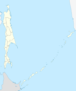
The Sea of Japan(see below for other names) is the marginal sea between the Japanese archipelago, Sakhalin, the Korean Peninsula, and the mainland of the Russian Far East. The Japanese archipelago separates the sea from the Pacific Ocean. Like the Mediterranean Sea, it has almost no tides due to its nearly complete enclosure from the Pacific Ocean. This isolation also affects faunal diversity and salinity, both of which are lower than in the open ocean. The sea has no large islands, bays or capes. Its water balance is mostly determined by the inflow and outflow through the straits connecting it to the neighboring seas and the Pacific Ocean. Few rivers discharge into the sea and their total contribution to the water exchange is within 1%.

The Woods Hole, Martha's Vineyard and Nantucket Steamship Authority, doing business as The Steamship Authority (SSA), is the statutory regulatory body for all ferry operations between mainland Massachusetts and the islands of Martha's Vineyard and Nantucket, as well an operator of ferry services between the mainland and the islands. It is the only ferry operator to carry automobiles to and from the islands. The Authority also operates several freight vessels, thus serving as the main link for shipping any commercial goods that are not transported using the airports on Nantucket or Martha's Vineyard.

Feklistova or Feklistov Island is one of the Shantar Islands in Sea of Okhotsk. With an area of 372 square kilometres, it is the second largest in the archipelago.

Iony Island, or Jonas' Island, formerly Ostrov Svyatogo Iony, is a small island in the Sea of Okhotsk.

Nedorazumeniya Island is an island on the north coast of the Sea of Okhotsk. It lies on the north side of Taui Bay, between Amakhton Bay to the west and Nagaev Bay to the east. It is about 20 kilometres (12 mi) west of the city of Magadan.

Taui Bay is a body of water in the Sea of Okhotsk off the coast of the Magadan Oblast in Russia. The bay opens to the south.

Ulban Bay is a bay in the northwestern Sea of Okhotsk, just south of the Shantar Islands. It is a southern branch of Academy Bay to the north. The Syran and Ulban rivers flow into its head.

Tugur Bay or Tugursky Bay is a large bay in the Tuguro-Chumikansky District of Khabarovsk Krai, Russian Federation.

Medvezhy Island is a long, narrow island in the northwestern Sea of Okhotsk, the westernmost of the Shantar Islands. It lies on the eastern side of Uda Gulf. It is 12.9 km long. It is separated from the mainland by Shevchenko Straight.

Prokofyeva is a small island in the Sea of Okhotsk. It is one of the Shantar Islands. It lies to the northeast of Bolshoy Shantar Island.

Uda Gulf or Uda Bay is a gulf or bay in Khabarovsk Krai, Russian Federation.

Ptichy Island is a small island in the Sea of Okhotsk.
Academy Bay is a large bay in the Tuguro-Chumikansky District of Khabarovsk Krai, Russian Federation.
Lebyazhya Bay is a small bay that indents the south side of Feklistova Island, one of the Shantar Islands, in the western Sea of Okhotsk. Its entrance is 11.3 kilometers (7.0 mi) wide and it is 5.6 kilometers (3.5 mi) deep. There are three small bays at its head: Enegelma Road to the west, Soboleva to the north, and Rosseta to the east. A small island, Sukhotina, lies to its southeast. In the spring and summer it is host to a small nesting colony of thick-billed murre. A number of streams of fresh water flow down the hills into the bay. Spring tides rise 6.5 meters (21 ft) while neaps rise 2.4 meters.
Bussol Strait is a wide strait that separates the islands of Broutona and Chirpoy to the west from Simushir to the east. It is nearly 58 km wide, making it the largest channel in the Kuril Islands.
Cape Ukurunru is a cape in the western Sea of Okhotsk. It has sheer cliffs that are grayish-brown in color. It forms the western point to the entrance of Ulban Bay.
Cape Bol'shoy Dugandzha is a headland in Khabarovsk Krai, Russia.
Cape Bersen'yeva is a headland in Khabarovsk Krai, Russia.
Thomas W. Long was an American whaling ship master.
Glinyanyy Island is a small island on the east side of Gizhigin Bay, in the northeastern Sea of Okhotsk. It is cone shaped.


