Related Research Articles
Seven Mile Island or Seven Mile Beach is the name of a barrier island on the Jersey Shore in Cape May County, New Jersey, United States. It is divided between the boroughs of Avalon to the north, from 6th to 80th Streets, and Stone Harbor to the south, from 80th Street to Hereford Inlet.

Absecon Island is a barrier island located on the Jersey Shore of the Atlantic Ocean in Atlantic County, New Jersey, USA. On the island are the resort communities of Atlantic City, Ventnor, Margate, and Longport. The island ends at Absecon Inlet to the north and Great Egg Harbor Inlet to the south.

The Cape May Canal is a 2.9-nautical mile waterway connecting Cape May Harbor to the Delaware Bay, at the southern tip of Cape May County, New Jersey. There is a long history of unfulfilled plans for a canal across Cape May. The canal was finally constructed by the United States Army Corps of Engineers during World War II to provide a protected route to avoid German U-boats operating off Cape May Point and to become part of the Intracoastal Waterway. The canal was dredged as a wartime emergency measure in 1942 and was the final link in a protected waterway intended to allow coastal shipping to travel along the coast with a greatly reduced risk of attack from German submarines.
Brigantine Island is an island off the Atlantic Ocean coast of New Jersey, located northeast of Atlantic City. It is 6 miles (9.7 km) long. The resort community of Brigantine is located on the island.
Ludlam Island is a barrier island in southern New Jersey, on which Sea Isle City, and Strathmere, a part of Upper Township are located.
Little Beach is a barrier island along the coast of New Jersey. It is believed to be the last uninhabited barrier island left on the U.S. Atlantic coast. It is part of Galloway Township, in Atlantic County, New Jersey.
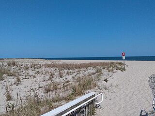
Corson Inlet is a narrow strait on the southern coast of New Jersey in the United States.
Peters Beach or Peter Beach is a former barrier island located on the Jersey Shore of the Atlantic Ocean in Atlantic County, New Jersey, United States. It is now a part of Brigantine Island.
Poverty Beach or Sewell Point is a barrier spit, approximately 2.5 miles (4 km) in length entirely within the City of Cape May, along the Atlantic Ocean coast of eastern New Jersey in the United States. It is the southernmost barrier island in New Jersey.
Squan Beach is the historic name of a barrier spit located on the Jersey Shore of the Atlantic Ocean in Ocean County, New Jersey, United States. Since the closing of Cranberry Inlet around 1812, it has been joined physically to Island Beach, and is a major component of the Barnegat Peninsula.
Island Beach is a barrier spit located on the Jersey Shore of the Atlantic Ocean in Ocean County, New Jersey. Since the closing of Cranberry Inlet about 1812 (approximately at the boundary between Ortley Beach and Seaside Heights), it has been joined physically to Squan Beach, and is a major component of the Barnegat Peninsula.
Short Beach Island, Short Beach or Tucker's Island was a barrier island located on the Jersey Shore of the Atlantic Ocean. Little Beach is a remnant of Short Beach; the northern remnant was encroached upon and attached to Long Beach Island before succumbing to erosion.
Pecks Beach or Peck's Beach is a barrier island located on the Jersey Shore in Cape May County, New Jersey.
Five Mile Beach or Holly Beach is the name of a barrier island on the Jersey Shore in Cape May County. The popular resort area collectively known as The Wildwoods are on Five Mile Beach and adjacent islands.
Two Mile Beach is a barrier island on the Jersey Shore in Cape May County, since 1922 connected to Five Mile Beach.
Brigantine Inlet is an inlet connecting Little Bay with the Atlantic Ocean in Atlantic County, New Jersey.
Great Egg Harbor Inlet is an inlet connecting Great Egg Harbor Bay with the Atlantic Ocean in New Jersey, forming a part of the boundary between Atlantic and Cape May Counties.
Townsends Inlet is an inlet connecting Townsend Sound with the Atlantic Ocean in Cape May County, New Jersey.
Hereford Inlet is an inlet in Cape May County, New Jersey.

Turtle Gut Inlet was an inlet located in what is now Wildwood Crest, in Cape May County, New Jersey, United States.
References
- ↑ Gordon, Thomas Francis (1834). A Gazetteer of the State of New Jersey - Thomas F. Gordon - Google Books . Retrieved October 28, 2018.
- ↑ Historical and Biographical Atlas of the New Jersey Coast, Woolman and Rose, Philadelphia, 1878; p. 21
- ↑ Thornton, John (1706). A New Mapp of East and West New Jarsey, Being an Exact Survey Taken by Mr. John Worlidge (Map). London.
- ↑ Evans, Lewis (1749). A Map of Pensilvania, New-Jersey, New-York, and the Three Delaware Counties (Map). Philadelphia.
- ↑ "Cape May Inlet". Geographic Names Information System . United States Geological Survey.