Cape Reinga

Last updated • 4 min readFrom Wikipedia, The Free Encyclopedia

Cape Reinga / Te Rerenga Wairua
Te Rerenga Wairua (Māori)
Cape Reinga, Northland, New Zealand, October 2007.jpg
New Zealand (location map).svg
Disc Plain red.svg
Cape Reinga
Coordinates: 34°25′44″S172°40′50″E / 34.4288°S 172.6805°E / -34.4288; 172.6805
Location Northland, New Zealand
Offshore water bodiesTasman Sea
Native nameTe Rerenga Wairua (Māori)

Cape Reinga ( /ˈrŋə/ ; sometimes spelled Rēinga, Māori : Te Rerenga Wairua), and officially Cape Reinga / Te Rerenga Wairua, [1] is the northwestern most tip of the Ngatikuri peninsula, at the northern end of the North Island of New Zealand. Cape Reinga is more than 100 km north of the nearest small town of Kaitaia.

Contents

In Māori, Te Rerenga Wairua means the leaping-off place of spirits. [2] Reinga is the Māori word for underworld. [3] Both refer to the Māori belief that the cape is the point where the spirits of the dead enter the underworld.

Cape Reinga is on the tentative list of UNESCO waiting to receive World Heritage Site status. [4] As of 2007, the cape is already a favourite tourist attraction, with over 120,000 visitors a year and around 1,300 cars arriving per day during peak season. Visitor numbers are growing by about five percent a year, and the increase is likely to become even more now that the road to the cape is fully sealed. [5]

Geography

The Tasman Sea (left) meets the Pacific Ocean (right). Meeting point of Tasman Sea and Pacific Ocean.jpg
The Tasman Sea (left) meets the Pacific Ocean (right).

Cape Reinga is generally considered the separation marker between the Tasman Sea to the west and the Pacific Ocean to the east. From the lighthouse it is possible to watch the tidal race, as the two seas clash to create unsettled waters just off the coast. The Māori refer to this as the meeting of Te Moana-a-Rehua, 'the sea of Rehua' with Te Tai-o-Whitirea, 'the sea of Whitirea', Rehua and Whitirea being a male and a female respectively. [2]

Cape Reinga lighthouse at sunset Cape Reinga Lighthouse.jpg
Cape Reinga lighthouse at sunset

The cape is often mistakenly thought of as being the northernmost point of the North Island, and thus, of mainland New Zealand. However, North Cape's Surville Cliffs, 30 km east of Cape Reinga are 3 km further north. Another headland just to the west of Cape Reinga is Cape Maria van Diemen, which was named by the Dutch explorer Abel Tasman during his journey in 1642 and thought of by him to be the northernmost point of the newly discovered country he named 'Staten Landt'.

Access

Cape Reinga is more than 100 km north of the nearest small town of Kaitaia. State Highway 1 extends all the way to the cape, but until 2010 was unsealed gravel road for the last 19 km. [6] Suitable vehicles can also travel much of the way via Ninety Mile Beach and Kauaeparaoa Stream (Te Paki Stream) stream bed.

The cape is also the northern terminus of the Te Araroa hiking trail.

Māori mythology

According to mythology, the spirits of the dead travel to Cape Reinga on their journey to the afterlife to leap off the headland and climb the roots of the 800-year-old pōhutukawa tree and descend to the underworld to return to their traditional homeland of Hawaiki, using the Te Ara Wairua, the 'Spirits' pathway'. At Cape Reinga they depart the mainland. They turn briefly at the Three Kings Islands for one last look back towards the land, then continue on their journey. [2]

A spring in the hillside, Te Waiora-a-Tāne (the 'Living waters of Tāne'), also played an important role in Māori ceremonial burials, representing a spiritual cleansing of the spirits, with water of the same name used in burial rites all over New Zealand. This significance lasted until the local population mostly converted to Christianity, and the spring was capped with a reservoir, with little protest from the mostly converted population of the area. However, the spring soon disappeared and only reappeared at the bottom of the cliff, making the reservoir useless. [2]

Restoration

The former metal road (actually State Highway 1) to Cape Reinga in 2005, sealing being finished in 2010. 'Metal road' is a local term for a gravel road. MetalRoadCapeReinga.jpg
The former metal road (actually State Highway 1) to Cape Reinga in 2005, sealing being finished in 2010. 'Metal road' is a local term for a gravel road.

In 2007 protests by Māori and increased tourist numbers led the Department of Conservation to announce that the public carpark and toilet facilities, which intrude on traditionally sacred ground, would be moved further away from the cape and extended, at a cost of NZ$6.5 million (for details, see external links below). [6] The road to the cape, one of the last stretches of State Highway 1, was sealed following three years of work and include extensive roadside revegetation with over 150,000 plants to prevent erosion. [5] In March 2009, the works on the visitor facilities were completed. [7]

Climate

Cape Reinga has a very mild oceanic climate (Cfb) with high precipitation and little temperature difference between the seasons.

Climate data for Cape Reinga (1991–2020)
MonthJanFebMarAprMayJunJulAugSepOctNovDecYear
Mean daily maximum °C (°F)21.9
(71.4)
22.9
(73.2)
21.7
(71.1)
19.9
(67.8)
17.6
(63.7)
15.5
(59.9)
14.7
(58.5)
14.8
(58.6)
15.6
(60.1)
16.9
(62.4)
18.1
(64.6)
20.1
(68.2)
18.3
(65.0)
Daily mean °C (°F)18.9
(66.0)
19.8
(67.6)
18.9
(66.0)
17.4
(63.3)
15.4
(59.7)
13.4
(56.1)
12.6
(54.7)
12.6
(54.7)
13.3
(55.9)
14.3
(57.7)
15.4
(59.7)
17.4
(63.3)
15.8
(60.4)
Mean daily minimum °C (°F)15.9
(60.6)
16.8
(62.2)
16.1
(61.0)
14.8
(58.6)
13.2
(55.8)
11.4
(52.5)
10.5
(50.9)
10.3
(50.5)
10.9
(51.6)
11.8
(53.2)
12.7
(54.9)
14.6
(58.3)
13.3
(55.8)
Average rainfall mm (inches)58.0
(2.28)
64.6
(2.54)
55.7
(2.19)
108.6
(4.28)
95.5
(3.76)
103.1
(4.06)
128.4
(5.06)
95.3
(3.75)
84.5
(3.33)
61.1
(2.41)
57.2
(2.25)
75.5
(2.97)
987.5
(38.88)
Source: NIWA [8]

Lighthouse

The lighthouse at Cape Reinga was built in 1941 and first lit during May of that year, replacing a lighthouse located on nearby Motuopao Island, which had been built 1879. In 1987, the lighthouse was fully automated and the lighthouse keepers were withdrawn. The previous 1000 watt light and its revolving Fresnel lens have since been replaced with a tiny 50 watt flashing beacon, lodged in their place in the huge lantern.

Related Research Articles

<span class="mw-page-title-main">Hine-nui-te-pō</span> Māori goddess

Hine-nui-te-pō in Māori legends, is a goddess of night and she receives the spirits of humans when they die. She is the daughter of Tāne Mahuta / Tāne Tuturi and Hine-ahuone. It is believed among Māori that the colour red in the sky comes from her. Hine-nui-te-pō shepherds the wairua/souls into the first level of Rarohenga to ready them for the next stage of their journey. Before she was Hine-nui-te-po her name was Hine-ti-tama. Her father Tane Mahuta took her virginity; she then felt upset, hiding herself in eternal darkness to hide from her father and became Hine-nui-te-po, goddess of the night.

<span class="mw-page-title-main">Northland Region</span> Region of New Zealand

The Northland Region is the northernmost of New Zealand's 16 local government regions. New Zealanders sometimes refer to it as the Winterless North because of its mild climate all throughout the year. The major population centre is the city of Whangārei, and the largest town is Kerikeri. At the 2018 New Zealand census, Northland recorded a population growth spurt of 18.1% since the previous 2013 census, placing it as the fastest growing region in New Zealand, ahead of other strong growth regions such as the Bay of Plenty Region and Waikato.

<span class="mw-page-title-main">Manawatāwhi / Three Kings Islands</span> Island group near Cape Reinga, New Zealand

The Manawatāwhi / Three Kings Islands are a group of 13 uninhabited islands about 55 kilometres (34 mi) northwest of Cape Reinga / Te Rerenga Wairua, New Zealand, where the South Pacific Ocean and Tasman Sea converge. They measure 6.85 km2 (2.64 sq mi) in area. The islands are on a submarine plateau, the Three Kings Bank, and are separated from the New Zealand mainland by an 8 km wide, 200 to 300 m deep submarine trough. Therefore, despite relative proximity to the mainland, the islands are listed with the New Zealand Outlying Islands. The islands are an immediate part of New Zealand, but not part of any region or district, but instead Area Outside Territorial Authority, like all the other outlying islands except the Solander Islands.

<span class="mw-page-title-main">Ninety Mile Beach, New Zealand</span> Beach in New Zealand

Te-Oneroa-a-Tōhē / Ninety Mile Beach is on the western coast of the far north of the North Island of New Zealand. The beach is actually 88 kilometres long. Its southern end is close to the headland of Tauroa Point, to the west of Ahipara Bay, near Kaitaia. From there it sweeps briefly northeast before running northwest along the Aupōuri Peninsula for the majority of its length. It ends at Tiriparepa / Scott Point, 5 kilometres (3 mi) south of Cape Maria van Diemen and about 10 kilometres (6 mi) south of Cape Reinga / Te Rerenga Wairua.

<span class="mw-page-title-main">Kaitaia</span> Town in the North Island of New Zealand

Kaitaia is a town in the Far North District of New Zealand, at the base of the Aupōuri Peninsula, about 160 km northwest of Whangārei. It is the last major settlement on State Highway 1. Ahipara Bay, the southern end of Te Oneroa-a-Tōhē / Ninety Mile Beach, is 5 kilometres (3.1 mi) west.

<span class="mw-page-title-main">Northland Peninsula</span> Peninsula in New Zealand

The Northland Peninsula, called the North Auckland Peninsula in earlier times, is in the far north of the North Island of New Zealand. It is joined to the rest of the island by the Auckland isthmus, a narrow piece of land between the Waitematā Harbour and the Manukau Harbour in the middle of the Auckland metropolitan area. The peninsula is not conterminous with the local government area of Northland Region, which occupies the northern 80% of the peninsula, as the southern section is administratively part of the Auckland Region.

<span class="mw-page-title-main">Far North District</span> Territorial authority district in Northland Region, New Zealand

The Far North District is the northernmost territorial authority district of New Zealand, consisting of the northern part of the Northland Peninsula in the North Island. It stretches from North Cape / Otou and Cape Reinga / Te Rerenga Wairua in the north, down to the Bay of Islands, the Hokianga and the town of Kaikohe.

<span class="mw-page-title-main">Muriwai</span> Beach community near Auckland, New Zealand

Muriwai, also called Muriwai Beach, is a coastal community on the west coast of the Auckland Region in the North Island of New Zealand. The black-sand surf beach and surrounding area is a popular recreational area for Aucklanders. The Muriwai Regional Park includes a nesting site for a large colony of gannets.

<span class="mw-page-title-main">Spirits Bay</span> Bay in Northland, New Zealand

Spirits Bay, officially named Piwhane / Spirits Bay, is a remote bay at the northern end of the Aupouri Peninsula, which forms the northern tip of New Zealand's North Island. It lies between Cape Reinga / Te Rerenga Wairua in the west and Ngataea / Hooper Point in the east. It is one of two bays in the short length of coast at the top of the North Island.

<span class="mw-page-title-main">Aupōuri Peninsula</span> Northernmost peninsula of New Zealand

The Aupōuri Peninsula is a tombolo at the northern tip of the North Island of New Zealand. It projects between the Tasman Sea to the west and the Pacific Ocean to the east. It constitutes the northern part of the Far North District, incorporating North Cape, Houhora and the northern half of Awanui.

<span class="mw-page-title-main">Rangitikei District</span> Territorial authority district in Manawatū-Whanganui

The Rangitikei District is a territorial authority district located primarily in the Manawatū-Whanganui region in the North Island of New Zealand, although a small part, the town of Ngamahanga, lies in the Hawke's Bay Region. It is located in the southwest of the island, and follows the catchment area of the Rangitīkei River.
<span class="mw-page-title-main">Te Aupōuri</span> Māori iwi in New Zealand

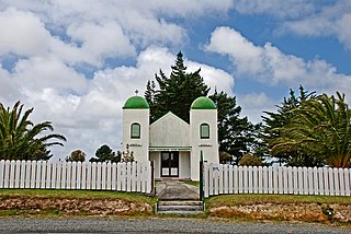
Te Aupōuri is the second northernmost Māori iwi, located north of Kaitaia, Northland, New Zealand, a region known as the Te Hiku o te Ika. The iwi is one of the six Muriwhenua iwi of the far north of the North Island.

Rarohenga is the subterranean realm where spirits of the deceased dwell after death, according to Māori oral tradition. The underworld is ruled by Hine-nui-te-pō, the goddess of death and night. Additional occupants include guardians, gods, goddesses, holy chiefs and nobles (rangatira), and the tūrehu, who are described as celestial, fairy-like people. Rarohenga is predominantly depicted as a place of peace and light. As articulated by Māori ethnographer Elsdon Best: It is a place where darkness is unknown. "This is the reason why, of all spirits of the dead since the time of Hine-ahuone…, not a single one has ever returned hither to dwell in this world".

<span class="mw-page-title-main">Te Pīhopatanga o Te Tai Tokerau</span>

Te Pīhopatanga o Te Tai Tokerau is an episcopal polity or diocese of the Anglican Church in Aotearoa, New Zealand and Polynesia. Literally, the diocese is the Anglican bishopric of the north coast of the North Island of Aotearoa, New Zealand; also known as the synod.

<span class="mw-page-title-main">Awanui</span> Place in Northland Region, New Zealand

Awanui is an historical river port in the far north of New Zealand, on the banks of the Awanui River just before it flows into Rangaunu Bay. Awanui lies at the south end of the Aupouri Peninsula in the Far North District Council of the Northland Region, approximately 7 km north of Kaitaia. The river port has ceased operation and a recreational wharf is located at Unahi, on the shore of Rangaunu Bay, approximately 3 km north of the township. The traditional name of Awanui was Kaiwaka and Awanui proper refers to the "River at Kaiwaka". Awanui had an estimated population of 650 as of June 2024.

<span class="mw-page-title-main">Herekino</span> Place in Northland Region, New Zealand

Herekino is a locality in Northland, New Zealand. It lies 26 km south west of Kaitaia. The Herekino Harbour, also called the Herekino River, is an estuary and inlet from the Tasman Sea to the west. The Herekino Forest, which contains a stand of large kauri, is to the north, and the Tauroa Peninsula lies to the north west.

<span class="mw-page-title-main">Ngāti Kurī</span> Māori iwi in New Zealand

Ngāti Kurī is a Māori iwi from Northland, New Zealand. The iwi is one of the five Muriwhenua iwi of the far north of the North Island. Ngāti Kurī trace their whakapapa (ancestry) back to Pōhurihanga, the captain of the waka (canoe) Kurahaupō. Kurī, in Māori, means "dog". The rohe of the iwi is focused on the most northern tip of the North Island and includes the Kermadec Islands, Manawatāwhi / Three Kings Islands, Cape Reinga / Te Rerenga Wairua, Ninety Mile Beach, Parengarenga Harbour, Te Kao and Houhora.

<span class="mw-page-title-main">Ghosts and spirits in Māori culture</span>

The topic of ghosts and spirits (kehua) in Māori culture is often considered a tapu subject, yet many Māori legends contain mentions of apparitions and paranormal occurrences. It is claimed that long deceased family members may appear to warn of upcoming danger, such as with the famous phantom canoe in 1886 that many reportedly saw on Lake Tarawera, that is believed to have been an omen for the volcanic eruption that occurred eleven days later.
<span class="mw-page-title-main">Muriwhenua</span> Ethnic group

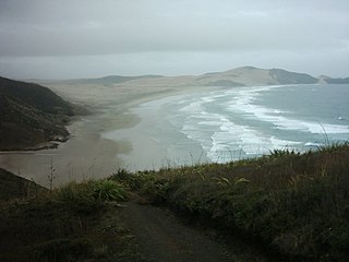
Muriwhenua are a group of northern Māori iwi, based in Te Hiku o te Ika, the northernmost part of New Zealand's North Island. It consists of six iwi, Ngāti Kurī, Ngāi Takoto, Te Pātū, Ngāti Kahu, Te Aupōuri and Te Rarawa, with a combined population of about 34,000 people. The spiritually significant Hokianga Harbour, located just to the south of the Maungataniwha Range, is of special significance to the Muriwhenua people.
References

  1. "Deed Of Settlement, Ngati Kuri and the Crown" (PDF). www.ngatikuri.iwi.nz. 9 September 2015. Retrieved 15 May 2024.
  2. 1 2 3 4 MITCALFE, BARRY (June 1961). "TE RERENGA WAIRUA - LEAPING PLACE OF THE SPIRITS". paperspast.natlib.govt.nz. Te Ao Hou. Retrieved 15 May 2024.
  3. "Cape Reinga/Te Rerenga Wairua heritage". www.doc.govt.nz. Retrieved 15 May 2024.
  4. All Tentative Sites [ dead link ] (from the World Heritage Site website)
  5. 1 2 Gee, Tony (3 September 2007). "Three-year Cape Reinga road upgrade under way". The New Zealand Herald . Retrieved 23 September 2011.
  6. 1 2 Gee, Tony (23 August 2007). "Cape Reinga improvements to restore mana of spirits' highway". NZ Herald. Retrieved 15 May 2024.
  7. "SH1 Cape Reinga, Project Newsletter 5, July 2009" (PDF). NZ Transport Agency . Archived from the original (PDF) on 22 May 2010. Retrieved 10 February 2010.
  8. "CliFlo – National Climate Database : Cape Reinga Aws". NIWA. Retrieved 20 May 2024.