
Daviess County is a county in the U.S. state of Indiana. As of the 2020 United States Census, the population was 33,381. The county seat is Washington. About 15% of the county's population is Amish of Swiss origin, as of 2017.
Washington is a city in Daviess County, Indiana. The population was 12,017 at the time of the 2020 census. The city is the county seat of Daviess County. It is also the principal city of the Washington, Indiana Micropolitan Statistical Area, which comprises all of Daviess County and had an estimated 2017 population of 31,648.

Cass Township is one of fifteen townships in Greene County, Indiana, USA. As of the 2020 census, its population was 299, down from 358 at 2010.

Decker Township is one of ten townships in Knox County, Indiana. As of the 2020 census, its population was 209 and it contained 95 housing units.

Harrison Township is one of ten townships in Knox County, Indiana. As of the 2020 census, its population was 1,921 and it contained 867 housing units.

Vigo Township is one of ten townships in Knox County, Indiana. As of the 2020 census, its population was 4,083 and it contained 2,095 housing units.

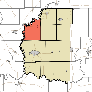
Barr Township is one of ten townships in Daviess County, Indiana. As of the 2020 census, its population was 5,431 and it contained 1,649 housing units.
Bogard Township is one of ten townships in Daviess County, Indiana. As of the 2020 census, its population was 1,592 and it contained 408 housing units.

Elmore Township is one of ten townships in Daviess County, Indiana, United States. As of the 2020 census, its population was 1,120 and it contained 462 housing units.

Harrison Township is one of ten townships in Daviess County, Indiana. As of the 2020 census, its population was 689 and it contained 308 housing units.

Madison Township is one of ten townships in Daviess County, Indiana. As of the 2020 census, its population was 3,018 and it contained 1,276 housing units.
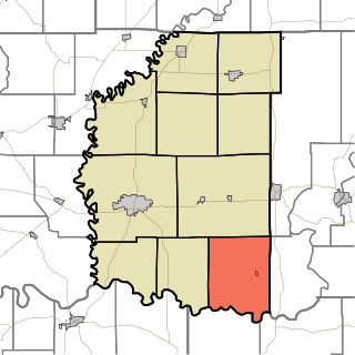
Reeve Township is one of ten townships in Daviess County, Indiana. As of the 2020 census, its population was 624 and it contained 246 housing units.
Steele Township is one of ten townships in Daviess County, Indiana. As of the 2010 census, its population was 910 and it contained 402 housing units.

Van Buren Township is one of ten townships in Daviess County, Indiana. As of the 2020 census, its population was 2,813 and it contained 727 housing units.

Veale Township is one of ten townships in Daviess County, Indiana. As of the 2020 census, its population was 1,130 and it contained 449 housing units.

Washington Township is one of ten townships in Daviess County, Indiana. As of the 2020 census, its population was 16,054 and it contained 6,811 housing units.

Boone Township is one of twelve townships in Dubois County, Indiana. As of the 2010 census, its population was 799 and it contained 321 housing units.

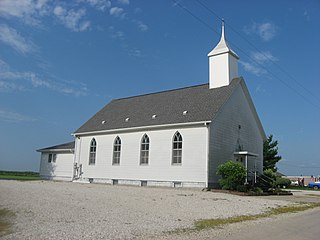
Cornettsville is an unincorporated community in Bogard Township, Daviess County, Indiana, United States.

Glendale is an unincorporated community in Harrison Township, Daviess County, Indiana.

Raglesville is an unincorporated community and census-designated place (CDP) in Van Buren Township, Daviess County, Indiana, United States. As of the 2010 census it had a population of 141.


