Raglesville, Indiana

Last updated

Raglesville, Indiana
Daviess County Indiana Incorporated and Unincorporated areas Raglesville Highlighted 1862712.svg
Location of Raglesville in Daviess County, Indiana.
USA Indiana location map.svg
Red pog.svg
Raglesville
Location in Indiana
Coordinates: 38°48′08″N86°57′44″W / 38.80222°N 86.96222°W / 38.80222; -86.96222
Country United States
State Indiana
County Daviess
Township Van Buren
Area
[1]
  Total0.86 sq mi (2.22 km2)
  Land0.85 sq mi (2.21 km2)
  Water0.00 sq mi (0.01 km2)
Elevation
[2]
600 ft (200 m)
Population
 (2020)
  Total115
  Density134.66/sq mi (51.99/km2)
ZIP code
47562
FIPS code 18-62712 [3]
GNIS feature ID2583466 [2]

Raglesville is an unincorporated community and census-designated place (CDP) in Van Buren Township, Daviess County, Indiana, United States. As of the 2010 census it had a population of 141. [4]

Contents

History

Raglesville was laid out in 1837. [5] A post office was established at Raglesville in 1849, and remained in operation until it was discontinued in 1923. [6] John Ragle was the first postmaster. [7]

Geography

Raglesville is located in northeastern Daviess County at 38°48′12″N86°57′41″W / 38.80333°N 86.96139°W / 38.80333; -86.96139 . It is 4 miles (6 km) southeast of Odon and 21 miles (34 km) northeast of Washington, the county seat.

According to the U.S. Census Bureau, the Raglesville CDP has an area of 0.85 square miles (2.2 km2), all of it land. [4]

Demographics

Historical population
CensusPop.Note
2020 115
U.S. Decennial Census [8]

Related Research Articles

<span class="mw-page-title-main">Daviess County, Indiana</span> County in Indiana, United States

Daviess County is a county in the U.S. state of Indiana. As of the 2020 United States Census, the population was 33,381. The county seat is Washington. About 15% of the county's population is Amish of Swiss origin, as of 2017.

<span class="mw-page-title-main">Memphis, Indiana</span> CDP in Indiana, United States

Memphis is a census-designated place (CDP) in Clark County, Indiana, United States. The population was 695 at the 2010 census.

<span class="mw-page-title-main">New Washington, Indiana</span> CDP in Indiana, United States

New Washington is a census-designated place (CDP) in Clark County, Indiana, United States. As of the 2010 census, the population was 566.

<span class="mw-page-title-main">Koontz Lake, Indiana</span> Census-designated place in Indiana, United States

Koontz Lake is an unincorporated community and census-designated place (CDP) in Starke and Marshall counties, in the U.S. state of Indiana. The population was 1,667 at the 2020 census.

<span class="mw-page-title-main">Mexico, Indiana</span> Census-designated place in Indiana, United States

Mexico is an unincorporated community and census-designated place (CDP) in Jefferson Township, Miami County, in the U.S. state of Indiana. The population was 915 at the 2020 census.

<span class="mw-page-title-main">Bass Lake, Indiana</span> Census-designated place in Indiana, United States

Bass Lake is a census-designated place (CDP) in California and North Bend Townships, Starke County, in the U.S. state of Indiana. The population was 1,195 at the 2010 census. Covering over 1,300 surface acres, Bass Lake is the third-largest natural lake in Indiana.

<span class="mw-page-title-main">Van Buren Township, Daviess County, Indiana</span> Township in Indiana, United States

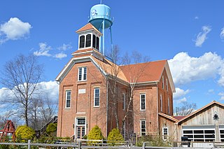
Van Buren Township is one of ten townships in Daviess County, Indiana. As of the 2010 census, its population was 2,552 and it contained 657 housing units. The population grew 30% since the 2000 census, when the population was 1,960.

<span class="mw-page-title-main">Herbst, Indiana</span> Census-designated place in Indiana, United States

Herbst is an unincorporated census-designated place in Franklin Township, Grant County, Indiana, in the United States. As of the 2010 census, the population was 112.

<span class="mw-page-title-main">Owensburg, Indiana</span> Census-designated place in Indiana, United States

Owensburg is an unincorporated community and census-designated place (CDP) in Jackson Township, Greene County, Indiana, United States. It was named in honor of the Owens family of early settlers. As of the 2010 census it had a population of 406.

<span class="mw-page-title-main">Scotland, Indiana</span> Census-designated place in Indiana, United States

Scotland is an unincorporated community and census-designated place (CDP) in Taylor Township, Greene County, Indiana, United States. As of the 2010 census it had a population of 134.

<span class="mw-page-title-main">Freetown, Indiana</span> Census-designated place in Indiana, United States

Freetown is an unincorporated community and census-designated place in Pershing Township, Jackson County, Indiana, United States. As of the 2010 census the population was 385.

<span class="mw-page-title-main">Vallonia, Indiana</span> Census-designated place in Indiana, United States

Vallonia is an unincorporated community and census-designated place (CDP) in Driftwood and Brownstown townships, Jackson County, Indiana, United States. It was an 18th-century French settlement and 19th-century American frontier fortification known as Fort Vallonia. As of the 2010 census, Vallonia had a population of 336.

Kent is an unincorporated community and census-designated place (CDP) in Republican Township, Jefferson County, Indiana, United States. As of the 2010 census it had a population of 70.

<span class="mw-page-title-main">Emison, Indiana</span> Census-designated place in Indiana, United States

Emison is an unincorporated community and census-designated place (CDP) in Busseron Township, Knox County, Indiana. Its population was 154 at the 2010 census.

<span class="mw-page-title-main">Westphalia, Indiana</span> Census-designated place in Indiana, United States

Westphalia is an unincorporated community and census-designated place (CDP) in Vigo Township, Knox County, Indiana. As of the 2010 census it had a population of 202.

<span class="mw-page-title-main">Hudson Lake, Indiana</span> Census-designated place in Indiana, United States

Hudson Lake is an unincorporated community and census-designated place (CDP) in Hudson Township, LaPorte County, Indiana, United States. The town sits on the dividing line between Central and Eastern time zones. It is the site of the Hudson Lake station stop of the South Shore Line. As of the 2010 census, the population of the CDP was 1,297.

<span class="mw-page-title-main">Rolling Prairie, Indiana</span> Census-designated place in Indiana, United States

Rolling Prairie is an unincorporated community and census-designated place (CDP) in Kankakee Township, LaPorte County, Indiana, United States. As of the 2010 census, it had a population of 582.

<span class="mw-page-title-main">Avoca, Indiana</span> Census-designated place in Indiana, United States

Avoca is an unincorporated community and census-designated place in Marshall Township, Lawrence County, Indiana, United States. As of the 2010 census the population was 583.

<span class="mw-page-title-main">Williams, Lawrence County, Indiana</span> Census-designated place in Indiana, United States

Williams is an unincorporated community and census-designated place in Spice Valley Township, Lawrence County, Indiana, United States. As of the 2010 census, the population was 286.

<span class="mw-page-title-main">Buffalo, Indiana</span> Census-designated place in Indiana, United States

Buffalo is a census-designated place (CDP) in Liberty Township, White County, in the U.S. state of Indiana. The population was 692 at the 2010 census.

References

  1. "2020 U.S. Gazetteer Files". United States Census Bureau. Retrieved March 16, 2022.
  2. 1 2 U.S. Geological Survey Geographic Names Information System: Raglesville, Indiana
  3. "U.S. Census website". United States Census Bureau . Retrieved January 31, 2008.
  4. 1 2 "Geographic Identifiers: 2010 Demographic Profile Data (G001): Raglesville CDP, Indiana". U.S. Census Bureau, American Factfinder. Retrieved October 23, 2015.[ dead link ]
  5. History of Knox and Daviess County, Indiana: From the Earliest Time to the Present. Goodspeed. 1886. pp.  706.
  6. "Daviess County". Jim Forte Postal History. Retrieved August 31, 2014.
  7. Baker, Ronald L. (October 1995). From Needmore to Prosperity: Hoosier Place Names in Folklore and History . Indiana University Press. p.  275. ISBN   978-0-253-32866-3. ...with John Ragle as postmaster...
  8. "Census of Population and Housing". Census.gov. Retrieved June 4, 2016.