Related Research Articles

Hampshire County is a county in the U.S. state of West Virginia. As of the 2010 census, the population was 23,964. Its county seat is Romney, West Virginia's oldest town (1762). The county was created by the Virginia General Assembly in 1754, from parts of Frederick and Augusta Counties (Virginia) and is the state's oldest county. The county lies in both West Virginia's Eastern Panhandle and Potomac Highlands regions.

The South Branch Potomac River has its headwaters in northwestern Highland County, Virginia near Hightown along the eastern edge of the Allegheny Front. After a river distance of 139 miles (224 km), the mouth of the South Branch lies east of Green Spring in Hampshire County, West Virginia where it meets the North Branch Potomac River to form the Potomac.

The Cacapon River, located in the Appalachian Mountains of West Virginia's Eastern Panhandle region, is an 81.0-mile-long (130.4 km) shallow river known for its fishing, boating, wildlife, hunting, and wilderness scenery. As part of the Potomac River watershed, it is an American Heritage River.
The Northwestern Turnpike is a historic road in West Virginia, important for being historically one of the major roads crossing the Appalachians, financed by the Virginia Board of Public Works in the 1830s. In modern times, west of Winchester, Virginia, U.S. Route 50 follows the path of the Northwestern Turnpike into West Virginia, whose major Corridor D project follows the western section of the original Northwestern Turnpike.

The Sloan–Parker House, also known as the Stone House, Parker Family Residence, or Richard Sloan House, is a late-18th-century stone residence near Junction, Hampshire County, in the U.S. state of West Virginia. It was built on land vacated by the Shawnee after the Native American nation had been violently forced to move west to Kansas following their defeat at the Battle of Point Pleasant in 1774. The building was added to the National Register of Historic Places on June 5, 1975, becoming Hampshire County's first property to be listed on the register. The Sloan–Parker House has been in the Parker family since 1854. The house and its adjacent farm are located along the Northwestern Turnpike in the rural Mill Creek valley.
Slanesville is an unincorporated community in northeastern Hampshire County in the U.S. state of West Virginia. Slanesville is located at the crossroads of Bloomery Pike with Slanesville Pike and Cold Stream Road. Slanesville Pike and Cold Stream Road formerly made up the Springfield Grade Road that ran from Capon Bridge to Springfield. According to the 2000 census, the Slanesville community has a population of 691.
Hanging Rock is an unincorporated community in Hampshire County in the U.S. state of West Virginia. Hanging Rock is named for the "Hanging Rock" outcrop that hangs over the Northwestern Turnpike. It should not be confused with the plural "Hanging Rocks" over the South Branch Potomac River north of Romney at Wapocomo. Originally, the community of Hanging Rock sprang up in the Henderson Hollow gap of North River Mountain. While only a few buildings of the old hamlet remain, today's Hanging Rock is situated at the intersection of North River Road and Delray Road where the North River flows under U.S. Route 50 towards the Cacapon.

West Virginia Route 28 is a north–south route through the Potomac Highlands of the U.S. state of West Virginia. The southern terminus of the route is at West Virginia Route 39 in Huntersville. The northern terminus is at the Maryland state line in Wiley Ford, where the route continues into Cumberland as Canal Parkway upon crossing the North Branch Potomac River.
The South Branch Valley Railroad is a 52.4-mile-long (84.3 km) railroad in the Eastern Panhandle of West Virginia. The branch line, which parallels the South Branch Potomac River, runs north from Petersburg to Green Spring, where it connects to the national rail network at a junction with the CSX Cumberland Subdivision.
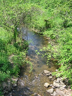
Dillons Run is a 12.9-mile-long (20.8 km) tributary stream of the Cacapon River, belonging to the Potomac River and Chesapeake Bay watersheds. The stream is located in Hampshire County in the U.S. state of West Virginia's Eastern Panhandle.
Mill Branch is a 9.1-mile-long (14.6 km) tributary stream of the Cacapon River, belonging to the Potomac River and Chesapeake Bay watersheds. The stream is located in eastern Hampshire County in West Virginia's Eastern Panhandle.

U.S. Route 50 in West Virginia runs from the border with Ohio to Virginia, passing briefly through Garrett County, Maryland, and following the Northwestern Turnpike. Prior to the U.S. Highway System it was West Virginia Route 1 and in the 1930s, the road was not finished in Maryland. Today the section of US 50 from Clarksburg to Parkersburg on the Ohio River is part of Corridor D of the Appalachian Development Highway System.
Moorefield and North Branch Turnpike was a turnpike in the U.S. state of Virginia built to facilitate travel and commerce between the Baltimore and Ohio Railroad at Green Spring on the North Branch Potomac River and Moorefield. Today, Green Spring Road, Harriott-Wappocomo Road, and West Virginia Route 28 encompass most of the Moorefield and North Branch Turnpike's original route.
The Springfield Grade Road was an early turnpike between Springfield, West Virginia and Capon Bridge, West Virginia.

The North River is a tributary of the Cacapon River, belonging to the Potomac River and Chesapeake Bay watersheds. The river is located in Hampshire and Hardy counties in the U.S. state of West Virginia's Eastern Panhandle. The mouth of the North River into the Cacapon is located at Forks of Cacapon. From its headwaters to its mouth, the North River spans 52.4 miles (84.3 km) in length.
James Caudy was an American frontiersman, settler, and landowner in the Ridge-and-Valley Appalachians of the Colony of Virginia—present-day West Virginia. Caudy was born in the Netherlands, immigrated to the Thirteen Colonies in the 1730s, and settled within the Cacapon River valley near present-day Capon Bridge in Hampshire County. As early as 1741, Caudy was associated with the arrangement and development of transportation routes throughout present-day Hampshire County. Caudy twice hosted George Washington; first during his surveying expedition in 1748 and again upon Washington's 1750 return to the Cacapon River valley.

The Capon Lake Whipple Truss Bridge, formerly known as South Branch Bridge or Romney Bridge, is a historic Whipple truss bridge in Capon Lake, West Virginia. It is located off Carpers Pike and crosses the Cacapon River. The bridge formerly carried Capon Springs Road over the river, connecting Capon Springs and Capon Lake.
References
- 1 2 3 4 5 6 7 8 9 Maxwell, Hu; Swisher, Howard Llewellyn (1897), History of Hampshire County, West Virginia: From Its Earliest Settlement to the Present, A.B. Boughner, printer
- ↑ Virginia General Assembly (1861), Journal of the House of Delegates of the State of Virginia, Virginia House of Delegates, Supt. Public Printing
| | This article is about a location in Hampshire County, West Virginia is a stub. You can help Wikipedia by expanding it. |
| | This Virginia road or road transport-related article is a stub. You can help Wikipedia by expanding it. |
| | This West Virginia road or road transport-related article is a stub. You can help Wikipedia by expanding it. |