
Chiloé Island also known as Greater Island of Chiloé, is the largest island of the Chiloé Archipelago off the west coast of Chile, in the Pacific Ocean. The island is located in southern Chile, in the Los Lagos Region.

Ancud is a city in southern Chile located in the northernmost part of the island and province of Chiloé, in Los Lagos Region. It is the second largest city of Chiloé Archipelago after Castro. The city was established in 1768 to function as the capital of the archipelago and held that position until 1982. Founded as bulwark against foreign powers in colonial times, the city played an important role in the Chilean colonization of Patagonia in the 19th century.
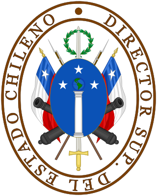
The Supreme Director of Chile was the Head of State and of Government of Chile in the periods of 1814 and 1817-1826.

This is a timeline of Chilean history, comprising important legal and territorial changes and political events in Chile and its predecessor states. To read about the background to these events, see History of Chile. See also the list of governors and presidents of Chile.

San Rafael Lake is an arc-shaped coastal lake located in the Aysén del General Carlos Ibáñez del Campo Region of Chile, within the national park that bears its name. To the north the lagoon is connected to the Moraleda Channel, to the south lies the Ofqui Isthmus. To the west and east lie the Taitao Peninsula and the Northern Patagonian Ice Field respectively.

The Chiloé Archipelago is a group of islands lying off the coast of Chile, in the Los Lagos Region. It is separated from mainland Chile by the Chacao Channel in the north, the Sea of Chiloé in the east and the Gulf of Corcovado in the southeast. All islands except the Desertores Islands form Chiloé Province. The main island is Chiloé Island. Of roughly rectangular shape, the southwestern half of this island is a wilderness of contiguous forests, wetlands and, in some places, mountains. The landscape of the northeastern sectors of Chiloé Island and the islands to the east is dominated by rolling hills, with a mosaic of pastures, forests and cultivated fields.
The Destruction of the Seven Cities is a term used in Chilean historiography to refer to the destruction or abandonment of seven major Spanish outposts in southern Chile around 1600, caused by the Mapuche and Huilliche uprising of 1598. The Destruction of the Seven Cities, in traditional historiography, marks the end of the Conquest period and the beginning of the proper colonial period.
Cuncos, Juncos or Cunches is a poorly known subgroup of Huilliche people native to coastal areas of southern Chile and the nearby inland. Mostly a historic term, Cuncos are chiefly known for their long-running conflict with the Spanish during the colonial era of Chilean history.

The dalca or piragua is a type of canoe employed by the Chonos, a nomadic indigenous people of southern Chile, and Huilliche people living in Chiloé archipelago. It was a light boat and ideal for navigating local waterways, including between islands of the Chiloé Archipelago, through the Chacao Channel to mainland Chile, and along the coast of the Gulf of Penas. Spanish chronicles called it best-suited for those waters, far superior to ships of the conquistadores.

The Dutch expedition to Valdivia was a naval expedition, commanded by Hendrik Brouwer, sent by the Dutch Republic in 1643 to establish a base of operations and a trading post on the southern coast of Chile. With Spain and the Dutch Republic at war, the Dutch wished to take over the ruins of the abandoned Spanish city of Valdivia. The expedition sacked the Spanish settlements of Carelmapu and Castro in the Chiloé Archipelago before sailing to Valdivia, having the initial support of the local natives. The Dutch arrived in Valdivia on 24 August 1643 and named the colony Brouwershaven after Brouwer, who had died several weeks earlier. The short-lived colony was abandoned on 28 October 1643. Nevertheless, the occupation caused great alarm among Spanish authorities. The Spanish resettled Valdivia and began the construction of an extensive network of fortifications in 1645 to prevent a similar intrusion. Although contemporaries considered the possibility of a new incursion, the expedition was the last one undertaken by the Dutch on the west coast of the Americas.
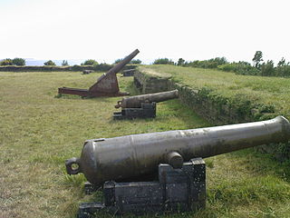
In Colonial times the Spanish Empire diverted significant resources to fortify the Chilean coast as consequence of Dutch and English raids. The Spanish attempts to block the entrance of foreign ships to the eastern Pacific proved fruitless due to the failure to settle the Strait of Magellan and the discovery of the Drake Passage. As result of this the Spanish settlement at Chiloé Archipelago became a centre from where the west coast of Patagonia was protected from foreign powers. In face of the international wars that involved the Spanish Empire in the second half of the 18th century the Crown was unable to directly protect peripheral colonies like Chile leading to local government and militias assuming the increased responsibilities.
In Colonial times the Spanish Empire diverted significant resources to fortify the Chilean coast as a consequence of Dutch and English raids. During the 16th century the Spanish strategy was to complement the fortification work in its Caribbean ports with forts in the Strait of Magellan. As attempts at settling and fortifying the Strait of Magellan were abandoned the Spanish began to fortify the Captaincy General of Chile and other parts of the west coast of the Americas. The coastal fortifications and defense system was at its peak in the mid-18th century.

The Governorate of Chiloé was political and military subdivision of the Spanish Empire that existed, with a 1784–1789 interregnum,from 1567 to 1848. The Governorate of Chiloé depended on the Captaincy General of Chile until the late 18th century when it was made dependent directly on the Viceroyalty of Peru. The administrative change was done simultaneously as the capital of the archipelago was moved from Castro to Ancud in 1768. The last Royal Governor of Chiloé, Antonio de Quintanilla, depended directly on the central government in Madrid.
The Antonio de Vea expedition of 1675–1676 was a Spanish naval expedition to the fjords and channels of Patagonia aimed to find whether rival colonial powers—specifically, the English—were active in the region. While this was not the first Spanish expedition to the region, it was the largest up to then, involving 256 men, one ocean-going ship, two long boats and nine dalcas. The expedition dispelled suspicion about English bases in Patagonia. Spanish authorities' knowledge of western Patagonia was greatly improved by the expedition, yet Spanish interest in the area waned thereafter until the 1740s.
Cristóbal Talcapillán, also known as Don Cristóbal, was a Chono man who became known for his role in ushering the expeditions of Bartolomé Gallardo (1674–1675) and Antonio de Vea (1675–1676) into the fjords and channels of Patagonia.
Bartolomé Diez Gallardo y Andrade was a criollo soldier from Chiloé. He is known for leading a 1674–1675 expedition to the fjords and channels of Patagonia, participating in the following year in the Antonio de Vea expedition to the same area and for serving as Governor of Chiloé from 1686 to 1688.
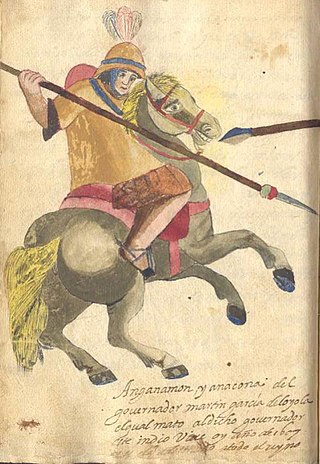
The Huilliche uprising of 1792 was an indigenous uprising against the Spanish penetration into Futahuillimapu, territory in southern Chile that had been de facto free of Spanish rule since 1602. The first part of the conflict was a series of Huilliche attacks on Spanish settlers and the mission in the frontier next to Bueno River. Following this a militia in charge of Tomás de Figueroa departed from Valdivia ravaging Huilliche territory in a quest to subdue anti-Spanish elements in Futahuillimapu.
Agüi Fort, also written as Agui or Ahui, and otherwise known as San Miguel de Agüi Castle), is a fortification located on the Lacuy peninsula, Chile.

By the late 1660s, the English rulers had considered invading Spanish-ruled Chile for several years. In 1655, Simón de Casseres proposed to Oliver Cromwell a plan to take over Chile with only four ships and a thousand men.
