Carn Llidi

Last updated

Carn Llidi
Carn Llidi (8397).jpg
Highest point
Elevation 181 m (594 ft) [1]
Prominence 122 m (400 ft) [1]
Listing HuMP
Coordinates 51°54′16″N5°17′23″W / 51.90456°N 5.28967°W / 51.90456; -5.28967 Coordinates: 51°54′16″N5°17′23″W / 51.90456°N 5.28967°W / 51.90456; -5.28967
Naming
English translationCairn of the Ashes
Language of name Welsh
Geography
Pembrokeshire UK relief location map.jpg
Red triangle with thick white border.svg
Carn Llidi
OS grid SM738280

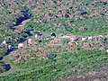
Carn Llidi is a hill east of St David's Head in Pembrokeshire, Wales. Carn Llidi and its surrounding area is part of the Pembrokeshire Coast National Park. [2]

Contents

The 594 feet (181 m) rocky hill stands in a prominent and isolated position dominating Whitesands Bay. On clear days, there are views west towards Ramsey Island and the Bishops and Clerks islets, and north towards Strumble Head; on clear evenings, in mid-summer at sunset, glimpses of the Wicklow Mountains in Ireland. [2] [3]

Archaeology

The area is rich in archaeology. Two burial chambers, presumed to be neolithic, are located on the higher southwest slopes of the hill. [4] Another stone nearby may be the capstone of a megalithic chamber. [5] Prehistoric enclosures and field systems are located to the northwest of the hill, [6] near to an iron-age defensive wall. [7]

During World War II, a Chain Home Low early-warning radar station was located on Carn Llidi. The concrete base and a Lewis gun pit remain. [8]

Also during World War II, on 4 June 1943, a Martin B-26 Marauder medium bomber of the 335th Bombardment Group of the US Air Force crashed into Carn Llidi killing all four crew, after it had become lost in poor weather on a flight from North Africa to Cornwall. A memorial incorporating one of the twisted propeller blades is located in the Whitesands Bay car park. [9]

Name

The meaning of Carn Llidi is Cairn of the Ashes, llidi being a South Walian variant of lludw, meaning ash or ashes. [10]

Access to the summit

The walk which leads from a Whitesands Bay car park can take you to the summit either through Porthmawr Farm or via the coast path towards St Davids Head. The climb does not require any special hiking ability, but it is advisable to wear proper outdoor clothing. [11]

See also

Related Research Articles

<span class="mw-page-title-main">Pembrokeshire Coast Path</span> Hiking trail in Wales

The Pembrokeshire Coast Path, often called the Pembrokeshire Coastal Path, is a designated National Trail in Pembrokeshire, southwest Wales. Established in 1970, it is a 186-mile (299 km) long-distance walking route, mostly at cliff-top level, with a total of 35,000 feet (11,000 m) of ascent and descent. At its highest point – Pen yr afr, on Cemaes Head – it reaches a height of 574 feet (175 m), and at its lowest point – Sandy Haven crossing, near Milford Haven – it is just 6 feet (2 m) above low water. Whilst most of the coastline faces west, it offers – at varying points – coastal views in every direction of the compass.

<span class="mw-page-title-main">St Davids</span> Cathedral city in Pembrokeshire, Wales

St Davids or St David's is a city and a community with a cathedral in Pembrokeshire, Wales, lying on the River Alun. It is the resting place of Saint David, Wales's patron saint, and named after him. St Davids is the United Kingdom's smallest city and urban area. St Davids was given city status in the 12th century. This does not derive automatically from criteria, but in England and Wales it was traditionally given to cathedral towns under practices laid down in the early 1540s, when Henry VIII founded dioceses. City status was lost in 1886, but restored in 1994 at the request of Queen Elizabeth II.

<span class="mw-page-title-main">Pembrokeshire Coast National Park</span> National park in Wales

Pembrokeshire Coast National Park is a national park along the Pembrokeshire coast in west Wales.

<span class="mw-page-title-main">Preseli Hills</span> Hill range in Wales

The Preseli Hills, known locally and historically as the Preseli Mountains, is a range of hills in western Wales, mostly within the Pembrokeshire Coast National Park.

<span class="mw-page-title-main">Bedd Arthur</span>

Bedd Arthur is a possibly Neolithic hengiform monument megalithic site in the Preseli Hills in the Welsh county of Pembrokeshire. Thirteen upright stones and at least 2 fallen ones, each around 0.6 metres (2.0 ft) high form an oval horseshoe with similarities to the earliest form of Stonehenge.

<span class="mw-page-title-main">Mynachlog-ddu</span> Human settlement in Wales

Mynachlog-ddu is a village, parish and community in the Preseli Hills, Pembrokeshire, Wales. The community includes the parish of Llangolman.

<span class="mw-page-title-main">Blorenge</span> Mountain in southeast Wales

Blorenge, also called The Blorenge, is a prominent hill overlooking the valley of the River Usk near Abergavenny, Monmouthshire, southeast Wales. It is situated in the southeastern corner of the Brecon Beacons National Park. The summit plateau reaches a height of 1,841 feet (561 m).

<span class="mw-page-title-main">Penally</span> Human settlement in Wales

Penally coastal village, parish and community 1 mile (1.6 km) southwest of Tenby in Pembrokeshire, Wales. The village is known for its Celtic Cross, Penally Abbey, the neighbouring St. Deiniol's Well, WWI Practice trenches, and Penally Training Camp. In the community, though nearer to St Florence than Penally, is Carswell Medieval House, a Grade II* listed building.

<span class="mw-page-title-main">Trefin</span> Human settlement in Wales

Trefin, formerly anglicised as Trevine, is a village in North Pembrokeshire, south-west Wales. The village lies within the parish and community of Llanrhian, which has a significant Welsh-speaking population.

<span class="mw-page-title-main">St David's Head</span> Headland in Pembrokeshire, Wales

St David's Head is a headland in the Pembrokeshire Coast National Park, southwest Wales, which marks the divide between the Irish Sea and the Celtic Sea. It is noted for its wildflowers and wildlife, and for the remains of ancient human settlement. The headland and its immediate hinterland are owned by the National Trust, and are accessible to the public by foot via the Pembrokeshire Coast Path.

<span class="mw-page-title-main">Whitesands Bay (Pembrokeshire)</span>

Whitesands Bay is a Blue Flag beach situated on the St David's peninsula in the Pembrokeshire Coast National Park, Wales. Whitesand Bay, on some maps, located 2 miles (3.2 km) west of St. Davids and 1 mile (1.6 km) south of St Davids Head, has been described as the best surfing beach in Pembrokeshire.

Llandeilo Llwydarth or Llandilo is an ancient area and parish in the Preseli Hills between Llangolman and Maenclochog in the community of Maenclochog, Pembrokeshire, Wales.

<span class="mw-page-title-main">Cwm Gwaun</span> Human settlement in Wales

Cwm Gwaun is a community and valley in north Pembrokeshire, Wales. The community is centred around Pontfaen, a parish and hamlet 4 miles (6.4 km) southeast of Fishguard, and includes the ancient parish of Llanychaer. In 2011, the population was 313. The valley is known for its unspoilt nature and old-world pub, and there are numerous other listed buildings.

<span class="mw-page-title-main">St Govan's Chapel</span> Building in Pembrokeshire, Wales

St Govan's Chapel is a chapel located at St Govan's Head, Pembrokeshire in south west Wales.

<span class="mw-page-title-main">Monington, Pembrokeshire</span> Human settlement in Wales

Monington is a small settlement and parish in the community of Nevern, north Pembrokeshire, Wales. It is on the Nant Ceibwr that flows through Moylegrove and into Ceibwr Bay. Part of the parish lies within the Pembrokeshire Coast National Park.

<span class="mw-page-title-main">Carnllundain</span> Hill in Wales

Carnllundain or Carn Llundain is the highest elevation of Ramsey Island in Pembrokeshire, Wales.

The geology of Pembrokeshire in Wales inevitably includes the geology of the Pembrokeshire Coast National Park which extends around the larger part of the county’s coastline and where the majority of rock outcrops are to be seen. Pembrokeshire’s bedrock geology is largely formed from a sequence of sedimentary and igneous rocks originating during the late Precambrian and the Palaeozoic era, namely the Ediacaran, Cambrian, Ordovician, Silurian, Devonian and Carboniferous periods, i.e. between 635 and 299 Ma. The older rocks in the north of the county display patterns of faulting and folding associated with the Caledonian Orogeny. On the other hand, the late Palaeozoic rocks to the south owe their fold patterns and deformation to the later Variscan Orogeny.

References

  1. 1 2 "Carn Llidi". Hill Bagging. Retrieved 3 February 2017.[ self-published source ]
  2. 1 2 "Places to visit on the St Davids Peninsula". Pembrokeshire Coast National Park. Retrieved 3 February 2017.
  3. Dennis Kelsall, Jan Kelsall (2012). Walking in Pembrokeshire: 41 circular walks in the national park. Cicerone Press. p. 69. ISBN   9781849655194 . Retrieved 5 February 2017.
  4. "Carn Llidi, Burial Chambers (305392)". Coflein. RCAHMW . Retrieved 3 February 2017.
  5. "Carn Llidi, Stone S of (400282)". Coflein. RCAHMW . Retrieved 3 February 2017.
  6. "Carn Llidi Enclosures; Penmaen Dewi Field System, St David's Head (24364)". Coflein. RCAHMW . Retrieved 3 February 2017.
  7. "Carn Llidi Defensive Wall (418496)". Coflein. RCAHMW . Retrieved 3 February 2017.
  8. "St David's Head". Experience Pembrokeshire. Archived from the original on 4 February 2017. Retrieved 3 February 2017.
  9. "Daughters remember US crash crew". BBC News. 6 June 2005.
  10. Charles, B.G. (1992). The Place Names of Pembrokeshire. National Library of Wales. p. sv Cnwc y Lludw. ISBN   0907158587.
  11. Jacinta Ashworth. "Walk 2057 - St. David's Head & Carn Llidi". www.walkingbritain.co.uk. Retrieved 3 February 2017.