
County Tipperary is a county in Ireland. It is in the province of Munster and the Southern Region. The county is named after the town of Tipperary, and was established in the early 13th century, shortly after the Norman invasion of Ireland. It is Ireland's largest inland county and shares a border with eight counties, more than any other. The population of the county was 159,553 at the 2016 census. The largest towns are Clonmel, Nenagh and Thurles.

Athea is a village in west County Limerick, Ireland. Athea has a Roman Catholic church, and is the centre for the parish of Athea, which encompasses several nearby townlands.
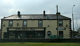
Hospital is a village in east County Limerick, Ireland. It is also a civil parish in the ancient barony of Smallcounty. The village's population was 653 as of the 2016 census. The village itself is situated in the townland of Barrysfarm, one of 11 in the civil parish. It lies on the River Mahore, a tributary of the River Camogue.
Castleknock is an affluent suburb located 8 km (5 mi) west of the centre of Dublin city, Ireland. It is centered on the village of the same name in Fingal.
Rockchapel is a village in north County Cork in Ireland. It is located near the border of counties Cork, Kerry and Limerick. Rockchapel is within the Dáil constituency of Cork North-West.

Caragh or Carragh is a village in County Kildare, Ireland. It is located on the R409 regional road between the River Liffey and the Grand Canal and is located 6.1 km north-west of Naas. The village is also 7.9 km from Clane and 10.6 km from Newbridge.

Ballymacelligott is a civil parish in the north of County Kerry in Ireland. It is situated 7 kilometres (4.3 mi) east of Tralee in the historical barony of Trughanacmy.
Derrinturn is a village in County Kildare, Ireland. It is part of the parish of Carbury. It is located about 60 km (37 mi) from Dublin.
Rossmore is a small village and townland in County Tipperary in Ireland. It is in the civil parish of Clonoulty, barony of Kilnamanagh Lower. It is located in the electoral division (ED) of Clonoulty West. It is also half of the Clonoulty and Rossmore parish in the Roman Catholic Archdiocese of Cashel and Emly.
Arywee is a townland in the parish of Fedamore, in County Limerick, Ireland.

Williamstown is a small townland in the parish of Fedamore, in County Limerick, Ireland.
Fanningstown is a townland in the parish of Fedamore, in County Limerick, Ireland.
Redwood is a townland in the historical Barony of Ormond Lower, County Tipperary, Ireland. It is also an electoral district in the Dáil constituency of Offaly having previously been part of the Tipperary North Dáil constituency.
Fedamore is a small village in County Limerick, Ireland. As of the 2016 census, Fedamore had a population of 329 people. It is also a civil parish in the ancient barony of Smallcounty.
Smallcounty or ‘’’Small County’’’ is a historical barony in County Limerick, Ireland. Settlements in the barony include Hospital, Herbertstown, Fedamore, Knockainy, and Six-Mile-Bridge.
Kilcullane is a civil parish and townland located in County Limerick, Ireland. The civil parish is in the barony of Smallcounty. It is located in east County Limerick near the village of Bruff. The north-eastern part of the parish borders the parish of Ballinard.
Midfield is a village, in the barony of Gallen, in County Mayo, in Ireland. It is located close to the towns of Kilkelly, Kiltimagh, and Swinford, and to Ireland West (Knock) Airport.

Meanus is a small village and townland in County Limerick, Ireland, approximately 19km south of Limerick City. As of the 2011 census, the townland of Meanus had a population of 63 people.
Ballyagran is a village and townland in County Limerick, Ireland. As of the 2016 census, the village had a population of 179 people. Ballyagran is also the name of a half-parish in the Roman Catholic Diocese of Limerick.
Ballyhahill is a village and townland in County Limerick, Ireland. As of the 2016 census, the village had a population of 146 people. The White River flows to the east of the village.

