
Saguaro Lake is the fourth reservoir on the Salt River, formed by the Stewart Mountain Dam in the U.S. state of Arizona. The lake is off State Route 87, about halfway between Phoenix and the ghost town of Sunflower. The dammed end of the lake is at 33.5656°N 111.5361°W, at an elevation of 1,506 feet (459 m).

Luna Lake is a natural body of water that covers approximately 75 acres (0.30 km2) of land. It is located about three miles (5 km) southeast of Alpine, Arizona, at the elevation of 7,890 ft (2,400 m), and is the centerpiece of the Luna Lake Wildlife Area.

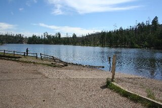
Lynx Lake, Arizona, is a 55-acre (220,000 m2) reservoir located within Prescott National Forest, approximately 5 miles (8.0 km) east of Prescott, Arizona, in the Bradshaw Mountains. The lake is located at 5,530 feet (1,690 m) elevation and is stocked for fishing. It is one of the most popular recreation areas in central Arizona. Mild weather, the cool ponderosa pine forest, trout fishing, boating, mountain hiking, horseback riding, archaeological sites, and bird watching attract visitors from throughout Arizona. The lake was formed in 1952, when a dam was put in Lynx Creek, 6 miles (9.7 km) below Walker, Arizona.
Show Low Lake is a 100-acre (0.40 km2) lake nestled at 6,500 feet (2,000 m) elevation in the White Mountains of Arizona which is administered by the Arizona Game and Fish Department along with the city of Show Low. Show Low Lake Park is located five miles (8 km) south of Show Low.
Woods Canyon Lake is a small lake located in northern Arizona, United States, about 30 mi (48 km) east of the city of Payson. It is one in a series of small, canyon-bound lakes located on the Mogollon Rim, collectively referred to as the Rim Lakes. It is among the more developed and accessible of the Rim Lakes. It is also the first reservoir on Chevelon Creek, upstream from Chevelon Canyon Lake.
Bear Canyon Lake is a lake built by Arizona Game and Fish Department for angler recreation. The facilities are maintained by Apache-Sitgreaves National Forest division of the USDA Forest Service.
Becker Lake is a reservoir managed as a trophy trout lake. Located near Springerville, Arizona, Becker Lake is part of the 622-acre (252 ha) Becker Lake Wildlife Area. Built around the year 1880, it is one of the oldest reservoirs in the White Mountains. The Arizona Game and Fish Department acquired the lake and property around it in 1973. The lake is located at 6,910 feet (2,110 m).
Black Canyon Lake is a lake in Navajo County, Arizona, United States.

Big Lake is a White Mountains' fishing lake, with attractive size, productivity and visitor amenities. As with most trout waters in Arizona, catch rates are best in spring, during late April and May after the winter ice thaws, and get better later in the summer and into fall until the lake freezes over again in late November. Big Lake is in Apache County and is managed by the Apache-Sitgreaves National Forests.
Bunch Reservoir is one of a trio of lakes on the Little Colorado River that provides trout fishing opportunities in and around the town of Greer.
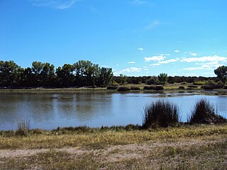
Concho Lake is an irrigation reservoir situated in the town of Concho, in the eastern Arizona grasslands at 6,300 feet (1,900 m). Much of the surrounding land is privately owned; the rest is owned by the Bureau of Land Management, but is managed for sport fisheries and wildlife resources by the Arizona Game and Fish.
Crescent Lake is located approximately 2 miles (3.2 km) north of Big Lake. The lake sits at just over 9,000 feet (2,700 m) elevation on the Apache-Sitgreaves National Forests, as such the facilities located here are managed by that authority. Access is restricted in the winter when roads are closed due to snow, generally December to early April.
Nelson Reservoir is a reservoir located in Apache County, Arizona between Springerville and Alpine. The Reservoir is a long and narrow lake which follows the Nutrioso Creek Valley for nearly a mile. Fish that remain in Nelson Reservoir after summer stockings can grow to good size, making it a popular fishing site with local anglers.
Rainbow Lake is a 116-acre manmade lake near the town of Pinetop-Lakeside in southern Navajo County, Arizona, United States. The lake was created in 1903 when Mormon settlers dammed Walnut Creek, a tributary of the Little Colorado River, to impound water for irrigation.
Built in 1896 on the Little Colorado River, River Reservoir is the largest and deepest of a trio of lakes collectively known as the Greer Lakes. Drained since 2004 because of safety issues, the dam at River Reservoir was repaired in 2005. Like the other two Greer Lakes, it has new amenities. River Reservoir is located at 8,220 feet (2,510 m) on the Apache-Sitgreaves National Forests.
Built in 1928, Scott Reservoir is an irrigation impoundment on Porter Creek near Pinetop-Lakeside, Arizona, USA. The least developed of the "in town" lakes, trees surround Scott Reservoir. It lies just outside the town limits on the Apache-Sitgreaves National Forests.
Located in the heart of Pinetop-Lakeside, Woodland Lake and the park surrounding it have been called the town's "Crown Jewel." In addition to trout fishing, the lake provides a host of other outdoor recreation opportunities. Woodland Lake lies on Apache-Sitgreaves National Forests property, just west of White Mountain Blvd. in Pinetop.
Lee Valley Lake is Arizona's highest elevation reservoir, situated at 9,420 feet (2,870 m) in the Apache-Sitgreaves National Forests near Mount Baldy. It is located approximately 35 miles from Pinetop-Lakeside, connected by Arizona highways 260 and 273 and forest road 113. Access is restricted in the winter when roads are closed due to snow, generally December to early April.
Hulsey Lake is a lake near Escudilla Peak in the Apache National Forest, Arizona. It is located at 8,620 feet (2,630 m) on the Apache-Sitgreaves National Forests. It is an impoundment of Hulsey Creek, a tributary of Nutrioso Creek. Due to snow and ice, the lake is usually inaccessible from November to mid-April.
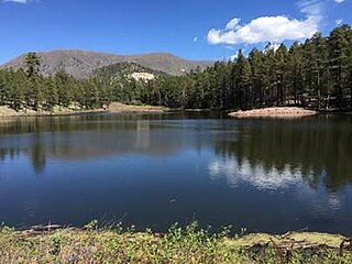
Willow Springs Lake is a cold water lake located on top of the Mogollon Rim in northern Arizona, about 23 mi (37 km) east of the city of Payson in the Apache-Sitgreaves National Forests, immediately adjacent to SR 260. It is a canyon-bound lake located on the Mogollon Rim, and is part of the collectivity known as the Rim Lakes. It can be found upstream from Chevelon Canyon Lake. The facilities are maintained by Apache-Sitgreaves National Forests division of the USDA Forest Service.

