Related Research Articles

The Alpine orogeny or Alpide orogeny is an orogenic phase in the Late Mesozoic (Eoalpine) and the current Cenozoic that has formed the mountain ranges of the Alpide belt.

The Moine Thrust Belt or Moine Thrust Zone is a linear tectonic feature in the Scottish Highlands which runs from Loch Eriboll on the north coast 190 kilometres (120 mi) south-west to the Sleat peninsula on the Isle of Skye. The thrust belt consists of a series of thrust faults that branch off the Moine Thrust itself. Topographically, the belt marks a change from rugged, terraced mountains with steep sides sculptured from weathered igneous, sedimentary and metamorphic rocks in the west to an extensive landscape of rolling hills over a metamorphic rock base to the east. Mountains within the belt display complexly folded and faulted layers and the width of the main part of the zone varies up to 10 kilometres (6.2 mi), although it is significantly wider on Skye.
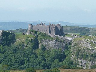
Carreg Cennen Castle is a castle sited on a high rocky outcrop overlooking the River Cennen, close to the village of Trap, four miles south east of Llandeilo in Carmarthenshire, Wales.

The geology of Wales is complex and varied; its study has been of considerable historical significance in the development of geology as a science. All geological periods from the Cryogenian to the Jurassic are represented at outcrop, whilst younger sedimentary rocks occur beneath the seas immediately off the Welsh coast. The effects of two mountain-building episodes have left their mark in the faulting and folding of much of the Palaeozoic rock sequence. Superficial deposits and landforms created during the present Quaternary period by water and ice are also plentiful and contribute to a remarkably diverse landscape of mountains, hills and coastal plains.
See also Line (geometry)

The Moorfoot Hills are a range of hills south of Edinburgh in east central Scotland, one of the ranges which collectively form the Southern Uplands.

The geology of the North Sea describes the geological features such as channels, trenches, and ridges today and the geological history, plate tectonics, and geological events that created them.
Fforest Fawr Geopark is a Geopark in the Brecon Beacons National Park, south Wales. It is the first designated Geopark in Wales having gained membership of both the European Geoparks Network and the UNESCO-assisted Global Network of National Geoparks in October 2005. The Geopark aims to promote and support sustainable tourism and other opportunities to improve the economy of the area whilst safeguarding the natural environment. Its aims largely coincide with the statutory duties and purpose of the National Park within which it sits.
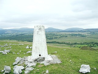
Moel Penderyn is a hill on the edge of Penderyn village, in the Brecon Beacons National Park in the county borough of Rhondda Cynon Taff, south Wales. It also appeared on older maps as 'Y Foel Penderyn'. Its summit at 371m is marked by a trig point.
The Neath Disturbance is a geological structure which stretches across south Wales from Swansea Bay northeastwards as far as Hereford in western England. It consists of a series of both faults and associated folds which were active during the mountain-building period known as the Variscan orogeny. This line of weakness probably featured in the earlier Caledonian Orogeny and perhaps reflects a more ancient line of weakness in the basement rocks.
The Cribarth Disturbance is a geological structure forming a lineament which stretches across south Wales from Swansea up the Swansea Valley then northeastwards to Brecon and beyond. It consists of both a series of faults and associated folds which were active during the mountain-building period known as the Variscan orogeny. This line of weakness probably featured in the earlier Caledonian Orogeny and perhaps reflects a more ancient line of weakness in the basement rocks. It is also known as the Tawe Valley Disturbance or the Swansea Valley Disturbance.
The Myddfai Steep Belt is a geological structure which affects rocks of Silurian and Devonian age in mid Wales. It extends for tens of miles across country from near Carmarthen northeastwards via Mynydd Myddfai, Mynydd Bach Trecastell and Mynydd Epynt to the vicinity of Llangammarch Wells. Within this linear zone, the rock beds have been tilted steeply to the southeast. The folding took place in late Silurian to early Devonian times. This structure gives rise to a series of landscape features along its length, not least the steep northwest-facing scarps of the hills and ranges mentioned above. Indeed, the feature can be seen as a significant lineament in aerial and satellite views of Wales.
The Moine Supergroup is a sequence of Neoproterozoic metamorphic rocks that form the dominant outcrop of the Scottish Highlands between the Moine Thrust Belt to the northwest and the Great Glen Fault to the southeast. The sequence is metasedimentary in nature and was metamorphosed and deformed in a series of tectonic events during the Late Proterozoic and Early Paleozoic. It takes its name from A' Mhòine, a peat bog in northern Sutherland.
The geological structure of Great Britain is complex, resulting as it does from a long and varied geological history spanning more than two billion years. This piece of the Earth's crust has experienced several episodes of mountain building or 'orogenies', each of which has added further complexity to the picture.
In geology, a disturbance is a linear zone of disturbed rock strata stretching for many miles across country which comprises a combination of folding and faulting. The British Geological Survey record a number of such features in South Wales including the Neath Disturbance, Pontyclerc Disturbance, Carreg Cennen Disturbance and the Cribarth Disturbance, the latter sometimes also known as the Tawe Valley or Swansea Valley Disturbance. The southwestward continuation of the Carreg Cennen Disturbance is known as the Llandyfaelog Disturbance.
The Cwm Llwyd Fault is a fault in the west of the Black Mountain of South Wales. It runs north, parallel to the A4069 road, for over 4 km from near Brynaman to meet the Carreg Cennen Disturbance near Brest Cwm Llwyd. It moved as a sinistral strike-slip fault during the Variscan Orogeny. Together with the Llwyn Celyn Fault it formed a left-stepping offset that created a pull apart structure, which preserved the Cwm Llwyd Outlier of Namurian rocks.
The geology of national parks in Britain strongly influences the landscape character of each of the fifteen such areas which have been designated. There are ten national parks in England, three in Wales and two in Scotland. Ten of these were established in England and Wales in the 1950s under the provisions of the National Parks and Access to the Countryside Act 1949. With one exception, all of these first ten, together with the two Scottish parks were centred on upland or coastal areas formed from Palaeozoic rocks. The exception is the North York Moors National Park which is formed from sedimentary rocks of Jurassic age.
This article describes the geology of the Brecon Beacons National Park in mid/south Wales. The area gained national park status in 1957 with the designated area of 1,344 km2 (519 sq mi) including mountain massifs to both the east and west of the Brecon Beacons proper. The geology of the national park consists of a thick succession of sedimentary rocks laid down from the late Ordovician through the Silurian and Devonian to the late Carboniferous period. The rock sequence most closely associated with the park is the Old Red Sandstone from which most of its mountains are formed. The older parts of the succession, in the northwest, were folded and faulted during the Caledonian orogeny. Further faulting and folding, particularly in the south of the park is associated with the Variscan orogeny.
The bedrock geology of Carmarthenshire in west Wales consists largely of Palaeozoic age sedimentary rocks. Unconsolidated deposits of Quaternary age in Carmarthenshire include a dissected cover of glacial till, valley floor alluvium and some scattered peat deposits in both upland and lowland settings. There are extensive beach and tidal flat deposits along the Carmarthenshire coast. The exploitation of the county's mineral riches, particularly coal and limestone, was a key part of the local economy through much of the nineteenth and twentieth centuries.
References
- ↑ British Geological Survey 1:50,000 map sheets 229 'Carmarthen' & 230 'Ammanford'
- ↑ https://www.geograph.org.uk/search.php?i=4967683 images of Carreg Cennen on Geograph website