Carrickfergus is a large town in County Antrim, Northern Ireland. It sits on the north shore of Belfast Lough, 11 miles (18 km) from Belfast. The town had a population of 28,141 at the 2021 Census. It is County Antrim's oldest town and one of the oldest towns in Ireland as a whole. Carrickfergus Castle, built in the late 12th century at the behest of Anglo-Norman knight John de Courcy, was the capital of the Earldom of Ulster. After the earldom's collapse, it remained the only English outpost in Ulster for the next four centuries. Carrickfergus was the administrative centre for Carrickfergus Borough Council, before this was amalgamated into the Mid and East Antrim District Council in 2015, and forms part of the Belfast Metropolitan Area. It is also a townland of 65 acres, a civil parish and a barony.

Larne is a town on the east coast of County Antrim, Northern Ireland, with a population of 18,853 at the 2021 census. It is a major passenger and freight roll-on roll-off port. Larne is administered by Mid and East Antrim Borough Council. Together with parts of the neighbouring districts of Antrim and Newtownabbey and Causeway Coast and Glens, it forms the East Antrim constituency for elections to the Westminster Parliament and Northern Ireland Assembly. The civil parish is in the historic barony of Glenarm Upper.

Ballyclare is a small town in County Antrim, Northern Ireland. It had a population of 9,953 according to the 2011 census, and is located within the Antrim and Newtownabbey Borough Council area.

Marquess of Donegall is a title in the Peerage of Ireland held by the head of the Chichester family, originally from Devon, England. Sir John Chichester sat as a Member of Parliament and was High Sheriff of Devon in 1557. One of his sons, Sir Arthur Chichester, was Lord Deputy of Ireland from 1605 to 1616. In 1613, he was raised to the Peerage of Ireland as Baron Chichester, of Belfast in County Antrim. He died childless in 1625 when the barony became extinct.

Ballymoney is a town and civil parish in County Antrim, Northern Ireland. It is within the Causeway Coast and Glens Borough Council area. The civil parish of Ballymoney is situated in the historic baronies of Dunluce Upper and Kilconway in County Antrim, as well as the barony of North East Liberties of Coleraine in County Londonderry. It had a population of 11,048 people at the 2021 Census.

Greenisland is a town in County Antrim, Northern Ireland. It lies 7 miles north-east of Belfast and 3 miles south-west of Carrickfergus. The town is on the coast of Belfast Lough and is named after a tiny islet to the west, the Green Island.

Whitehead is a large seaside village on the east coast of County Antrim, Northern Ireland, lying almost midway between the towns of Carrickfergus and Larne. It lies within the civil parish of Templecorran, the historic barony of Belfast Lower, and is part of Mid and East Antrim Borough Council. Before the Plantation of Ulster its name was recorded as both Whitehead and Kinbaine.

The A2 is a major road in Northern Ireland, a considerable length of which is often referred to the Antrim Coast Road because much of it follows the scenic coastline of County Antrim; other parts of the road follow the coasts in Counties Down and Londonderry.

Glynn is a small village and civil parish in the Mid and East Antrim Borough Council area of County Antrim, Northern Ireland. It lies a short distance south of Larne, on the shore of Larne Lough. As of the 2011 census, the Glynn ward had a population of 2,027 people.

Sir Charles Lanyon DL, JP was an English architect of the 19th century. His work is most closely associated with Belfast, Northern Ireland.

Northern Ireland is divided into six counties, namely: Antrim, Armagh, Down, Fermanagh, Londonderry and Tyrone. Six largely rural administrative counties based on these were among the eight primary local government areas of Northern Ireland from its 1921 creation until 1973. The other two local government areas were the urban county boroughs of Derry and Belfast.

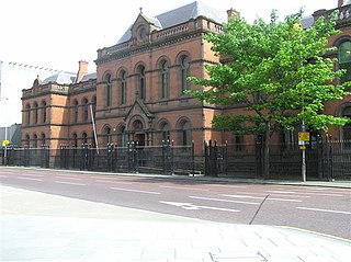
The Crumlin Road Courthouse is a former judicial facility on Crumlin Road in Belfast, Northern Ireland. It is a Grade B+ listed building.

Mid and East Antrim is a local government district in Northern Ireland. The district was created on 1 April 2015 by merging the Borough of Ballymena, the Borough of Larne and the Borough of Carrickfergus. The local authority is Mid and East Antrim Borough Council.

Boneybefore is a village near Carrickfergus in County Antrim, Northern Ireland. It lies between the A2 road and Belfast Lough. It is home to the Andrew Jackson Centre, the ancestral home of Andrew Jackson, 7th president of the United States.

Carrickfergus is a barony in County Antrim, Northern Ireland. It is bounded on the south-east by Belfast Lough, and otherwise surrounded by the barony of Belfast Lower. It is coextensive with the civil parish of Carrickfergus or St Nicholas and corresponds to the former county of the town of Carrickfergus, a county corporate encompassing Carrickfergus town.

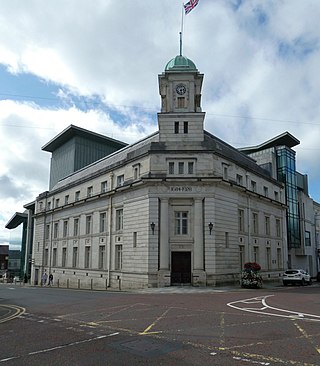
Ballymena Town Hall is a municipal structure in Bridge Street in Ballymena, County Antrim, Northern Ireland. The town hall, which is the headquarters of Mid and East Antrim Borough Council, is a Grade B1 listed building.

Ballymoney Town Hall is a municipal structure in the High Street, Ballymoney, County Antrim, Northern Ireland. The structure, which incorporates a local history museum, is a Grade B1 listed building.

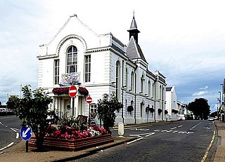
Ballyclare Town Hall is a municipal structure in The Square, Ballyclare, County Antrim, Northern Ireland. The structure, which is primarily used as an events venue, is a Grade B2 listed building.

The Old Town Hall is a municipal structure in Victoria Street, Belfast, Northern Ireland. The structure, which has most recently been used as courthouse, is a Grade B1 listed building.


