The Dead Sea, also known by other names, is a salt lake bordered by Jordan to the east and the West Bank and Israel to the west. It lies in the Jordan Rift Valley, and its main tributary is the Jordan River.

Potash includes various mined and manufactured salts that contain potassium in water-soluble form. The name derives from pot ash, plant ashes or wood ash soaked in water in a pot, the primary means of manufacturing potash before the Industrial Era. The word potassium is derived from potash.

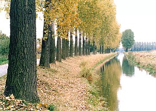
The Aller is a 215-kilometre-long (134 mi) river in the states of Saxony-Anhalt and Lower Saxony in Germany. It is a right-hand, and hence eastern, tributary of the Weser and is also its largest tributary. Its last 117 kilometres (73 mi) form the Lower Aller federal waterway. The Aller was extensively straightened, widened and, in places, dyked, during the 1960s to provide flood control of the river. In a 20-kilometre-long (12 mi) section near Gifhorn, the river meanders in its natural river bed.

The Saint John River is a 673-kilometre-long (418 mi) river that flows from Northern Maine into Canada, and runs south along the western side of New Brunswick, emptying into the Atlantic Ocean in the Bay of Fundy. Eastern Canada's longest river, its drainage basin is one of the largest on the east coast at about 55,000 square kilometres (21,000 sq mi).

The Kootenay River or Kootenai River is a major river of the Northwest Plateau in southeastern British Columbia, Canada, and northern Montana and Idaho in the United States. It is one of the uppermost major tributaries of the Columbia River, the largest North American river that empties into the Pacific Ocean. The Kootenay River runs 781 kilometres (485 mi) from its headwaters in the Kootenay Ranges of the Canadian Rockies, flowing from British Columbia's East Kootenay region into northwestern Montana, then west into the northernmost Idaho Panhandle and returning to British Columbia in the West Kootenay region, where it joins the Columbia at Castlegar.

Sussex is a town in Kings County, New Brunswick, Canada. Sussex is located in south central New Brunswick, between the province's three largest cities, Saint John, Moncton, and Fredericton.

Pickering is a market town and civil parish in North Yorkshire, England, on the border of the North York Moors National Park. Historically part of the North Riding of Yorkshire, it is at the foot of the moors, overlooking the Vale of Pickering to the south.

The Kennebecasis River is a tributary of the Saint John River in southern New Brunswick, Canada. The name Kennebecasis is thought to be derived from the Mi'kmaq "Kenepekachiachk", meaning "little long bay place." It runs for approximately 95 kilometres, draining an area in the Caledonia Highlands, an extension of the Appalachian Mountains, inland from the Bay of Fundy.

The Qu'Appelle River is a river in the Canadian provinces of Saskatchewan and Manitoba that flows 430 kilometres (270 mi) east from Lake Diefenbaker in south-western Saskatchewan to join the Assiniboine River in Manitoba, just south of Lake of the Prairies, near the village of St. Lazare. It is in a region called the Prairie Pothole Region of North America, which extends throughout three Canadian provinces and five U.S. states. It is also within Palliser's Triangle and the Great Plains ecoregion.

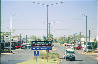
Tennant Creek is a town located in the Northern Territory of Australia. It is the seventh largest town in the Northern Territory, and is located on the Stuart Highway, just south of the intersection with the western terminus of the Barkly Highway. At the 2021 census, Tennant Creek had a population of 3,080 people, of which 55% (1,707) identified themselves as Indigenous.

The River Conwy is a river in northern Wales. From its source to its discharge in Conwy Bay it is 55 kilometres (34 mi) long and drains an area of 678 square km. "Conwy" was formerly anglicised as "Conway."

The Driftless Area, also known as Bluff Country, the Blufflands, the Paleozoic Plateau, and the Coulee Region, is a topographical and cultural region in the Midwestern United States that comprises southwestern Wisconsin, southeastern Minnesota, northeastern Iowa, and the extreme northwestern corner of Illinois. The Driftless Area is a USDA Level III Ecoregion: Ecoregion 52. The Driftless Area takes up a large portion of the Upper Midwest forest–savanna transition.

Dal is a lake in Srinagar, the summer capital of Jammu and Kashmir, India. It is an urban lake, the second largest lake in Jammu and Kashmir, and the most visited place in Srinagar by tourists and locals. It is integral to tourism and recreation in the Kashmir valley and is variously known as the "Lake of Flowers", "Jewel in the crown of Kashmir" or "Srinagar's Jewel". The lake is also an important source for commercial operations in fishing and water plant harvesting.

Penobsquis is a Canadian village in New Brunswick.

Jemseg is a Canadian rural community in Cambridge Parish, Queens County, New Brunswick. It is located on the east bank of the Jemseg River along its short run from Grand Lake to the Saint John River. The village briefly served as the Capital of Acadia (1690–91).

Nova Scotia is a province located in Eastern Canada fronting the Atlantic Ocean. One of the Maritime Provinces, Nova Scotia's geography is complex, despite its relatively small size in comparison to other Canadian provinces.

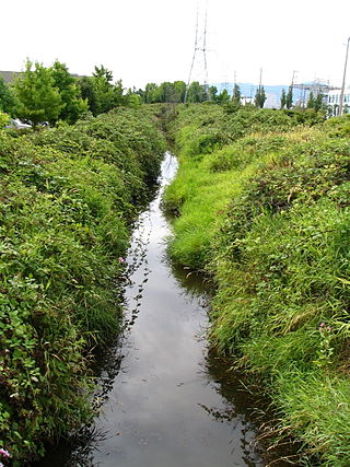
Still Creek is a long stream flowing across Central Burnaby, British Columbia and into Burnaby Lake. Still Creek's path lies mainly through the industrial area which contributes to its high level of pollution, although through dedicated work of local volunteers the creek is slowly recovering.
New Germany is a village in Lunenburg County, Nova Scotia, Canada. Located along the LaHave River and New Germany Lake it is a main service centre connecting Bridgewater and Middleton via highway Trunk 10. New Germany is situated 25 kilometres north of Bridgewater and 64 kilometres south of Middleton Annapolis Valley. It has a population of 447 as of the 2021 census.

Highway 5 is a major highway in the Canadian province of Saskatchewan. It begins in downtown Saskatoon and runs eastward to the Manitoba border near Togo, where it becomes Provincial Road 363. The highway is approximately 393 kilometres (244 mi) long. Between the early 1900s (decade) and 1976, Provincial Highway 5 was a trans-provincial highway travelling approximately 630 kilometres (390 mi) in length. At this time it started at the Alberta border in Lloydminster and traveled east to the Manitoba border.
Currow is a rural village in County Kerry in south west Ireland, located approximately 12 km from Killarney and 18 km from Tralee. Currow is situated on the Brown Flesk River, a tributary of the River Maine.


