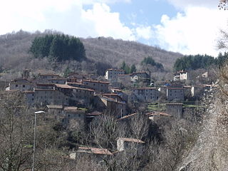
Resana is a comune (municipality) in the Province of Treviso in the Italian region Veneto, located about 35 kilometres (22 mi) northwest of Venice and about 25 kilometres (16 mi) west of Treviso. As of 31 December 2004, it had a population of 8,186 and an area of 25.0 square kilometres (9.7 sq mi).

Loreggia is a comune (municipality) in the Province of Padua in the Italian region Veneto, located about 35 kilometres (22 mi) northwest of Venice and about 20 kilometres (12 mi) northeast of Padua.

San Martino di Lupari is a comune (municipality) in the Province of Padua in the Italian region Veneto, located about 45 kilometres (28 mi) northwest of Venice and about 25 kilometres (16 mi) north of Padua.

Santa Giustina in Colle is a comune (municipality) in the Province of Padua in the Italian region Veneto, located about 35 kilometres (22 mi) northwest of Venice and about 15 kilometres (9 mi) north of Padua. As of 31 December 2004, it had a population of 6,823 and an area of 17.9 square kilometres (6.9 sq mi).

Montenars is a comune (municipality) in the Province of Udine in the Italian region Friuli-Venezia Giulia, located about 80 kilometres (50 mi) northwest of Trieste and about 20 kilometres (12 mi) north of Udine. As of 31 December 2004, it had a population of 554 and an area of 20.6 square kilometres (8.0 sq mi).

Castelfranco di Sotto is a comune (municipality) in the Province of Pisa in the Italian region Tuscany, located about 40 kilometres (25 mi) west of Florence and about 30 kilometres (19 mi) east of Pisa.

Montopoli in Val d'Arno is a comune (municipality) in the Province of Pisa in the Italian region Tuscany, located about 40 kilometres (25 mi) southwest of Florence and about 30 kilometres (19 mi) east of Pisa.

Badia Tedalda is a comune (municipality) in the Province of Arezzo in the Italian region Tuscany, located about 80 kilometres (50 mi) east of Florence and about 35 kilometres (22 mi) northeast of Arezzo. Two of its Fraziones, Santa Sofia Marecchia and Cicognaia, form an exclave in the province of Pesaro e Urbino.

Bucine is a comune (municipality) in the Province of Arezzo in the Italian region Tuscany, located about 45 kilometres (28 mi) southeast of Florence and about 20 kilometres (12 mi) west of Arezzo.
Castelfranco di Sopra is a frazione (parish) of the comune of Castelfranco Piandiscò, in the Province of Arezzo in the Italian region Tuscany. It is located about 30 kilometres (19 mi) southeast of Florence and about 30 kilometres (19 mi) northwest of Arezzo.

Castel San Niccolò is a comune (municipality) in the Province of Arezzo in the Italian region Tuscany, located about 40 kilometres (25 mi) east of Florence and about 35 kilometres (22 mi) northwest of Arezzo.

Castiglion Fibocchi is a comune (municipality) in the Province of Arezzo in the Italian region Tuscany, located about 50 kilometres (31 mi) southeast of Florence and about 12 kilometres (7 mi) northwest of Arezzo.

Chitignano is a comune (municipality) in the Province of Arezzo in the Italian region Tuscany, located about 50 kilometres (31 mi) east of Florence and about 20 kilometres (12 mi) north of Arezzo. As of 31 December 2004, it had a population of 996 and an area of 14.7 square kilometres (5.7 sq mi).

Chiusi della Verna is a comune (municipality) in the Province of Arezzo in the Italian region Tuscany, located about 60 kilometres (37 mi) east of Florence and about 25 kilometres (16 mi) north of Arezzo. It is in the Casentino traditional region.

Loro Ciuffenna is a comune (municipality) in the Province of Arezzo in the Italian region Tuscany, located about 40 kilometres (25 mi) southeast of Florence and about 25 kilometres (16 mi) northwest of Arezzo.

Marciano della Chiana is a comune (municipality) in the Province of Arezzo in the Italian region Tuscany, located about 70 kilometres (43 mi) southeast of Florence and about 20 kilometres (12 mi) southwest of Arezzo.

Montemignaio is a comune (municipality) in the Province of Arezzo in the Italian region Tuscany, located about 30 kilometres (19 mi) east of Florence and about 35 kilometres (22 mi) northwest of Arezzo.

Ortignano Raggiolo is a comune (municipality) in the Province of Arezzo in the Italian region Tuscany, located about 40 kilometres (25 mi) southeast of Florence and about 25 kilometres (16 mi) northwest of Arezzo.

Pieve Santo Stefano is a comune (municipality) in the Province of Arezzo in the Italian region Tuscany, located about 70 kilometres (43 mi) east of Florence and about 25 kilometres (16 mi) northeast of Arezzo.

Terranuova Bracciolini is a comune (municipality) in the Province of Arezzo in the Italian region Tuscany, located about 35 kilometres (22 mi) southeast of Florence and about 25 kilometres (16 mi) northwest of Arezzo.


