Casville, North Carolina

Last updated

Casville, North Carolina
USA North Carolina location map.svg
Red pog.svg
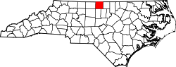
Casville
Location within the state of North Carolina
Coordinates: 36°23′24″N79°30′15″W / 36.39000°N 79.50417°W / 36.39000; -79.50417
Country United States
State North Carolina
County Caswell
Time zone UTC-5 (Eastern (EST))
  Summer (DST) UTC-4 (EDT)

Casville is an unincorporated community in Caswell County, North Carolina, United States. It is located at the crossroads of U.S. Route 158 and Ashland Rd/Park Springs Rd.

Travelers along US 158 notice a drastic change in the speed limit from 55 mph (88.5 km/h) to 35 mph (56.3 km/h) as they approach the community's only caution traffic signal; the speed limit returns to 55 mph (89 km/h) after leaving the crossroads area.[ citation needed ]

Casville has two gas stations for those traveling along US 158 between Yanceyville, North Carolina and Reidsville, North Carolina.[ citation needed ] In the 2000s, it had a convenience store called the Casville Food Mart. [1]

It has a volunteer fire department. [2] [3] As of 1996, the Casville fire department was the only volunteer fire department in Caswell County to receive funding from a fire tax levied on residents within its service district. [4]

Neighboring communities include Pelham and Ruffin.

Related Research Articles

<span class="mw-page-title-main">Danville, Virginia</span> Independent city in Virginia, United States

Danville is an independent city in the Commonwealth of Virginia in the United States. The city is located in the Southside Virginia region and on the fall line of the Dan River. It was a center of tobacco production and was an area of Confederate activity during the American Civil War, due to its strategic location on the Richmond and Danville Railroad. In April 1865 it briefly served as the third and final capital of the Confederacy before its surrender later that year.

<span class="mw-page-title-main">Caswell County, North Carolina</span> County in North Carolina, United States

Caswell County is a county in the U.S. state of North Carolina. It is located in the Piedmont Triad region of the state. At the 2020 census, the population was 22,736. Its county seat is Yanceyville.

<span class="mw-page-title-main">Milton, North Carolina</span> Town in North Carolina, United States

Milton is a town in Caswell County, North Carolina, United States. The population was 166 at the 2010 census. It is adjacent to the Virginia International Raceway, just across the state line in Virginia.

<span class="mw-page-title-main">Yanceyville, North Carolina</span> Town in North Carolina, United States

Yanceyville is a town in and the county seat of Caswell County, North Carolina, United States. Located in the Piedmont Triad region of the state, the town had a population of 1,937 at the 2020 census.

<span class="mw-page-title-main">U.S. Route 158</span> Highway in the United States

U.S. Route 158 (US 158) is an east–west United States highway that runs for 350 miles (560 km) from Mocksville to Whalebone Junction in Nags Head, entirely in the state of North Carolina. It is also a critical route that connects the cities of Winston-Salem, Summerfield, and Reidsville with one another.

<span class="mw-page-title-main">Dan River</span> River in the U.S. states of North Carolina and Virginia

The Dan River flows 214 miles (344 km) in the U.S. states of North Carolina and Virginia. It rises in Patrick County, Virginia, and crosses the state border into Stokes County, North Carolina. It then flows into Rockingham County. From there it flows back into Virginia through Pittsylvania County before reentering North Carolina near the border between Caswell County and Rockingham County. It flows into northern Caswell County and then back into southern Virginia and finally into Kerr Reservoir on the Roanoke River.

<span class="mw-page-title-main">Speed limits in the United States</span>

In the United States, speed limits are set by each state or territory. States have also allowed counties and municipalities to enact typically lower limits. Highway speed limits can range from an urban low of 25 mph (40 km/h) to a rural high of 85 mph (137 km/h). Speed limits are typically posted in increments of five miles per hour (8 km/h). Some states have lower limits for trucks, some also have night and/or minimum speed limits.

<span class="mw-page-title-main">Virginia State Route 86</span> Highway in Virginia connecting two states

State Route 86 is a state highway in the U.S. state of Virginia. The state highway runs 3.33 miles (5.36 km) from the North Carolina state line, where the highway continues south as North Carolina Highway 86 to U.S. Route 29 Business and SR 413. The entire route is contained within the independent city of Danville.

<span class="mw-page-title-main">North Carolina Highway 86</span> State highway in Orange and Caswell counties in North Carolina, United States

North Carolina Highway 86 (NC 86) is a primary state highway in the U.S. state of North Carolina that runs north and south through Orange and Caswell Counties from Chapel Hill to the Virginia state line at Danville, Virginia. The highway primarily links the towns of Chapel Hill, Hillsborough, and Yanceyville, along with providing a route between Chapel Hill and Virginia. Between Chapel Hill and Hillsborough, NC 86 parallels and serves as an alternative to I-40.

Ruffin is an unincorporated community located in Rockingham County, North Carolina. It is northeast of Reidsville, North Carolina, and southwest of Danville, Virginia, just off US 29. It has a population of 419.

Pelham is an unincorporated community in northwestern Caswell County, North Carolina at the North Carolina/Virginia border. Pelham is located along Pelham Loop Road near the eastern terminus of NC 700 at US 29. It was named for Confederate Col. John Pelham, known as "the Gallant Pelham" for his extraordinary bravery, whose parents, Dr. Atkinson and Martha Mumford McGehee Pelham, resided in neighboring Person County before moving to Alabama. Nearby communities, independent cities, and municipalities include Danville, Eden, Ruffin, Yanceyville, Purley, Reidsville and Casville.

<span class="mw-page-title-main">North Carolina Highway 150</span> State highway in North Carolina, US

North Carolina Highway 150 (NC 150) is a primary state highway in the U.S. state of North Carolina. It serves the Foothills and Piedmont Triad areas of the state, connecting the cities of Shelby, Mooresville, Salisbury and Winston-Salem.

John Kerr was a Baptist minister who also served two term in the U.S. House of Representatives representing Virginia's 15th congressional district

<span class="mw-page-title-main">WKVK</span> Radio station in Semora, North Carolina

WKVK is a radio station broadcasting a Contemporary Christian format. Licensed to Semora, North Carolina, it serves a large swath of central North Carolina and Southside Virginia as an outlet of K-LOVE. The station is currently owned by Educational Media Foundation.

<span class="mw-page-title-main">North Carolina Highway 39</span> State highway in North Carolina, US

North Carolina Highway 39 (NC 39) is a primary state highway in the U.S. state of North Carolina. Traveling north–south, it connects the cities of Selma, Louisburg and Henderson, in the Research Triangle area.

<span class="mw-page-title-main">North Carolina Highway 62</span> State highway in North Carolina, US

North Carolina Highway 62 (NC 62) is a primary state highway in the U.S. state of North Carolina. Primarily in the Piedmont Triad, it runs from NC 109 in Thomasville northeast to the Virginia state line in Milton.

Providence is an unincorporated community in Caswell County, North Carolina, United States. Providence is 7 miles (11 km) north-northwest of Yanceyville and directly south of Danville, Virginia. Providence has a post office with ZIP code 27315.

<span class="mw-page-title-main">Caswell County Schools</span> School district in North Carolina, US

Caswell County Schools is a PK–12 graded school district serving Caswell County, North Carolina. Its six schools serve 3,012 students as of the 2010–2011 school year.

<span class="mw-page-title-main">William B. Umstead Bridge</span> Bridge in Dare County

The William B. Umstead Bridge is a two-lane automobile bridge spanning the Croatan Sound, between Manns Harbor and Roanoke Island, in Dare County, North Carolina. The bridge carries US 64 and is utilized by local and seasonal tourist traffic. The bridge speed limit is 55 miles per hour (89 km/h), except during the months of July and August when it will drop to 20 miles per hour (32 km/h) during dusk and dawn; the west end of the bridge becomes home of more than hundred-thousand purple martins as they prepare for their annual migration to Brazil.

Elijah Benton Withers was an American politician and lawyer from North Carolina and Virginia. He served as a member of the North Carolina House of Representatives in 1874.

References

  1. Carne, John R. (January 23, 2008). "Community mourns slain storeowner". Danville Register and Bee. Danville, Virginia. Retrieved July 26, 2024 via Newspapers.com.
  2. Handgraaf, Brie (August 26, 2008). "Man faces charge in fatal car crash". Times-News. Burlington, North Carolina. Retrieved July 26, 2024 via ProQuest.
  3. "Caswell Business Directory & Newcomer's Guide" (PDF). Town of Yanceyville. 2023. Retrieved July 26, 2024.
  4. Benson, Robert (March 23, 1996). "Tax 'makes things more easy...' for Casville department". Danville Register and Bee. Danville, Virginia. Retrieved July 26, 2024 via Newspapers.com.