
Westchester County is located in the U.S. state of New York. It is the seventh most populous county in the State of New York and the most populous north of New York City. According to the 2020 United States Census, the county had a population of 1,004,456, its highest decennial count ever and an increase of 55,344 (5.8%) from the 949,113 counted in 2010. Located in the Hudson Valley, Westchester covers an area of 450 square miles (1,200 km2), consisting of six cities, 19 towns, and 23 villages. Established in 1683, Westchester was named after the city of Chester, England. The county seat is the city of White Plains, while the most populous municipality in the county is the city of Yonkers, with 211,569 residents per the 2020 U.S. Census.

Spartanburg County is a county located on the northwestern border of the U.S. state of South Carolina. As of the 2020 census, the population was 327,997, making it the fifth-most populous county in South Carolina. Its county seat is Spartanburg.

Scotland County is a county located in the southern part of the U.S. state of North Carolina. Its county seat is and largest city is Laurinburg. The county was formed in 1899 from part of Richmond County and named in honor of the Scottish settlers who occupied the area in the 1700s. As of the 2020 census, its population was 34,174.

Robeson County is a county in the southern part of the U.S. state of North Carolina and is its largest county by land area. Its county seat and largest city is Lumberton. The county was formed in 1787 from part of Bladen County and named in honor of Thomas Robeson, a colonel who had led Patriot forces in the area during the Revolutionary War. As of the 2020 census, the county's population was 116,530. It is a majority-minority county; its residents are approximately 38 percent Native American, 22 percent white, 22 percent black, and 10 percent Hispanic. It is included in the Fayetteville-Lumberton-Pinehurst, NC Combined Statistical Area. The state-recognized Lumbee Tribe of North Carolina is headquartered in Pembroke.
Moore County is a county located in the U.S. state of North Carolina. As of the 2020 census, its population was 99,727. Its county seat is Carthage and its largest municipality Pinehurst. It is a border county between the Piedmont and the Atlantic Coastal Plain.

Hoke County is a county in the U.S. state of North Carolina. As of the 2020 census, its population was 52,082. Its county seat is Raeford.

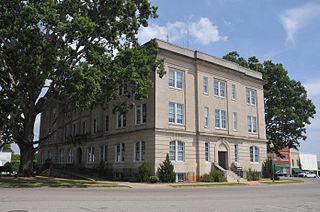
Currituck County is the northeastern most county in the U.S. state of North Carolina. As of the 2020 census, the population was 28,100. Its county seat is Currituck. The county was formed in 1668 as a precinct of Albemarle County and later gained county status in 1739. The name is "traditionally said to be an indigenous word for wild geese; Coratank." Currituck County is included in the Virginia Beach-Norfolk-Newport News, VA-NC Metropolitan Area. It is in the northeastern section of the state and is bounded by the Atlantic Ocean, Currituck Sound, Camden County, Dare County and the Commonwealth of Virginia. Currituck Court House, mentioned as early as 1755, was the name of the county seat. Today the words "Court House" have been dropped and only Currituck is used as the community name.

Caswell County is a county in the U.S. state of North Carolina. It is located in the Piedmont Triad region of the state. At the 2020 census, the population was 22,736. Its county seat is Yanceyville.
Five Forks is a census-designated place (CDP) in Greenville County, South Carolina, United States. The population was 17,737 at the 2020 census, up from 14,140 in 2010, and 8,064 in 2000. It is a growing, affluent suburb of Greenville and is part of the Greenville–Mauldin–Easley Metropolitan Statistical Area.

Greer is a city in Greenville and Spartanburg counties in the U.S. state of South Carolina. The population was 35,308 as of the 2020 census. Greer is a included in the Greenville, SC Metropolitan Statistical Area, which is part of the Greenville-Spartanburg-Anderson, SC Combined Statistical Area in Upstate South Carolina.

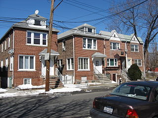
Pelham is a suburban town in Westchester County, approximately 10 miles northeast of Midtown Manhattan. As of the 2020 census, it had a population of 13,078, an increase from the 2010 census. Historically, Pelham was composed of five villages and became known as "the Pelhams". Pelham currently contains two independently incorporated villages: the Villages of Pelham and Pelham Manor.
Pelham Bay is a middle class residential neighborhood in the borough of the Bronx, in New York City. It is named for Pelham Bay Park, New York City's largest park, which lies on the neighborhood's northeastern border; and for Pelham Bay, a body of water in that park. The neighborhood is bounded roughly by Pelham Parkway on the north, the New England Thruway (I-95) on the east, the Bruckner Expressway (I-95) on the south, and the Hutchinson River Parkway on the west.

John Pelham was a Confederate cavalry soldier under J. E. B. Stuart during the American Civil War. Robert E. Lee called Pelham "The Gallant Pelham" for his use of light artillery at the Battle of Fredericksburg to delay U.S. soldiers.
Ruffin is an unincorporated community located in Rockingham County, North Carolina. It is northeast of Reidsville, North Carolina, and southwest of Danville, Virginia, just off US 29. It has a population of 419.
Casville is an unincorporated community in Caswell County, North Carolina, United States, located at the crossroads of U.S. Route 158 and Ashland Rd/Park Springs Rd. Travelers along US 158 notice a drastic change in the speed limit from 55 mph (88.5 km/h) to 35 mph (56.3 km/h) as they approach the community's only caution traffic signal; the speed limit returns to 55 mph (89 km/h) after leaving the crossroads area. Casville has two gas stations for those traveling along US 158 between Yanceyville, North Carolina and Reidsville, North Carolina. It even has a restaurant which opens and closes often, and churches and a volunteer fire department. Neighboring communities include Pelham and Ruffin.
Spartanburg Regional Healthcare System(SRHS) is one of South Carolina's largest healthcare systems. SRHS draws patients primarily from the areas of Spartanburg, Cherokee, Union, and Greenville counties, located in the Piedmont region of South Carolina, and Rutherford and Polk counties, located in western North Carolina. Spartanburg General Hospital was organized under the authority of the South Carolina General Assembly in 1917 and officially became the Spartanburg Regional Health Services District, Inc., a political subdivision of the State of South Carolina, by the charter granted by the secretary of state of South Carolina on May 1, 1995.

North Carolina Highway 700 is a primary state highway in the U.S. state of North Carolina. The highway runs east–west from Eden to U.S. Route 29 in Pelham.
Pelham is an unincorporated community in Spartanburg County in the upstate of the U.S. state of South Carolina. The Sugar Tit area has about five mile radius around Joe's Lake. It is located around the junction of State 101 and State 296 southeast of Greer, between Reidville and Five Forks. It is mostly farmland and plantations. After BMW came more subdivisions and industrial parks appeared in the area.

Pelham is an unincorporated community and census-designated place (CDP) in Grundy County, Tennessee, United States. As of the 2010 census, its population was 403. Pelham is located at the junction of U.S. Route 41, State Route 2, and State Route 50 near the base of the Cumberland Plateau, 5.35 miles (8.61 km) north-northwest of Monteagle. Pelham has a post office with ZIP code 37366, which opened on April 4, 1832.

