Blanch, North Carolina

Last updated

Blanch, North Carolina
USA North Carolina location map.svg
Red pog.svg
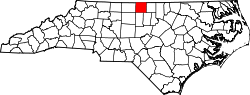
Blanch
Location within the state of North Carolina
Coordinates: 36°30′29″N79°17′42″W / 36.50806°N 79.29500°W / 36.50806; -79.29500
Country United States
State North Carolina
County Caswell
Elevation
387 ft (118 m)
Time zone UTC-5 (Eastern (EST))
  Summer (DST) UTC-4 (EDT)
ZIP code
27212 [1]
Area code(s) 336 and 743
GNIS feature ID981582

Blanch (formerly, Blanche) is an unincorporated community in Dan River Township, Caswell County, North Carolina, between North Carolina Highway 86, and North Carolina Highway 62, at an elevation of 387 feet (118 m). [2]

Related Research Articles

<span class="mw-page-title-main">Joanot Martorell</span> Valencian writer and knight

Joanot Martorell was a Valencian knight and writer, best known for authoring the novel Tirant lo Blanch, written in Valencian and published at Valencia in 1490. This novel is often regarded as one of the peaks of the literature in Catalan language and it played a major role in influencing later writers such as Miguel de Cervantes, who, in the book burning scene of Don Quixote, says "I swear to you, my friend, this is the best book of its kind in the world". The novel deals with the adventures of a knight in the Byzantine Empire; it is considered one of the first works of alternate history.

<span class="mw-page-title-main">Interstate 20</span> Interstate in southern US

Interstate 20 (I‑20) is a major east–west Interstate Highway in the Southern United States. I-20 runs 1,539 miles (2,477 km) beginning at an interchange with I-10 in Scroggins Draw, Texas, and ending at an interchange with I-95 in Florence, South Carolina. Between Texas and South Carolina, I-20 runs through northern Louisiana, Mississippi, Alabama, and Georgia. The major cities that I-20 connects to include Dallas-Fort Worth, Texas; Shreveport, Louisiana; Jackson, Mississippi; Birmingham, Alabama; Atlanta, Georgia; and Columbia, South Carolina.

<span class="mw-page-title-main">Interstate 26</span> Interstate Highway mostly in the Carolinas

Interstate 26 (I-26) is a main route of the Interstate Highway System in the Southeastern United States. Nominally east–west, as indicated by its even number, I-26 runs from the junction of U.S. Route 11W (US 11W) and US 23 in Kingsport, Tennessee, generally southeastward to US 17 in Charleston, South Carolina. The portion from Mars Hill, North Carolina, east to I-240 in Asheville, North Carolina, has signs indicating FUTURE I-26, because the highway does not yet meet all of the Interstate Highway standards. A short realignment, as an improvement in the freeway, was also planned in Asheville but has been postponed indefinitely due to North Carolina's budget shortfalls.

<span class="mw-page-title-main">Interstate 85</span> Interstate Highway across the southeastern US

Interstate 85 (I-85) is a major Interstate Highway in the Southeastern United States. Its southern terminus is at an interchange with I-65 in Montgomery, Alabama; its northern terminus is an interchange with I-95 in Petersburg, Virginia, near Richmond. It is nominally north–south as it carries an odd number, but it is physically oriented northeast–southwest and covers a larger east-west span than north-south. While most Interstates that end in a "5" are cross-country, I-85 is primarily a regional route serving five southeastern states: Virginia, North Carolina, South Carolina, Georgia, and Alabama.

<i>Tirant lo Blanch</i> Book by Joanot Martorell and Martí Joan de Galba (1490)

Tirant lo Blanch is a chivalric romance written by the Valencian knight Joanot Martorell, finished posthumously by his friend Martí Joan de Galba and published in the city of Valencia in 1490 as an incunabulum edition. The title means "Tirant the White" and is the name of the romance's main character who saves the Byzantine Empire.

Blanch or blanching may refer to:

<span class="mw-page-title-main">North Carolina Highway 12</span> State highway in North Carolina, US

North Carolina Highway 12 (NC 12) is a 148.0-mile-long (238.2 km) primary state highway in the U.S. state of North Carolina, linking the peninsulas and islands of the northern Outer Banks. Most sections of NC 12 are two lanes wide, and there are also two North Carolina Ferry System routes which maintain continuity of the route as it traverses the Outer Banks region. NC 12 is part of the Outer Banks Scenic Byway, a National Scenic Byway. The first NC 12 appeared on the 1924 North Carolina Official Map and at its greatest length ran from NC 30 in Pollocksville to NC 48 near Murfreesboro. Over time it was replaced by both U.S. Route 258 (US 258) and NC 58 and ceased to exist in 1958. The current NC 12 first appeared on the 1964 state highway map running from US 158 in Nags Head to Ocracoke. In 1976 NC 12 was extended to US 70 on the mainland and in 1987 was extended north to Corolla.

<span class="mw-page-title-main">North Carolina Highway 67</span> State highway in North Carolina, US

North Carolina Highway 67 (NC 67) is a 40.9-mile-long (65.8 km) primary state highway in the U.S. state of North Carolina. The highway travels through Yadkin and Forsyth Counties between its western terminus at U.S. Route 21 Business in Jonesville and NC 150 in Winston-Salem. NC 67 primarily follows an east–west alignment and connects the towns of Jonesville, Boonville, and East Bend, along with the city of Winston-Salem.

Semora is an unincorporated community in Caswell County, North Carolina, United States. It lies just northwest of Hyco Lake and has some presence in Person County. Semora is home to one of the oldest churches in North Carolina, the Red House Presbyterian Church.

<span class="mw-page-title-main">North Carolina Highway 16</span> State highway in North Carolina, US

North Carolina Highway 16 (NC 16) is a 143.8-mile primary state highway in the U.S. state of North Carolina. Traveling in a north–south direction, it connects the cities and towns of Charlotte, Newton, Conover, Taylorsville, Wilkesboro and Jefferson, linking the Charlotte metropolitan area with the mountainous High Country. NC 16 is part of a three-state route 16 that connects the Charlotte region with northwestern West Virginia.

<span class="mw-page-title-main">Interstate 95 in North Carolina</span> Highway in North Carolina, US

Interstate 95 (I-95) is a part of the Interstate Highway System that runs along the East Coast of the United States from Miami, Florida, to the Canadian border in Houlton, Maine. In the state of North Carolina, the route runs for 181.36 miles (291.87 km) from the South Carolina border near Rowland to the Virginia border near Pleasant Hill. The highway serves the cities of Lumberton, Fayetteville, Wilson, Rocky Mount, and Roanoke Rapids. The route goes through a mostly rural area of the state, avoiding most of the major metro areas of North Carolina. It forms the informal border between the Piedmont and Atlantic Plain regions of the state.

<span class="mw-page-title-main">North Carolina Highway 97</span> State highway in North Carolina, US

North Carolina Highway 97 (NC 97) is a primary state highway in the U.S. state of North Carolina, connecting the cities of Zebulon and Rocky Mount with the vast rural coastal plains.

<span class="mw-page-title-main">Interstate 40 in North Carolina</span> Highway with its western terminus at the Tennessee state line

Interstate 40 (I-40) is a part of the Interstate Highway System that travels 2,556.61 miles (4,114.46 km) from Barstow, California, to Wilmington, North Carolina. In North Carolina, I-40 travels 420.21 miles (676.26 km) across the entirety of the state from the Tennessee state line along the Pigeon River Gorge to U.S. Route 117 (US 117) and North Carolina Highway 132 (NC 132) in Wilmington. I-40 is the longest Interstate Highway in North Carolina and is the only Interstate to completely span the state from west to east.

<span class="mw-page-title-main">1896 Georgia Bulldogs football team</span> American college football season

The 1896 Georgia Bulldogs football team represented the Georgia Bulldogs of the University of Georgia during the 1896 Southern Intercollegiate Athletic Association football season. As a member of the Southern Intercollegiate Athletic Association (SIAA), the team provided Georgia with its first undefeated season, compiling a 4–0 record and defeating North Carolina for the first time. The Bulldogs were co-champions of the SIAA with LSU, who joined the conference in 1896.

<span class="mw-page-title-main">North Carolina Highway 115</span> State highway in North Carolina, US

North Carolina Highway 115 is a primary state highway in the U.S. state of North Carolina. It runs from U.S. Route 21 in North Charlotte north through Mecklenburg, Iredell and Wilkes counties. Its northern terminus is at its intersection with US 421 Business, NC 18 and NC 268 in North Wilkesboro.

<span class="mw-page-title-main">U.S. Route 70 in North Carolina</span> Highway in North Carolina

U.S. Route 70 (US 70) is a part of the United States Numbered Highway System that runs from Globe, Arizona, to the Crystal Coast of the US state of North Carolina. In North Carolina, it is a major 488-mile-long (785 km) east–west highway that runs from the Tennessee border to the Atlantic Ocean. From the Tennessee state line near Paint Rock to Asheville it follows the historic Dixie Highway, running concurrently with US 25. The highway connects several major cities including Asheville, High Point, Greensboro, Durham, Raleigh, Goldsboro, and New Bern. From Beaufort on east, US 70 shares part of the Outer Banks Scenic Byway, a National Scenic Byway, before ending in the community of Atlantic, located along Core Sound.

<span class="mw-page-title-main">North Carolina Highway 41</span> State highway in North Carolina, US

North Carolina Highway 41 (NC 41) is a primary state highway in the U.S. state of North Carolina. The highway travels in a north–south orientation between the South Carolina state line to Lumberton, then switches to an east–west orientation connecting the cities and towns of Elizabethtown, White Lake, Harrells, Wallace, Beulaville and Trenton.

<span class="mw-page-title-main">U.S. Route 421 in North Carolina</span> Highway in North Carolina

U.S. Route 421 (US 421) is part of the United States Numbered Highway System that runs from Fort Fisher, North Carolina to Michigan City, Indiana. In the U.S. state of North Carolina, US 421 travels 328 miles (528 km) from its southern terminus at Fort Fisher to the Tennessee state line near the community of Zionville, North Carolina. US 421 traverses the state from east to west travelling from the coastal plains to Appalachian Mountains. It provides an important connection between the cities of Wilmington, Sanford, Greensboro, Winston-Salem, and Boone. Despite being signed as north–south, much of the routing of US 421 in North Carolina runs in an east–west direction, particularly between Greensboro and the Tennessee state line. Portions of US 421 have been upgraded to freeway standards including the majority of its routing between Sanford and North Wilkesboro.

Hwy 55 Burgers Shakes & Fries is a fast casual restaurant chain that operates primarily in the state of North Carolina and other neighboring states on the east coast of the United States. Founded by Kenney Moore as Andy's Cheesesteaks and Cheeseburgers, the first location opened in Goldsboro, North Carolina, in 1991. In 2012, seeking to expand beyond North Carolina, the company changed their name to Hwy 55 and opened their first out-of-state restaurant in May of that year. As of February, 2022, the chain has a total of 108 locations in the United States, primarily in North Carolina (81) and South Carolina (12), with 15 other locations in the states of Florida, Georgia, Montana, Ohio, Tennessee, Texas, Virginia, and West Virginia. The restaurant serves hamburgers, cheesesteaks, sandwiches, salads, hand-dipped ice cream and milkshakes.

References

  1. "Blanch ZIP Code". zipdatamaps.com. 2022. Retrieved November 11, 2022.
  2. U.S. Geological Survey Geographic Names Information System: Blanch, North Carolina