Hightowers, North Carolina

Last updated

Hightowers, North Carolina
USA North Carolina location map.svg
Red pog.svg
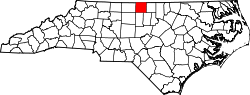
Hightowers
Location of Hightowers in North Carolina
Usa edcp location map.svg
Red pog.svg
Hightowers
Hightowers (the United States)
Coordinates: 36°19′37″N79°14′36″W / 36.32694°N 79.24333°W / 36.32694; -79.24333
Country United States
State North Carolina
County Caswell
Township Hightowers
Elevation
[1]
712 ft (217 m)
Time zone UTC-5 (Eastern (EST))
  Summer (DST) UTC-4 (EDT)
Area code 336
GNIS feature ID1006239 [1]

Hightowers is an unincorporated community in Hightowers Township, Caswell County, North Carolina, United States, northwest of Prospect Hill. It is located around the intersection of North Carolina Highway 119, and Nicks Road, a former alignment of Highway 86.

Reedy Fork, a tributary to Hyco Creek, rises here. [2]

Related Research Articles

<span class="mw-page-title-main">French Broad River</span> River in North Carolina and Tennessee, United States

The French Broad River is a river in the U.S. states of North Carolina and Tennessee. It flows 218 miles (351 km) from near the town of Rosman in Transylvania County, North Carolina, into Tennessee, where its confluence with the Holston River at Knoxville forms the beginning of the Tennessee River. The river flows through the counties of Transylvania, Buncombe, Henderson, and Madison in North Carolina, and Cocke, Jefferson, Sevier, and Knox in Tennessee. It drains large portions of the Pisgah National Forest and the Cherokee National Forest.

<span class="mw-page-title-main">Saluda River</span> River in South Carolina, USA

The Saluda River is a principal tributary of the Congaree River, about 200 mi (320 km) long, in northern and western South Carolina in the United States. Via the Congaree River, it is part of the watershed of the Santee River, which flows to the Atlantic Ocean.

Coleman River is a 6.6-mile-long (10.6 km) stream that is located in the Blue Ridge Mountains, mostly within Rabun County, Georgia. It is one of the main tributaries of the Tallulah River. The headwaters of Coleman River are located in Clay County, North Carolina, and the river travels a short distance before crossing into Georgia. The length of Coleman River in Rabun County is approximately 5.4 miles (8.7 km), with about 1.3 miles (2.1 km) traveling through private lands and about 4.1 miles (6.6 km) traveling through the Chattahoochee National Forest. The northern part of Coleman River in Georgia, from an elevation of about 2,800 feet (850 m) northward, together with the portion of Coleman River in North Carolina, is located in the Southern Nantahala Wilderness.

<span class="mw-page-title-main">Dick's Knob</span> Mountain in United States of America

Dick's Knob or Dicks Knob, with an elevation of 4,620 feet (1,408 m), is the third-highest peak in the State of Georgia if using a 200 ft. prominence rule. It is located in Rabun County, Georgia within the Southern Nantahala Wilderness and is the second-highest mountain in the county.

<span class="mw-page-title-main">Hightower Bald</span>

Hightower Bald, with an elevation of 4,568 feet (1,392 m) is the fourth-highest peak in the US state of Georgia. It is located in Towns County, Georgia at the North Carolina state line and is within the boundaries of the Southern Nantahala Wilderness of the Chattahoochee National Forest.

<span class="mw-page-title-main">North Carolina Highway 119</span> State highway in North Carolina, US

North Carolina Highway 119 (NC 119) is a primary state highway in the U.S. state of North Carolina.

<span class="mw-page-title-main">Camden, North Carolina</span> Census-designated place in North Carolina, United States

Camden is an unincorporated town and Census-designated place in Camden County, North Carolina, United States. It is the county seat of Camden County, a consolidated city-county. As of the 2010 census, the Camden town had a population of 599.

<span class="mw-page-title-main">Prospect Hill, North Carolina</span> Unincorporated community in North Carolina, United States

Prospect Hill is a small unincorporated community in Hightowers Township, Caswell County, North Carolina, United States. It lies at the intersection of North Carolina Highways 49 and 86. It is in extreme southeastern Caswell County.

Evergreen is an unincorporated community and census-designated place (CDP) in Tatums Township, Columbus County, North Carolina, United States. It lies on North Carolina Highway 242, north of U.S. Route 74 and NC 130, at an elevation of 108 feet (33 m). The population was 420 at the 2010 census.

Barco is an unincorporated community in Currituck County, North Carolina, United States at the southern terminus of North Carolina Highway 168, on U.S. Highway 158.

Clegg is an unincorporated community in Wake County, North Carolina, United States on North Carolina Highway 54, north of the highway's intersection with North Carolina Highway 540.

<span class="mw-page-title-main">Juliff, Texas</span> Unincorporated community in Texas, United States

Juliff is an unincorporated community situated along Farm to Market Road 521 (FM 521) in eastern Fort Bend County, Texas, United States. The settlement was founded in the 1850s as a shipping point along the Brazos River and the railroad reached there in the same decade. The community received postal service in 1891, and except for a brief closure, retained it until the late 1950s. Starting in the 1930s, Juliff enjoyed a heyday as a place of raucous entertainment after local residents opened several taverns and dance halls. This era ended in the 1960s when the bars relocated to Houston. Sometime later, the railroad that ran alongside FM 521 was discontinued. In December 2013 the community was a collection of homes along the east side of FM 521.

<span class="mw-page-title-main">Tate City, Georgia</span>

Tate City is an unincorporated community and census-designated place in Towns County, Georgia, United States. It was founded as a mining and logging community. The community was named after one Mr. Tate, a businessperson in the local lumber industry.

Hopkins is an unincorporated community in eastern Wake County, North Carolina, United States. The center of the community lies at the crossroads of Hopkins Chapel Road and Fowler Road, near North Carolina Highway 96, about three miles north of the town of Zebulon.

Bluerock Mountain is a mountain in Western North Carolina, near the community of Bat Cave. It is split between Henderson and Rutherford counties, it is home of the Bat Cave Preserve and part of Chimney Rock State Park. Its elevation reaches 2,835 feet (864 m).

<span class="mw-page-title-main">South Carolina Highway 903</span>

South Carolina Highway 903 (SC 903) is a 27.090-mile (43.597 km) primary state highway in the U.S. state of South Carolina. It connects Lancaster to Darlington, Florence, and the Grand Strand.

Reedy Fork is a 10.13 mi (16.30 km) long 2nd order tributary to Hyco Creek in Caswell County, North Carolina. Reedy Fork joins Hyco Creek within Hyco Lake.

Lynch Creek is a 7.79 mi (12.54 km) long 2nd order tributary to Hyco Creek in Caswell County, North Carolina, United States.

Negro Creek is a 4.80 mi (7.72 km) long 2nd order tributary to Hyco Creek in Caswell County, North Carolina.

References

  1. 1 2 U.S. Geological Survey Geographic Names Information System: Hightowers, North Carolina. Retrieved on 2008-04-05.
  2. "Get Maps". USGS Topoview. US Geological Survey. Retrieved November 7, 2020.