| Cat Law | |
|---|---|
 Cat Law | |
| Highest point | |
| Elevation | 671 m (2,201 ft) [1] |
| Prominence | 296 m (971 ft) |
| Listing | Graham, Marilyn |
| Coordinates | 56°44′08″N3°06′53″W / 56.73562°N 3.11486°W Coordinates: 56°44′08″N3°06′53″W / 56.73562°N 3.11486°W |
| Geography | |
| Location | Angus, Scotland |
| Parent range | The Mounth |
| OS grid | NO318610 |
| Topo map | OS Landranger 44 |
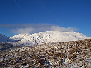
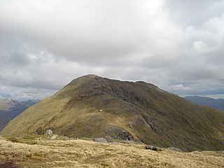
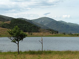
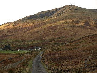
Cat Law (671 m) is a hill in the southern Mounth of Scotland, north of Kirriemuir in Angus.

The Mounth is the range of hills on the southern edge of Strathdee in northeast Scotland. It was usually referred to with the article, i.e. "the Mounth". The name is a corruption of the Scottish Gaelic monadh which in turn is akin to the Welsh mynydd, and may be of Pictish origin. Traditionally the people of northern Scotland did not consider the Grampians to be a single range, but several, and these were known as the Mounth or the Mounths. Mountain ranges to the west are known as Monadh Liath and the Monadh Ruadh, which could be translated as the Grey Mounth and the Red Mounth.

Kirriemuir, sometimes called Kirrie, is a burgh in Angus, Scotland. Its history reaches back to earliest recorded times, when it is thought to have been a major ecclesiastical centre. Later it was identified with witchcraft, and some older houses still feature a "witches stane" to ward off evil. In the 19th century, it was an important centre of the jute trade. The playwright J.M. Barrie was born and buried here, and a statue of Peter Pan stands in the town square.

Angus is one of the 32 local government council areas of Scotland, a registration county and a lieutenancy area. The council area borders Aberdeenshire, Dundee City and Perth and Kinross. Main industries include agriculture and fishing. Global pharmaceuticals company GSK has a significant presence in Montrose in the north of the county.
A rounded peak, it lies above Strathmore in the south and offers excellent views across the Angus countryside from its summit. It is usually climbed from the nearby village of Balintore. [2]
Strathmore is a strath in east central Scotland running from northeast to southwest between the Grampian mountains and the Sidlaws. It is approximately 50 miles (80 km) long and 10 miles (16 km) wide. Strathmore is underlain by Old Red Sandstone but this is largely obscured by glacial till, sands and gravels deposited during the ice age. Its northeast to southwest alignment is influenced by the underlying geological structure of the area which reflects the dominant Caledonian trend of both the central lowlands and the Highlands of Scotland; its northern margin reflects the presence of the Highland Boundary Fault. Strathmore is fertile and has some of Scotland's best arable farmland, producing soft fruits and cereals.
Balintore is a village in Angus, Scotland. It lies in Glen Isla, four miles north of the Loch of Lintrathen and seven miles west of Kirriemuir. Approximately half a mile to the east is Knowehead of Auldallan farm, where there can be found a pair of uninscribed standing stones.