Cathcart Tower

Last updated

Cathcart Tower
Cedar Island, Kingston, Ontario
Cathcart Tower.JPG
Type Martello tower
Site history
Built1848
MaterialsLocal limestone
Official nameCathcart Tower, Cedar Island
Part of Rideau Canal
Criteria Cultural: (i)(iv)
Reference 1221-004
Inscription2007 (31st Session)
Area0.25 ha (27,000 sq ft)
Buffer zone9.15 ha (985,000 sq ft)
Coordinates 44°13′31″N76°27′14″W / 44.225400°N 76.453981°W / 44.225400; -76.453981
Canada Southern Ontario relief location map.jpg
Red pog.svg
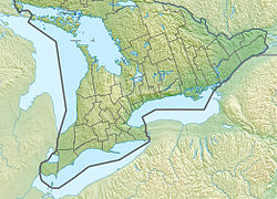
Location of Cathcart Tower in Southern Ontario
Canada Ontario relief location map.jpg
Red pog.svg
Cathcart Tower (Ontario)
Canada relief map 2.svg
Red pog.svg
Cathcart Tower (Canada)

Cathcart Tower is a Martello tower located on Cedar Island in the St. Lawrence River, off the eastern shore of Fort Henry in Kingston, Ontario, Canada. It is one of four such towers built in the 1840s to protect Kingston's harbour and the entrance to the Rideau Canal. The other towers are: Fort Frederick, Shoal Tower, and Murney Tower. Alexander Mackenzie was a foreman on the construction of the Carthcart Tower and later went on to become Canada's second prime minister 1873–1878. It was his work crew whose boat capsized while returning from Cedar Island, drowning 17 men. Hamilton Cove was subsequently renamed Deadman's Bay.

Cathcart Tower Kingston Ontario One of kingstons martello towers.jpg
Cathcart Tower Kingston Ontario

Built in 1848, this limestone tower is 11 m high and 16.5 m in diameter. [1] It is surrounded by a shallow ditch and by a glacis extending to the shorelines on three sides. The guns of Cathcart Tower covered the eastern approaches of Kingston Harbour.

The towers' construction was prompted by a dispute between Great Britain and the United States over the boundary between British Columbia and Oregon that threatened to lead to war (see Oregon crisis). [2] When war was averted, Cathcart Tower was used for a time as a barracks for soldiers garrisoned at nearby Fort Henry. Eventually it was abandoned.

The tower is now part of the Rideau Canal and Kingston Fortifications National Historic Site, the Rideau Canal and Kingston Fortifications UNESCO World Heritage Site, and is within the boundaries of Thousand Islands National Park (formerly St. Lawrence Islands National Park). [3]

The tower is reached by small water craft with a dock located on the north side of Cedar Island.
Related Research Articles

<span class="mw-page-title-main">Kingston, Ontario</span> City in Ontario, Canada

Kingston is a city in Ontario, Canada, on the northeastern end of Lake Ontario. It is at the beginning of the St. Lawrence River and at the mouth of the Cataraqui River, the south end of the Rideau Canal. Kingston is midway between Toronto, Ontario, and Montreal, Quebec, and is also near the Thousand Islands, a tourist region to the east, and the Prince Edward County tourist region to the west. Kingston is nicknamed the "Limestone City" because it has many heritage buildings constructed using local limestone.

<span class="mw-page-title-main">Citadel Hill (Fort George)</span> Historic site in Nova Scotia, Canada

Citadel Hill is a hill that is a National Historic Site in Halifax, Nova Scotia, Canada. Four fortifications have been constructed on Citadel Hill since the city was founded by the English in 1749, and were referred to as Fort George—but only the third fort was officially named Fort George. According to General Orders of October 20, 1798, it was named after King George III. The first two and the fourth and current fort, were officially called the Halifax Citadel. The last is a concrete star fort.

<span class="mw-page-title-main">Rideau Canal</span> Canal in Canada

The Rideau Canal is a 202 kilometre long canal that links the Ottawa River, at Ottawa, with the Saint Lawrence River at Kingston, Ontario, Canada. Its 46 locks raise boats from the Ottawa River 83 metres upstream along the Rideau River to the Rideau Lakes, and from there drop 50 metres downstream along the Cataraqui River to Kingston.

<span class="mw-page-title-main">Thousand Islands National Park</span> National park in Ontario, Canada

Thousand Islands National Park, formerly known as the St. Lawrence Islands National Park, is a Canadian National Park located on the 1000 Islands Parkway in the Thousand Islands Region of the Saint Lawrence River. The islands are actually the worn-down tops of ancient mountains. This region, the Frontenac Axis, connects the Canadian Shield from Algonquin Park in Ontario to the Adirondack Mountains in New York.

<span class="mw-page-title-main">Gananoque</span> Town in Ontario, Canada

Gananoque is a town in the Leeds and Grenville area of Ontario, Canada. The town had a population of 5,383 year-round residents in the 2021 Canadian Census, as well as summer residents sometimes referred to as "Islanders" because of the Thousand Islands in the Saint Lawrence River, Gananoque's most important tourist attraction. The Gananoque River flows through the town and the St. Lawrence River serves as the southern boundary of the town.

<span class="mw-page-title-main">Martello tower</span> Small defensive fort

Martello towers, sometimes known simply as Martellos, are small defensive forts that were built across the British Empire during the 19th century, from the time of the French Revolutionary Wars onwards. Most were coastal forts.

<span class="mw-page-title-main">Fort Henry National Historic Site</span> National historic site and fort in Kingston, Ontario

Fort Henry National Historic Site is located in Kingston, Ontario, Canada on Point Henry, a strategic, elevated point near the mouth of the Cataraqui River where it flows into the St. Lawrence River at the east end of Lake Ontario. The fort and the point on which the fort was built were named after Henry Hamilton, former Lieutenant-Governor of the Province of Quebec.

<span class="mw-page-title-main">John By</span> British military engineer

Lieutenant-Colonel John By was an English military engineer. He is best known for having supervised the construction of the Rideau Canal and for having founded Bytown in the process. It developed and was designated as the Canadian capital, Ottawa.

<span class="mw-page-title-main">Murney Tower</span> Defensive tower built to protect Kingston, Ontario from American threats

Murney Tower is a Martello tower in Kingston, Ontario, Canada, whose construction dates to January 1846. The Tower was built in response to the Oregon Crisis, which was a tense dispute over the border between British North America and the United States in the 1840s.

<span class="mw-page-title-main">Fort Wellington</span> Historic site in Ontario, Canada

Fort Wellington National Historic Site is a historic military fortification located on the north shore of the St. Lawrence River at Prescott, Ontario. The military fortification was used by the British Army, and the Canadian militia for most of the 19th century, and by the militia in the 20th century, until 1923, when the property was handed over to the Dominion Parks Commission, the predecessor to Parks Canada. The fort was earlier named a National Historic Site of Canada in January 1920.

<span class="mw-page-title-main">Fort Frederick (Kingston, Ontario)</span> UNESCO World Heritage Site

Fort Frederick is a historic military building located on Point Frederick on the grounds of the Royal Military College of Canada (RMC) in Kingston, Ontario, Canada. Its construction dates to 1846 and the Oregon boundary dispute. The fort consists of earthworks surrounding a Martello tower. Fort Frederick is included in two separate National Historic Sites of Canada: Kingston Fortifications National Historic Site and the Point Frederick Buildings National Historic Site.

<span class="mw-page-title-main">Leeds and the Thousand Islands</span> Township in Ontario, Canada

Leeds and the Thousand Islands is a township in the Canadian province of Ontario, located within the United Counties of Leeds and Grenville. The township is located along the Saint Lawrence River, and extends north into rural hamlets and villages. Formerly, this township was divided into three separate townships: Leeds, Lansdowne, and Escott townships; these townships amalgamated to form the current township of Leeds and the Thousand Islands.

<span class="mw-page-title-main">St. Lawrence Parks Commission</span>

The St. Lawrence Parks Commission is a Crown agency of the Government of Ontario that manages parks and heritage sites along the shoreline of the St. Lawrence River in southeastern Ontario. It functions similarly to the Niagara Parks Commission's role in overseeing attractions and conservation on the Ontario side of the Niagara River.

Kingston Mills, located approximately 7 kilometres (4.3 mi) north of downtown Kingston, Ontario, is the southernmost lockstation and one of 24 lockstations of the Rideau Canal system. Kingston Mills is a component of the Rideau Canal National Historic Site, and along with the rest of the Rideau Canal, is a World Heritage Site. The site is managed and operated by Parks Canada.

<span class="mw-page-title-main">Royal Military College of Canada Museum</span>

The Royal Military College of Canada Museum, established in 1962, is located in a Martello tower known as Fort Frederick on the campus of the Royal Military College of Canada in Kingston, Ontario, and is operated by the college. Until 2016 the museum had regular hours from the last weekend in June until Labour Day. Although admission was free, donations were accepted. Guided tours were offered in English and French. Genealogical research and archival records services were offered relating to college history or with inquires relating to ex-cadets when permitted by privacy regulations.

<span class="mw-page-title-main">Shoal Tower</span> UNESCO World Heritage Site

Shoal Tower, originally known as Victoria Tower, is a Martello tower located in the harbour of Kingston, Ontario, Canada, directly opposite Kingston City Hall. It is one of four such towers built in the 1840s to protect Kingston's harbour and the entrance to the Rideau Canal. Cathcart Tower on Cedar Island, Shoal Tower in the Confederation Basin, Fort Frederick on the grounds of the Royal Military College of Canada, and Murney Tower were part of the same strategic improvements. Although 16 Martello towers were built in Canada, only 11 are still standing, four of them in Kingston.

Point Frederick is a 41-hectare (101-acre) peninsula in Kingston, Ontario, Canada. The peninsula is located at the south end of the Rideau Canal where Lake Ontario empties into the St. Lawrence River. Point Frederick is bounded by the Cataraqui River to the west, the St. Lawrence River to the south, and Navy Bay to the east. The peninsula is occupied by the Royal Military College of Canada (RMC). Several of the buildings located on Point Frederick and the site of the old naval dockyard are national historic sites. Fort Frederick, at the south end of the peninsula, is a feature of the Kingston Fortifications National Historic Site of Canada.

<span class="mw-page-title-main">Kingston Fortifications</span> UNESCO World Heritage Site

The Kingston Fortifications are a series of 19th century defensive works in Kingston, Ontario, Canada, that are National Historic Sites of Canada and UNESCO World Heritage Sites. The fortification system consists of five installations:

References

  1. "Nomination of the Rideau Canal for Inscription in the World Heritage List". Government of Canada, Parks Canada Agency. 2007-06-22. Archived from the original on 2012-09-13. Retrieved 2009-02-08.
  2. "The Origins of Structures in St. Lawrence Islands National Park". Government of Canada, Parks Canada Agency. 2008-05-21. Retrieved 2009-02-08.
  3. "Government of Canada Names Thousand Islands National Park". Government of Canada, Parks Canada Agency. 2013-03-13. Retrieved 2015-08-29.