An artifact or artefact is a general term for an item made or given shape by humans, such as a tool or a work of art, especially an object of archaeological interest. In archaeology, the word has become a term of particular nuance and is defined as an object recovered by archaeological endeavor, which may be a cultural artifact having cultural interest.

In archaeological excavation, a feature is a collection of one or more contexts representing some human non-portable activity, such as a hearth or wall. Features serve as an indication that the area in which they are found has been interfered with in the past, usually by humans.

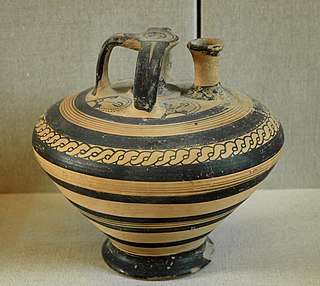
The Weeden Island cultures are a group of related archaeological cultures that existed during the Late Woodland period of the North American Southeast. The name for this group of cultures was derived from the Weedon Island site in Old Tampa Bay in Pinellas County.

The State Line Archeological District is a complex of archaeological sites and national historic district located west of Elizabethtown, Ohio, United States. Located on both sides of the Indiana/Ohio border, the historic district is composed of five contributing properties spread out across 8 acres (3.2 ha) of land. It is believed to have been the site of a village of the Fort Ancient culture of prehistoric Native Americans.

Town Creek Indian Mound is a prehistoric Native American archaeological site located near present-day Mount Gilead, Montgomery County, North Carolina, in the United States. The site, whose main features are a platform mound with a surrounding village and wooden defensive palisade, was built by the Pee Dee, a South Appalachian Mississippian culture people that developed in the region as early as 980 CE. They thrived in the Pee Dee River region of North and South Carolina during the Pre-Columbian era. The Town Creek site was an important ceremonial site occupied from about 1150—1400 CE. It was abandoned for unknown reasons. It is the only ceremonial mound and village center of the Pee Dee located within North Carolina.

The Kincaid Mounds Historic Site c. 1050–1400 CE, is a Mississippian culture archaeological site located at the southern tip of present-day U.S. state of Illinois, along the Ohio River. Kincaid Mounds has been notable for both its significant role in native North American prehistory and for the central role the site has played in the development of modern archaeological techniques. The site had at least 11 substructure platform mounds, and 8 other monuments.
The Greenwich Cove Site is a prehistoric archaeological site in Warwick, Rhode Island, US. The site is a significant multi-component site, with finds dating from the Late Archaic to the Middle Woodland Period. It notably includes a shell midden that has only been moderately affected by vandalism and development; these are particularly rare in coastal Rhode Island. The site was added to the National Register of Historic Places in 1980.
The Little Egypt site was an archaeological site located in Murray County, Georgia, near the junction of the Coosawattee River and Talking Rock Creek. The site originally had three platform mounds surrounding a plaza and a large village area. It was destroyed during the construction of the Dam of Carters Lake in 1972. It was situated between the Ridge and Valley and Piedmont sections of the state in a flood plain. Using Mississippian culture pottery found at the site archaeologists dated the site to the Middle and Late South Appalachian culture habitation from 1300 to 1600 CE during the Dallas, Lamar, and Mouse Creek phases.
The Sixtoe Mound site (9MU100) is an archaeological site in Murray County, Georgia excavated by Arthur Randolph Kelly from 1962-1965 as a part of the Carters Dam project conducted for the National Park Service by the University of Georgia. The site consisted of a low platform mound and an associated village. The majority of the mound was excavated, while the village received little excavation.
The Mill Branch archaeological site is located in Warren County, Georgia west of Augusta and south of Thomson. It is located in the Brier Creek watershed. A reservoir was deemed necessary to assist in kaolin processing during times of drought. For this project to commence, a permit was needed from the Corps of Engineers, which required a cultural resource impact study to first be done. J.M. Huber Corporation contracted Southeastern Archaeological Services to do an initial survey of the area in 1988 with additional data recovery in 1990. J.M Huber Corporation determined that two sites surveyed by Southeastern Archaeological Services, specifically 9WR4 and 9WR11, could not be avoided or preserved. Huber no longer owns this property. These two sites were excavated between April 23 and May 31, 1990. The field report, Archaeological Investigations at Mill Branch Sites 9WR4 and 9WR11 Warren County, Georgia, was published in 1995 and compiled by R. Jerald Ledbetter.

The Summer Island site, designated 20DE4, is an archaeological site located on the northwest side of Summer Island, in Delta County, Michigan. It is classified as a stratified, multi-component site with Middle Woodland, Upper Mississippian and Early Historic/Protohistoric occupations. It was listed on the National Register of Historic Places in 1971.
Mound 34 is a small platform mound located roughly 400 metres (1,300 ft) to the east of Monks Mound at Cahokia Mounds near Collinsville, Illinois. Excavations near Mound 34 from 2002 to 2010 revealed the remains of a copper workshop, although the one of a kind discovery had been previously found in the late 1950s by archaeologist Gregory Perino, but lost for 60 years. It is so far the only remains of a copper workshop found at a Mississippian culture archaeological site.
Dewil Valley, located in the northernmost part of Palawan, an island province of the Philippines that is located in the Mimaropa region, is an archaeological site composed of thousands of artifacts and features. According to the University of the Philippines Archaeological Studies Program, or UP-ASP, the closest settlement can be found in New Ibajay, which is covered by the town capital of El Nido, which is located around 9 km (5.6 mi) south-east of Dewil Valley. Physically it measures around 7 km (4.3 mi) long, and 4 km (2.5 mi) wide. It is in this place which the Ille Cave, one of the main archaeological sites, can be found. It is actually a network of 3 cave mouths located at its base. It has been discovered that this site in particular has been used and occupied by humans over multiple time periods.
Melkhoutboom Cave is an archaeological site dating to the Later Stone Age, located in the Zuurberg Mountains, Cape Folded Mountain Belt, in the Addo Elephant National Park, Sarah Baartman District Municipality in the Eastern Cape Province of South Africa.
The Donaldson site is an archaeological site in Ontario that was designated a National Historic Site of Canada in 1982. The 3-acre (12,000 m2) site is the largest within the Saugeen complex, and is representative of typical habitation and mortuary practices of the Woodland period before the European discovery of the Americas, from about 200 BCE until 700 CE.

The Moccasin Bluff site is an archaeological site located along the Red Bud Trail and the St. Joseph River north of Buchanan, Michigan. It was listed on the National Register of Historic Places in 1977, and has been classified as a multi-component prehistoric site with the major component dating to the Late Woodland/Upper Mississippian period.
The Kelso Site, near Mullen in Hooker County, Nebraska, United States, was listed on the National Register of Historic Places in 1974.
The Griesmer site (La-3) is located on the Kankakee River in Lake County, Indiana, about a mile southeast of Schneider, in Northwestern Indiana. It is classified as a Prehistoric, multi-component site with Middle Woodland, Late Woodland and Upper Mississippian occupations. The deposits were not stratified, but observation of the types of artifacts present, together with radiocarbon dates, helped to define the sequence of occupations at the site.
The Fifield Site (Pr-55) is located on Damon Run Creek in Porter County, north-western Indiana. It is classified as a late prehistoric, single-component Upper Mississippian Fisher village.
The Oak Forest Site (11Ck-53) is located in Oak Forest, Cook County, Illinois, near the city of Chicago. It is classified as a late prehistoric to Protohistoric/Early Historic site with Upper Mississippian Huber affiliation.