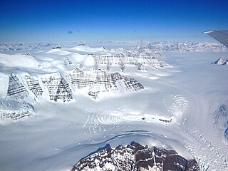
A glacier is a persistent body of dense ice that is constantly moving under its own weight. A glacier forms where the accumulation of snow exceeds its ablation over many years, often centuries. It acquires distinguishing features, such as crevasses and seracs, as it slowly flows and deforms under stresses induced by its weight. As it moves, it abrades rock and debris from its substrate to create landforms such as cirques, moraines, or fjords. Although a glacier may flow into a body of water, it forms only on land and is distinct from the much thinner sea ice and lake ice that form on the surface of bodies of water.

The Alpine region of Switzerland, conventionally referred to as the Swiss Alps, represents a major natural feature of the country and is, along with the Swiss Plateau and the Swiss portion of the Jura Mountains, one of its three main physiographic regions. The Swiss Alps extend over both the Western Alps and the Eastern Alps, encompassing an area sometimes called Central Alps. While the northern ranges from the Bernese Alps to the Appenzell Alps are entirely in Switzerland, the southern ranges from the Mont Blanc massif to the Bernina massif are shared with other countries such as France, Italy, Austria and Liechtenstein.

A jökulhlaup is a type of glacial outburst flood. It is an Icelandic term that has been adopted in glaciological terminology in many languages. It originally referred to the well-known subglacial outburst floods from Vatnajökull, Iceland, which are triggered by geothermal heating and occasionally by a volcanic subglacial eruption, but it is now used to describe any large and abrupt release of water from a subglacial or proglacial lake/reservoir.

Vidraru Dam is a dam in Romania. It was completed in 1966 on the Argeș River and creates Lake Vidraru. The arch dam was built with the primary purpose to produce hydroelectricity. The dam's height is 166 metres, the arch length 305 meters and it can store 465 million cubic metres of water. The reservoir has a total shoreline (perimeter) length of 28 km.

Glacial landforms are landforms created by the action of glaciers. Most of today's glacial landforms were created by the movement of large ice sheets during the Quaternary glaciations. Some areas, like Fennoscandia and the southern Andes, have extensive occurrences of glacial landforms; other areas, such as the Sahara, display rare and very old fossil glacial landforms.

The term freshet is most commonly used to describe a snowmelt, an annual high water event on rivers resulting from snow and river ice melting. A spring freshet can sometimes last several weeks on large river systems, resulting in significant inundation of flood plains as the snowpack melts in the river's watershed. Freshets can occur with differing strength and duration depending upon the depth of the snowpack and the local average rates of warming temperatures. Deeper snowpacks which melt quickly can result in more severe flooding. Late spring melts allow for faster flooding; this is because the relatively longer days and higher solar angle allow for average melting temperatures to be reached quickly, causing snow to melt rapidly. Snowpacks at higher altitudes and in mountainous areas remain cold and tend to melt over a longer period of time and thus do not contribute to major flooding. Serious flooding from southern freshets are more often related to rain storms of large tropical weather systems rolling in from the South Atlantic or Gulf of Mexico, to add their powerful heating capacity to lesser snow packs. Tropically induced rainfall influenced quick melts can also affect snow cover to latitudes as far north as southern Canada, so long as the generally colder air mass is not blocking northward movement of low pressure systems.

The Bartang is a river of Central Asia, tributary to the Panj and consequently to the Amu Darya. In its upper reaches, it is also known as the Murghab and Aksu; it flows through the Wakhan in Afghanistan, then through the Rushon District of the Gorno-Badakhshan autonomous region, Tajikistan. The river is 528 kilometres (328 mi) long and has a basin area of 24,700 square kilometres (9,500 sq mi).

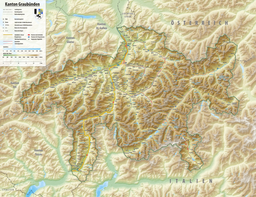
Flims is a municipality in the Imboden Region in the Swiss canton of Graubünden. The town of Flims is dominated by the Flimserstein which one can see from almost anywhere in the area.
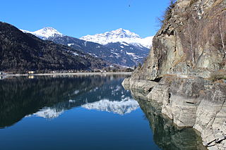
Lago di Poschiavo is a natural lake in the Val di Poschiavo in the Swiss canton of Graubünden.

The Lac d'Émosson is a reservoir in the canton of Valais, Switzerland. It is located in the municipalities of Salvan and Finhaut. The closest small city in Switzerland is Martigny. The lake has a surface area of 3.27 km² and an elevation of 1,930 m. The maximum depth is 161 m. The purpose of the Émosson Dam is hydroelectric power generation. Water from the reservoir first powers the 189 MW Vallorcine Power Station downstream and just over the border in Vallorcine, France. Water is then sent through a headrace tunnel to the 162 MW La Bâtiaz Power Station, 12 km (7 mi) to the east in Martigny, Switzerland. The drop between the dam and La Bâtiaz Power Station is 1,400 m (4,593 ft).

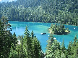
Crestasee is a small lake shared by the municipalities of Flims and Trin in the Grisons, Switzerland. From 1892 a guest house on its northern end served as pension and still is a restaurant today in its original state.

Crap Sogn Gion is a mountain and cable car station located near Flims in the Swiss canton of Graubünden. Regarding the definition used in the Alps by the Swiss Alpine Club it cannot be called a mountain but only a location at the end of a ridge descending from the Vorab in the Glarus Alps.

Lag Tuleritg is a lake at Flims in the canton of Grisons, Switzerland.

Lag Prau Pulté is a lake at Flims in the canton of Grisons, Switzerland.

The Flims rockslide happened about 10,000 years ago in eastern Switzerland. It is the biggest known landslide incident in the Alps, and the biggest worldwide whose effects are still visible, moving some 12 km3 (2.9 cu mi) of rock, about 300 times that of the historic Swiss Goldau landslide. The town of Flims can be found at the line where the slip surface disappears under the debris. North of Flims the rock face of Flimserstein stands 350 metres (1,148 ft) high whereas more westerly the slide surface is clearly visible. South of Flims is a huge hilly debris area that has been forest ever since, as this area is not suitable for farming, firstly for its shape and, even more for its lack of water. The river Rhine crosses this debris in a gorge called Ruinaulta. The Rhine still runs in debris, which shows that it has not yet reached its level as before the incident. The highest hill in the debris area is almost 200 metres (656 ft) higher than Flims at the end of the sliding surface.

Overdeepening is a characteristic of basins and valleys eroded by glaciers. An overdeepened valley profile is often eroded to depths which are hundreds of metres below the deepest continuous line along a valley or watercourse. This phenomenon is observed under modern day glaciers, in salt-water fjords and fresh-water lakes remaining after glaciers melt, as well as in tunnel valleys which are partially or totally filled with sediment. When the channel produced by a glacier is filled with debris, the subsurface geomorphic structure is found to be erosionally cut into bedrock and subsequently filled by sediments. These overdeepened cuts into bedrock structures can reach a depth of several hundred metres below the valley floor.
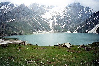
Sheshnag Lake is an alpine high elevation oligotrophic lake located in Anantnag district of Kashmir Valley in Jammu and Kashmir, India at an elevation of 3590 meters. It is situated on the track leading to the Amarnath cave, about 23 km from Pahalgam. It has a maximum length of 1.1 km and maximum width of 0.7 km.
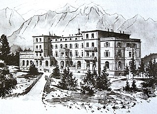
The Waldhaus Flims is a five star hotel in Flims, a resort village to the west of Chur, in the eastern Swiss canton of Graubünden (Grigioni/Grisons).
Sandow is the highest village of Chiktan block, situated 60 kilometres (37 mi) away in the east of district headquarter Kargil, Ladakh. Sandow is surrounded by villages - Lamsoo in the west, Yokma Kharboo and Shakar in the south, and Lhalung Batalik in the north. Sandow falls under the Shakar constituency zone. The village is 58 kilometres (36 mi) from Kargil town, located at a latitude of 34.55 and longitude of 76.38 and at an altitude of 3,200 metres (10,500 ft) above mean sea level. The village was settled some around 300 years before, on a syncline of a complex range of Himalayas.

Sarykopa is a bittern salt lake in the Kostanay Region, Kazakhstan.
