
The common crane, also known as the Eurasian crane, is a bird of the family Gruidae, the cranes. A medium-sized species, it is the only crane commonly found in Europe besides the demoiselle crane and the Siberian crane that only are regular in the far eastern part of the continent. Along with the sandhill crane, demoiselle crane and the brolga, it is one of only four crane species not currently classified as threatened with extinction or conservation dependent on the species level. Despite the species' large numbers, local extinctions and extirpations have taken place in part of its range, and an ongoing reintroduction project is underway in the United Kingdom.

Seven Persons is a hamlet in Alberta, Canada within Cypress County. It is located approximately 20 kilometres (12 mi) southwest of Medicine Hat on Highway 3 and has an elevation of 755 metres (2,477 ft).

Aldersyde is a hamlet in Alberta, Canada within the Foothills County. Located between Highway 2 and Highway 2A south of Highway 7, the hamlet is approximately 8 kilometres (5.0 mi) southeast of Okotoks, 10 kilometres (6.2 mi) north of High River and 25 kilometres (16 mi) south of Calgary. The Canadian Pacific Kansas City Aldersyde subdivision runs through the hamlet.

Division No. 1 is a census division in Alberta, Canada. It is located in the southeast corner of southern Alberta and surrounds the City of Medicine Hat. The division is made up of the counties of Cypress and Forty Mile No. 8.

Nordegg is a hamlet in west-central Alberta, Canada within Clearwater County. It is in the North Saskatchewan River valley in the foothills of the Canadian Rockies, just east of the intersection of the David Thompson Highway and the Highway 734 spur of the Bighorn Highway. A former coal mining town, it was named after Martin Nordegg and the name probably means "North Corner" in a German dialect. The railway station name at the locality was called Brazeau rather than Nordegg at certain points in its history, but the local post office has always been named Nordegg. The name Brazeau is now obsolete.
De Winton is a hamlet in southern Alberta, Canada within the Foothills County. It is located just south of the City of Calgary and west of Highway 2A.

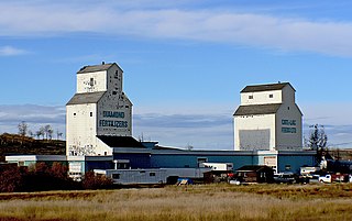
Acadia Valley is a hamlet in southeast Alberta, Canada within the Municipal District (MD) of Acadia No. 34. The MD of Acadia No. 34's municipal office is located in Acadia Valley.

Etzikom is a hamlet in Alberta, Canada within the County of Forty Mile No. 8. It is approximately 20 kilometres (12 mi) east of Foremost on Highway 61.

Manyberries is a hamlet in Alberta, Canada within the County of Forty Mile No. 8. It is located approximately 85 km (53 mi) south of Medicine Hat, at the eastern end of Highway 61.
Carvel is a hamlet in Alberta, Canada within Parkland County. It is located on Highway 770, approximately 35 kilometres (22 mi) west of Edmonton. The hamlet's name is derived from the novel Richard Carvel by the American writer Winston Churchill.
Woolford is a hamlet in southern Alberta, Canada within Cardston County. It is located on Highway 503, approximately 16 kilometres (9.9 mi) southeast of Cardston between the St. Mary River and the Milk River Ridge. It is named after Thomas Woolford who came to the area in 1900.

Cherhill is a hamlet in Alberta, Canada within Lac Ste. Anne County. It is located along Highway 43, approximately 35 kilometres (22 mi) east of Mayerthorpe and 82 kilometres (51 mi) northwest of Edmonton.
Alhambra is a hamlet in Alberta, Canada within Clearwater County. It is located close to the David Thompson Highway, east of Rocky Mountain House.
Buffalo is a hamlet and a ghost town in Alberta, Canada that is under the jurisdiction of the Special Areas Board. It is on Highway 555, between Bindloss and Jenner, south of the Red Deer River, at an elevation of 720 metres (2,360 ft).
Elmworth is a hamlet in northern Alberta, Canada within the County of Grande Prairie No. 1. It is located on Highway 722 north of the Wapiti River and east of the British Columbia border. It has an elevation of 715 metres (2,346 ft). The Elmworth natural gas field stretches west and south of the hamlet.

Brosseau is a hamlet in central Alberta, Canada within the County of Two Hills No. 21. It is located on the north bank of the North Saskatchewan River along the Highway 29 / Highway 36 concurrency, 50 km (31 mi) southwest of St. Paul. The hamlet of Duvernay is located immediately across the river along the south bank.
Cessford is a hamlet in southern Alberta, Canada within Special Area No. 2. It is located approximately 22 kilometres (14 mi) east of Highway 36 and 54 kilometres (34 mi) northeast of Brooks.
Eaglesham is a hamlet in northern Alberta, Canada within Birch Hills County, located 6 kilometres (3.7 mi) north of Highway 49, approximately 89 kilometres (55 mi) northeast of Grande Prairie.
Esther is a hamlet in southern Alberta, Canada that is under the jurisdiction of the Special Areas Board. Within Special Area No. 3, it is 16 kilometres (9.9 mi) east of Highway 41, 185 kilometres (115 mi) north of Medicine Hat. It was first settled in 1910. The community has the name of Anna Esther Landreth, a girl in the neighbourhood.

