Cavill Avenue

Last updated

Pedestrian mall in 2017 Cavill Avenue at Surfers Paradise, Queensland looking east.jpg
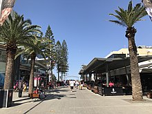
Pedestrian mall in 2017

Cavill Avenue is a street and a pedestrian mall in Surfers Paradise, Gold Coast, Queensland, Australia. It is in the heart of the Surfers Paradise shopping and entertainment district. It was named in honour of the man credited as the founder of Surfers Paradise, James Cavill, known as Jim Cavill. [1]

Contents

History

In 1887, German immigrant Johann Meyer operated a ferry across the Nerang River. From Southport, travellers would follow the Meyer's Ferry Road (now Ferry Road) to a spit of land that created a narrow point in the river ( 28°00′04″S153°25′29″E / 28.0011°S 153.4247°E / -28.0011; 153.4247 (Meyer's Ferry) ) (the narrow spit is no longer in existence due to changes in the river and the creation of Chevron Island but is in the vicinity of the Gold Coast Arts Centre). From that point, Meyer's ferry would take the travellers across the river to Meyer's Ferry Road at Elston (as Surfers Paradise was then known) along which the travellers would walk to the surf beach. Businesses established along Meyer's Ferry Road at Elston which created the main street of Surfers Paradise now known as Cavill Avenue. Although the surf beaches of Elston were a popular destination, the lack of road access limited the extent of residential and commercial development. [2] [3]

It was not until 1925, when the Jubilee Bridge was built across the Nerang River between Southport and Main Beach, that Surfers Paradise was opened up for tourism and associated development. [4] During the same period Jim Cavill built the Surfers Paradise Hotel on the south eastern corner of Ferry Road and the South Coast Road.

In 1945, in response to a letter from Mr. E Shersby to name streets after local pioneers, the Southport Town Council decided to rename the section of Ferry Road east of the Nerang River, and in front of the Surfers Paradise Hotel, in honour of Jim Cavill. [5] It was decided to name the section of Ferry Road west of the Nerang River after Johann Meyer. [6]

Geography

Between the Surfers Paradise Beach and Orchid Avenue, Cavill Avenue is a pedestrian mall. The Centro Surfers Paradise is a major shopping centre on pedestrian section of Cavill Avenue. The Circle on Cavill is the second shopping center on the street, located at the western end of the road, near the Gold Coast Highway.

Located near the intersection of Surfers Paradise Boulevard and Cavill Avenue is the G:link Cavill Avenue Station. The G:link is the Gold Coast's new light rail system connecting Broadbeach with Helensvale via Surfers Paradise, Main Beach, Southport, Gold Coast University Hospital and Parkwood

The Soul is a 243 m tall skyscraper and the second tallest skyscraper on the Gold Coast behind Q1. The building is situated on the Esplanade just to the north of Cavill Avenue. At the river end of the street are the two towers of Circle on Cavill.

Events

The mall is the centre of the annual Schoolies celebrations. According to crime statistics the mall is an alcohol fueled violence hotspot. [7]

See also

Related Research Articles

<span class="mw-page-title-main">Surfers Paradise, Queensland</span> Town in Queensland, Australia

Surfers Paradise is a town and suburb in the City of Gold Coast, Queensland, Australia. In the 2021 census, the suburb of Surfers Paradise had a population of 26,412 people.
<span class="mw-page-title-main">Nerang River</span> River in Queensland, Australia

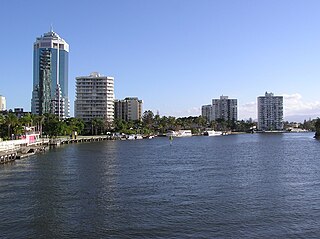
The Nerang River is a perennial river in South East Queensland, Australia. Its catchment lies within the Gold Coast local government area and covers an area of 490 square kilometres (190 sq mi). The river is approximately 62 kilometres (39 mi) in length.

<span class="mw-page-title-main">Nerang, Queensland</span> Town in Queensland, Australia

Nerang is a town and suburb in the City of Gold Coast, Queensland, Australia. In the 2021 census, the suburb of Nerang had a population of 17,048 people.

<span class="mw-page-title-main">Southport, Queensland</span> Suburb of Gold Coast, Queensland, Australia

Southport is a coastal town and suburb in the City of Gold Coast in Queensland, Australia. It contains the Gold Coast central business district. In the 2021 census, Southport had a population of 36,786 people.

<span class="mw-page-title-main">Jim Cavill</span>

James Freeman Cavill a Brisbane hotelier, was one of the pioneers of the Gold Coast, Australia.
<span class="mw-page-title-main">Johan Meyer</span>

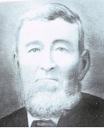
Johann Heinrich Casper Meyer (??-1901) was a German immigrant to Queensland and a pioneer of the Gold Coast region.

<span class="mw-page-title-main">Gold Coast Broadwater</span>

The Gold Coast Broadwater, also known as Southport Broadwater, Gold Coast Harbour and The Broadwater, is a large shallow estuary of water located in the Gold Coast district of South East Queensland, Australia. The estuary reaches from the locality of Southport in the south, to the southern section of the UNESCO World Heritage Listed Moreton Bay in the north. Separated via the Seaway from the Coral Sea by a thin strip of land called Stradbroke Island, the original body of water was a lagoon created from water deposited from the Nerang River. Part of the Broadwater is contained within the Moreton Bay Marine Park.

<span class="mw-page-title-main">Carrara, Queensland</span> Suburb of Gold Coast, Queensland, Australia

Carrara is a suburb in the City of Gold Coast, Queensland, Australia. In the 2021 census, Carrara had a population of 13,138 people.
<span class="mw-page-title-main">Circle on Cavill</span> Commercial development with two residential towers positioned in the Surfers Paradise CBD

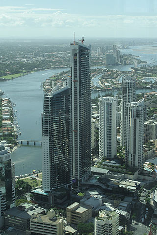
Circle on Cavill is a $551 million commercial development with two residential towers built by the Sunland Group and positioned in a key city block in the heart of the Surfers Paradise CBD, neighbouring with Towers of Chevron Renaissance shopping mall and resort apartment complex. Circle on Cavill is bounded by the main Surfers Paradise Boulevard at the western end of Cavill Mall and river end of Cavill Avenue, between the Gold Coast Highway and Ferny Avenue, in Surfers Paradise on the Gold Coast, Queensland, Australia.

<span class="mw-page-title-main">History of the Gold Coast, Queensland</span>

The history of the Gold Coast in Queensland, Australia began in prehistoric times with archaeological evidence revealing occupation of the district by indigenous Australians for at least 23,000 years. The first early European colonizers began arriving in the late 1700s, settlement soon followed throughout the 19th century, and by 1959 the town was proclaimed a city. Today, the Gold Coast is one of the fastest-growing cities in Australia.

Benowa is a suburb in the City of Gold Coast, Queensland, Australia. In the 2021 census, Benowa had a population of 9,889 people.

<span class="mw-page-title-main">Bundall, Queensland</span> Suburb of Gold Coast, Queensland, Australia

Bundall is a suburb in the City of Gold Coast, Queensland, Australia. In the 2021 census, Bundall had a population of 4,895 people.

<span class="mw-page-title-main">Labrador, Queensland</span> Suburb of Gold Coast, Queensland, Australia

Labrador is a coastal suburb in the City of Gold Coast, Queensland, Australia. In the 2021 census, Labrador had a population of 18,643 people.

<span class="mw-page-title-main">G:link</span> Light rail system on the Gold Coast, Australia

G:link, also known as the Gold Coast Light Rail, the Gold Coast Tram or simply the 'G, is a light rail system serving the Gold Coast in Queensland, Australia, and is the sole light rail system in Queensland. The system forms part of Translink's South East Queensland public transport network and consists of a single 20 km (12 mi) line of nineteen stations. Helensvale railway station is the northern terminus of the system, while Broadbeach South serves as the southern terminus. The line initially opened on 20 July 2014 and was subsequently extended northwest from Gold Coast University Hospital to Helensvale on 17 December 2017.

<span class="mw-page-title-main">Ferry Road, Gold Coast</span> Road in Southport, Queensland, Australia

Ferry Road is a road in Southport, on the Gold Coast, Queensland, Australia. Originally a suburban street, it is now part of Southport–Burleigh Road, a state controlled road

The following is a timeline of history of the city of Gold Coast, Queensland, Australia.

<span class="mw-page-title-main">Kinkabool</span> Historic site in Queensland, Australia

Kinkabool is a heritage-listed apartment block at 32–34 Hanlan Street, Surfers Paradise, Queensland, Australia. It was designed by John M. Morton of Lund Hutton Newell Black & Paulsen and built from 1959 to 1960 by J D Booker Constructions Pty Ltd. It was added to the Queensland Heritage Register on 5 February 2009.

<span class="mw-page-title-main">Jubilee Bridge (Southport)</span> Bridge in Gold Coast, Queensland

The Jubilee Bridge (1925–1966) was a bridge across the Nerang River in South East Queensland, Australia. The bridge connected the suburbs of Southport to Main Beach on the Gold Coast, providing the first road connection to Surfers Paradise. It facilitated the development of the Gold Coast beach suburbs and holiday resorts.

<span class="mw-page-title-main">Gold Coast central business district</span> Place in Queensland, Australia

The Gold Coast central business district (CBD) is the planned main commercial centre of the Gold Coast, Queensland, Australia. The area encompasses an eastern portion of the Southport suburb. Its north–south axis runs from North Street in the north to Brighton Parade in the south. Its east–west axis runs from Broadwater in the east to the High Street in the west.

<span class="mw-page-title-main">Chevron Island</span> Island in Queensland, Australia

The Chevron Island is an urban island that lies in the Nerang River and is a neighbourhood within the suburb of Surfers Paradise in the City of Gold Coast, Queensland, Australia.
References

  1. "Death of man who named Surfers Paradise". Townsville Daily Bulletin . Vol. LXXII. Queensland, Australia. 7 March 1952. p. 2. Retrieved 11 May 2016 via National Library of Australia.
  2. "Surfers Paradise history". Gold Coast City Council. Archived from the original on 4 June 2016. Retrieved 15 January 2015.
  3. "History: Understanding the Gold Coast". Cultural Precinct Gold Coast. Gold Coast City Council. Archived from the original on 30 September 2015. Retrieved 29 September 2015.
  4. "SOUTHPORT JUBILEE". Queensland Times . Vol. LXVI, no. 12, 286. Queensland, Australia. 28 November 1925. p. 7 (DAILY.). Retrieved 11 May 2016 via National Library of Australia.
  5. "TOWN COUNCIL MATTERS". South Coast Bulletin . No. 907. Queensland, Australia. 24 October 1945. p. 2. Retrieved 11 May 2016 via National Library of Australia.
  6. "SURFERS' PARADISE". South Coast Bulletin . No. 911. Queensland, Australia. 28 November 1945. p. 1. Retrieved 11 May 2016 via National Library of Australia.
  7. Lisa Cornish (12 January 2014). "Brisbane's Fortitude Valley heads the Queensland list of street violence hotspots". The Courier-Mail. News Ltd. Archived from the original on 12 January 2014. Retrieved 15 January 2015.


28°00′07″S153°25′47″E / 28.00199°S 153.42976°E / -28.00199; 153.42976