Chevron Island

Last updated

Chevron Island
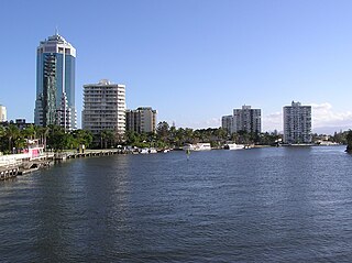
Chevon Island CBD 20231008 134848.jpg
Chevon Island CBD, 2023.
Chevron-Island-open-street-map, 2015.JPG
Chevron Island in OpenStreetMap, 2015
Chevron Island
Geography
Location Nerang River
Total islands2
Major islandsChevron; Cronin
Highest elevation2 m (7 ft) [1]
Administration
State Queensland
Region Gold Coast, South East Qld
Largest settlement Surfers Paradise

The Chevron Island is an urban island that lies in the Nerang River and is a neighbourhood within the suburb of Surfers Paradise in the City of Gold Coast, Queensland, Australia. [2] [3]

Contents

History

Chevron Island is a natural island previously known as Goat Island. [4] [5] Goat Island hosted a cattle farm. The name Goat Island originated from when the original farm had a large goat population. Although it was a cattle farm, the goats helped keep the tougher vegetation from taking over. The goats were moved on after the sale of the farm and no records show what happened to them afterwards.[ citation needed ]

The Gold Coast has many man-made islands created from land reclamation; however Chevron Island (Goat Island) already existed. [6] The shape and height of the island were added to with sand fill and also by detaching the island from where HOTA now exists in the 1950s. Chevron Island also had a landing point for the barge/ferry crossing the Nerang River to Cavill Avenue. [7] Prior to land reclamation, the Nerang River was wide and shallow with many sandbanks with shifting riverbanks. Through dredging, deeper channels were created for shipping in the river with the spoil being used to create inhabitable islands and permanent river edge embankments, all of which facilitated residential and commercial development. [8] [9]

Geography

Chevron Island is a medium density residential area. It is connected by two bridges to Southport and Bundall to the west and to the coastal strip of Surfers Paradise to the east with Thomas Drive continuing from Slatyer Road in Southport/Bundall through to Elkhorn Avenue in coastal strip of Surfers Paradise. [10]

The island has an elevation of 2 metres (6 ft 7 in) above sea level [1] at the mean high tide mark.

Cronin Island ( 27°59′34″S153°25′06″E / 27.99278°S 153.41833°E / -27.99278; 153.41833 (Cronin Island) ) is a small reclaimed island accessible from Chrevon Island and also lies within the Nerang River. [11] [12] Cronin Island is named after Jack Cronin, the first engineer employed by the Southport Town Council (now the Gold Coast City Council). [13]

Related Research Articles

<span class="mw-page-title-main">Gold Coast, Queensland</span> Australian coastal city

The Gold Coast, often referred to by its initials G.C., and officially the City of Gold Coast, is a city in Queensland, Australia. It is Australia’s sixth-largest city, the most populous non-capital city, and the state's second-largest city after Brisbane, with a population over 600,000. The Gold Coast is a coastal city and region located approximately 66 kilometres (41 mi) south-southeast of the centre of the state capital, Brisbane. The city's central business district is located roughly in the centre of the Gold Coast in the suburb of Southport. The urban area of the Gold Coast is concentrated along the coast, sprawling almost 60 kilometres, joining up with the Greater Brisbane metropolitan region to the north and to the state border with New South Wales to the south. Nicknames of the city include the ‘Glitter Strip’ and the ‘Goldy’. The demonym of a Gold Coast resident is Gold Coaster.

<span class="mw-page-title-main">Surfers Paradise, Queensland</span> Suburb of Gold Coast City, Queensland, Australia

Surfers Paradise is a suburb in the City of Gold Coast, Queensland, Australia. In the 2021 census, Surfers Paradise had a population of 26,412 people.
<span class="mw-page-title-main">Nerang River</span> River in Queensland, Australia

The Nerang River is a perennial river in South East Queensland, Australia. Its catchment lies within the Gold Coast local government area and covers an area of 490 square kilometres (190 sq mi). The river is approximately 62 kilometres (39 mi) in length.
<span class="mw-page-title-main">Main Beach, Queensland</span> Suburb of Gold Coast, Queensland, Australia

Main Beach is a coastal town and suburb in the City of Gold Coast, Queensland, Australia. In the 2016 census, the suburb of Main Beach had a population of 3,883 people.

<span class="mw-page-title-main">Nerang, Queensland</span> Suburb of Gold Coast, Queensland, Australia

Nerang is a town and suburb in the City of Gold Coast, Queensland, Australia. In the 2016 census, Nerang had a population of 16,864 people.

<span class="mw-page-title-main">Southport, Queensland</span> Suburb of Gold Coast, Queensland, Australia

Southport is a coastal town and suburb in the City of Gold Coast in Queensland, Australia. It contains the Gold Coast central business district. In the 2021 census, Southport had a population of 36,786 people.

<span class="mw-page-title-main">Gold Coast Seaway</span>

The Gold Coast Seaway or Southport Seaway is the main navigation entrance from the Pacific Ocean into the Gold Coast Broadwater and southern Moreton Bay and is one of Australia's most significant coastal engineering projects. It is located at the northern end of the Southport Spit where the Nerang River enters the Pacific Ocean. The channel was constructed between 1984 and 1986, primarily to facilitate the safe passage of sea-faring vessels. The passage was previously known as the Southport Bar. The mouth of the Nerang River was once located further south in Broadbeach. The main driving force for this movement is the northward drift of sand along the coast.

<span class="mw-page-title-main">City of Gold Coast</span> Local government area in Queensland, Australia

The City of Gold Coast is the local government area spanning the Gold Coast, Queensland, Australia and surrounding areas. With a population of 606,774, it is the second most populous local government area in the State of Queensland. Its council maintains a staff of over 2,500. It was established in 1948, but has existed in its present form since 2008. It is on the border with New South Wales with the Tweed Shire to the south in New South Wales.

<span class="mw-page-title-main">Carrara, Queensland</span> Suburb of Gold Coast, Queensland, Australia

Carrara is a suburb in the City of Gold Coast, Queensland, Australia. In the 2016 census, Carrara had a population of 12,060 people.

<span class="mw-page-title-main">History of the Gold Coast, Queensland</span>

The history of the Gold Coast in Queensland, Australia began in prehistoric times with archaeological evidence revealing occupation of the district by indigenous Australians for at least 23,000 years. The first early European colonizers began arriving in the late 1700s, settlement soon followed throughout the 19th century, and by 1959 the town was proclaimed a city. Today, the Gold Coast is one of the fastest-growing cities in Australia.

Benowa is a suburb in the City of Gold Coast, Queensland, Australia. In the 2016 census, Benowa had a population of 8,741 people.

<span class="mw-page-title-main">Bundall, Queensland</span> Suburb of Gold Coast, Queensland, Australia

Bundall is a suburb in the City of Gold Coast, Queensland, Australia. In the 2016 census, Bundall had a population of 4,523 people.

<span class="mw-page-title-main">G:link</span> Light rail system on the Gold Coast, Australia

G:link, also known as the Gold Coast Light Rail and the Gold Coast Tram, is a light rail system serving the Gold Coast in Queensland, Australia, and is the sole light rail system in Queensland. The system forms part of Translink's South East Queensland public transport network and consists of a single 20 km (12 mi) line of nineteen stations. The Helensvale railway station is the northern terminus of the system, while Broadbeach South is the southern terminus. The line opened on 20 July 2014 and was extended northwest from Gold Coast University Hospital to Helensvale on 17 December 2017.

<span class="mw-page-title-main">Ferry Road, Gold Coast</span>

Ferry Road is a road in Southport, on the Gold Coast, Queensland, Australia. Originally a suburban street, it is now part of Southport–Burleigh Road, a state controlled road

<span class="mw-page-title-main">Cavill Avenue</span> Street in Surfers Paradise, Queensland

Cavill Avenue is a street and a pedestrian mall in Surfers Paradise, Gold Coast, Queensland, Australia. It is in the heart of the Surfers Paradise shopping and entertainment district. It was named in honour of the man credited as the founder of Surfers Paradise, James Cavill, known as Jim Cavill.

<span class="mw-page-title-main">Town of Southport</span>

The Town of Southport was a local government area in South East Queensland, Australia.

The Town of South Coast was a local government area in South East Queensland, Australia.

The following is a timeline of history of the city of Gold Coast, Queensland, Australia.

<span class="mw-page-title-main">Jubilee Bridge, Southport</span> Bridge in Gold Coast, Queensland

The Jubilee Bridge (1925–1966) was a bridge across the Nerang River in South East Queensland, Australia. The bridge connected the suburbs of Southport to Main Beach on the Gold Coast, providing the first road connection to Surfers Paradise. It facilitated the development of the Gold Coast beach suburbs and holiday resorts.

References

  1. 1 2 Ryan, J. K.; Waltham, Nathan J.; Benfer, Nathan P.; King, Brian A.; Lemckert, Charles J.; Zigic, Sasha (2013). "Gold Coast Broadwater: Southern Moreton Bay, Southeast Queensland (Australia)". In Wolanski, Eric (ed.). Estuaries of Australia in 2050 and beyond. Dordrecht Springer. pp. 93–109. ISBN   978-94-007-7019-5.
  2. "Chevron Island – island (entry 7046)". Queensland Place Names. Queensland Government . Retrieved 30 September 2015.
  3. "Chevron Island – neighbourhood (entry 7047)". Queensland Place Names. Queensland Government . Retrieved 30 September 2015.
  4. "Surfers Paradise". Queensland Places. Centre for the Government of Queensland, University of Queensland. Retrieved 17 June 2019.
  5. Wright, Karen. "Southport Stories" (PDF). Gold Coast City Council. p. 2. Archived (PDF) from the original on 17 June 2019. Retrieved 17 June 2019.
  6. Zerna, Jennifer. "Southport Stories" (PDF). Gold Coast City Council. p. 85. Retrieved 14 August 2018.
  7. "City of Gold Coast: Thomas Drive, Chevron Island". www.goldcoast.qld.gov.au. Retrieved 30 September 2015.
  8. "Nerang River Catchment". City of Gold Coast . Retrieved 28 September 2015.
  9. "History of the Gold Coast Seaway". Gold Coast Waterways Authority. 28 August 2013. Retrieved 1 October 2015.
  10. "Queensland Globe". State of Queensland . Retrieved 30 September 2015.
  11. "Cronin Island – island (entry 8804)". Queensland Place Names. Queensland Government . Retrieved 30 September 2015.
  12. "Cronin Island – neighbourhood (entry 8805)". Queensland Place Names. Queensland Government . Retrieved 30 September 2015.
  13. Young, Bernadette; Marshall, Candice (9 May 2013). "What's in a name?". ABC Gold & Tweed Coasts. Archived from the original on 14 March 2012. Retrieved 10 October 2020.

27°59′48″S153°25′15″E / 27.99667°S 153.42083°E / -27.99667; 153.42083