The Gold Coast Highway runs north to south through Miami, with Christine Avenue and Pacific Avenue connecting to the west.
History
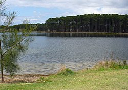
Miami Swamp next to Hotel Miami, 1935
The history of Miami can be dated back to the early 1920s when prospective investors were looking over plans for a new real estate development called Miami Shore at North Burleigh.[8] The name "Miami Shore" was chosen as a reference to Miami Shores, Florida.[9] The investors built their wooden or fibro bungalows on estates such as this, or rented their cottages to holiday makers.[10] They could also stay in the Hotel Miami which opened in 1925 by E. H. Berry.[11] In 1953, tennis courts were constructed.[12]Pizzey Park Sporting Complex was established on 60 hectares (150 acres) in 1969.[13]
Burleigh State High School opened on 1 January 1963. It was subsequently renamed South Coast District State High School and then to Miami State High School.[14][15] Because there was a visible rock face remaining from an earlier quarry, the school principal William Callinan covered it up with a set of huge yellow letters saying "HI MIAMI HIGH". It now says just "MIAMI HIGH".[16][17]
On Sunday 22 December 1963, Calvary Memorial Catholic Church was officially opened and dedicated by Archbishop James Duhig. It commemorates those who served in the Korean War.[18]
Miami State School opened on 30 January 1979; it is now within the suburb boundaries of Mermaid Waters.[14]
In 1988, Australian musician John Farnham's music video for the top-10 song "Two Strong Hearts" was filmed outside the famous "Miami Ice" factory at 2015 Gold Coast Highway.[19]
Other sporting teams include the Eastern Cobras, and the Bond Pirates Rugby Union Club in Pizzey Park, which fields teams in juniors, seniors, women and Over 35s competitions. Bond Pirates have provided Wallabies players Tai McIsaac and James Slipper, and several members of the Croatian and Tongan national teams. Bond Pirates is an amalgamated Club, consisting of the original Bond University Club and the original Pirates Club.[citation needed]
The Gold Coast Light Rail is currently being extended along the Gold Coast Highway as part of the Gold Coast Light Rail Stage 3 extension to Burleigh Heads, these works are expected to reach completion in 2025. Of the eight stations which are to be delivered as part of the Stage 3 works three will be located in Miami, Miami North Station (opposite Miami State High), Miami Station (between Hythe Street and Miami Shore Parade) and Christine Avenue Station (between Mountain View Avenue and Christine Avenue).[37]
↑ "Advertising". The Brisbane Courier. No.20, 534. Queensland, Australia. 14 November 1923. p.11. Archived from the original on 27 January 2022. Retrieved 27 January 2022– via National Library of Australia.
↑ "Advertising". The Brisbane Courier. No.20, 555. Queensland, Australia. 8 December 1923. p.14. Archived from the original on 25 November 2023. Retrieved 31 January 2023– via National Library of Australia.
↑ "History". The Miami Tavern, Miami, QLD. Archived from the original on 27 October 2023. Retrieved 19 November 2023.
↑ "MIAMI TENNIS CLUB". South Coast Bulletin. No.1591. Queensland, Australia. 19 August 1953. p.3. Archived from the original on 19 November 2023. Retrieved 20 November 2023– via National Library of Australia.
This page is based on this Wikipedia article Text is available under the CC BY-SA 4.0 license; additional terms may apply. Images, videos and audio are available under their respective licenses.