Ashmore, Queensland

Last updated

Map all coordinates using: OpenStreetMap
Ashmore
Gold Coast,  Queensland
Lions Park, Ashmore, Queensland, Australia.jpg
Lions Park along Currumburra Road, 2022
Gold Coast locator map.svg
Red pog.svg
Ashmore
Ashmore, Queensland
Coordinates 27°59′21″S153°22′43″E / 27.9891°S 153.3786°E / -27.9891; 153.3786 (Ashmore (centre of suburb))
Population11,910 (2016 census) [1]
 • Density1,751/km2 (4,540/sq mi)
Established1972
Postcode(s) 4214
Area6.8 km2 (2.6 sq mi)
Time zone AEST (UTC+10:00)
Location
LGA(s) City of Gold Coast
State electorate(s) Southport
Federal division(s) Moncrieff
Suburbs around Ashmore:
Molendinar Southport Southport
Nerang Ashmore Southport
Carrara Benowa Bundall

Ashmore is a suburb of the City of Gold Coast, Queensland, Australia. [2] In the 2016 census, Ashmore had a population of 11,910 people. [1]

Contents

History

In October 1887, in the area now known as Ashmore and Benowa, 5 subdivisions comprising the Benowa Estate and Plantation on the Nerang River were advertised to be auctioned by James R. Dickson. [3] A map advertising the auction states the Estate was located 4 miles to Southport bound by a good road on one side and bound by the navigable Nerang River on the other side. Extensive buildings and plant for sugar manufacturing were included in the estate. [4]

In the 1970s, Jim Donellon, a property investor from Sydney, purchased and developed a housing estate called Ashmore Village. The Ashmore Plaza Shopping Centre was developed by the late 1970s. [5]

Ashmore State School opened on 23 January 1978. [6]

Trinity Lutheran Primary School opened in Cotlew Street on 27 January 1981. [6]

The suburb was officially bounded and named Ashmore on N1 December 1982. [2]

Bellevue Park State School opened on 24 January 1983 in Southport. [6] It is now within Ashmore. [7]

Trinity Lutheran College opened on Ashmore Road as a secondary school on 28 January 1987. In 2002 it amalgamated with the Trinity Lutheran Primary School under the name Trinity Lutheran College. The early and junior year students are at the Cotlew Street campus while the middle and senior students are at the Ashmore Road campus. [6] [8]

Demographics

In the 2011 census, Ashmore recorded a population of 11,586 people, 52.5% female and 47.5% male. [9] The median age of the Ashmore population was 40 years, 3 years above the national median of 37. 65.7% of people living in Ashmore were born in Australia. The other top responses for country of birth were New Zealand 9.2%, England 4.9%, Japan 1.1%, Scotland 0.7%, Korea, Republic of 0.7%. 82.9% of people spoke only English at home; the next most common languages were 1.5% Japanese, 0.9% Korean, 0.6% German, 0.6% Greek, 0.5% Mandarin. [9]

In the 2016 census, Ashmore had a population of 11,910 people. [1]

Natural environment

Pre-clearing, the vegetation of Ashmore included substantial areas of blackbutt (Eucalyptus pilularis) tall open forest on lowland metamorphosed sediments. This ecosystem type is now listed as endangered with extinction in Queensland having been extensively cleared for agriculture and housing development.

The area now occupied by Royal Pines resort once supported established Eucalyptus tereticornis forests and wetlands with patches of rainforest. Jabiru, magpie geese and a variety of water birds used these wetlands which stretched from Nerang to near Burleigh Heads along the floodplain of the Nerang River Valley and Mudgeereebah and Bonogin Creeks. This ecosystem was akin to Kakadu with lagoons of lilypads, swamp rainforest and gnarled old paperbark forest filled with palms. In the 1980s prior to the development of Royal Pines resort, farmland with remnant degraded wetlands and some forest remained, and jabiru, spoonbills, magpie geese and a variety of other birds could be seen there. Development in recent decades has led to the loss of most remnant natural vegetation.

Education

Ashmore State School is a government primary (Prep-6) school for boys and girls at Currumburra Road ( 27°59′21″S153°22′53″E / 27.9891°S 153.3813°E / -27.9891; 153.3813 (Ashmore State School) ). [10] [11] In 2018, the school had an enrolment of 894 students with 59 teachers (52 full-time equivalent) and 32 non-teaching staff (23 full-time equivalent). [12] It includes a special education program. [10]

Bellevue Park State School is a government primary (Prep-6) school for boys and girls at Sapium Road ( 27°59′44″S153°23′46″E / 27.9956°S 153.3962°E / -27.9956; 153.3962 (Bellevue Park State School) ). [10] [13] In 2018, the school had an enrolment of 636 students with 42 teachers (39 full-time equivalent) and 29 non-teaching staff (19 full-time equivalent). [12] It includes a special education program. [10]

Trinity Lutheran College is a private primary and secondary (6-12) school for boys and girls with two campuses, with the Prep-5 campus at 251 Cotlew Street ( 27°59′04″S153°22′17″E / 27.9844°S 153.3714°E / -27.9844; 153.3714 (Trinity Lutheran College) ) [10] [14] and the 6-12 campus at 641 Ashmore Road ( 27°58′45″S153°21′48″E / 27.9791°S 153.3633°E / -27.9791; 153.3633 (Trinity Lutheran College) ). [10] [14] In 2018, the school had an enrolment of 1,082 students with 86 teachers (78 full-time equivalent) and 61 non-teaching staff (33 full-time equivalent). [12]

There is no government secondary school in Ashmore. The nearest government secondary schools are Keebra Park State High School in neighbouring Southport to the east, Benowa State High School in neighbouring Benowa to the south, and Nerang State High School in neighbouring Nerang to the west. [7]

Gold Coast Institute of TAFE also has one campus located in Ashmore. It is on the corner of Heeb Street and Benowa Road.

Amenities

The main retail area of Ashmore is on Southport-Nerang Road, which features the Ashmore City Shopping Centre, as well as several larger stores such as Spotlight and Anaconda. The suburb features Hungry Jack's, Pizza Hut and Red Rooster opposite Ashmore Plaza. Additionally, there are numerous factory retail outlets with well known-brands offering discounted prices, as well as a locally owned popular Florist, Flowers Gold Coast.

The Gold Coast City Council operates a fortnightly mobile library service which visits Ashmore Village Park (BMX Park) on Currumburra Road. [15]

Ashmore Uniting Church is at 144 Cotlew Street ( 27°59′14″S153°23′07″E / 27.9872°S 153.3854°E / -27.9872; 153.3854 (Ashmore Uniting Church) ). [16] [17] [18]

Transport

Public Transport in Ashmore consists of six different bus routes, though no more than two cover most areas of the suburb. The number 741 bus from Australia Fair to Broadbeach South Station, runs through Ashmore on Cotlew Street, Freda Street and Heeb Street through other streets. It runs on weekdays and weekends and is often considered very unreliable and infrequent.[ citation needed ] The 738 is a half hourly bus service that runs between Griffith University and Broadbeach South Station and follows the number 741 bus from Heeb Street until Freda Street where it turns onto Nerang-Southport Road and continues onto Ashmore City.

Major roads in Ashmore include Cotlew Street, Ashmore Road, Currumburra Road, Heeb Street, Wardoo Street, Benowa Road and Nerang-Southport Road.

See also

Related Research Articles

<span class="mw-page-title-main">Surfers Paradise, Queensland</span> Suburb of Gold Coast City, Queensland, Australia

Surfers Paradise is a suburb in the City of Gold Coast, Queensland, Australia. In the 2021 census, Surfers Paradise had a population of 26,412 people.

<span class="mw-page-title-main">Broadbeach, Queensland</span> Suburb of Gold Coast, Queensland, Australia

Broadbeach is a suburb in the City of Gold Coast, Queensland, Australia. In the 2021 census, Broadbeach had a population of 6,786 people.

<span class="mw-page-title-main">Burleigh Heads, Queensland</span> Suburb of Gold Coast, Queensland, Australia

Burleigh Heads is a suburb in the City of Gold Coast, Queensland, Australia. In the 2016 census, Burleigh Heads had a population of 10,077 people.

<span class="mw-page-title-main">Mudgeeraba, Queensland</span> Town in Queensland, Australia

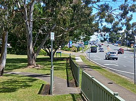
Mudgeeraba is a town and suburb in the City of Gold Coast, Queensland, Australia. In the 2021 census, the suburb of Mudgeeraba had a population of 14,578 people. Mudgeeraba's essential character remains one of a nineteenth-century village.

<span class="mw-page-title-main">Nerang, Queensland</span> Suburb of Gold Coast, Queensland, Australia

Nerang is a town and suburb in the City of Gold Coast, Queensland, Australia. In the 2016 census, Nerang had a population of 16,864 people.

<span class="mw-page-title-main">Southport, Queensland</span> Suburb of Gold Coast, Queensland, Australia

Southport is a coastal town and suburb in the City of Gold Coast in Queensland, Australia. It contains the Gold Coast central business district. In the 2021 census, Southport had a population of 36,786 people.

<span class="mw-page-title-main">City of Gold Coast</span> Local government area in Queensland, Australia

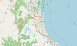
The City of Gold Coast is the local government area spanning the Gold Coast, Queensland, Australia and surrounding areas. With a population of 606,774, it is the second most populous local government area in the State of Queensland. Its council maintains a staff of over 2,500. It was established in 1948, but has existed in its present form since 2008. It is on the border with New South Wales with the Tweed Shire to the south in New South Wales.

<span class="mw-page-title-main">Carrara, Queensland</span> Suburb of Gold Coast, Queensland, Australia

Carrara is a suburb in the City of Gold Coast, Queensland, Australia. In the 2016 census, Carrara had a population of 12,060 people.

Benowa is a suburb in the City of Gold Coast, Queensland, Australia. In the 2016 census, Benowa had a population of 8,741 people.

<span class="mw-page-title-main">Bundall, Queensland</span> Suburb of Gold Coast, Queensland, Australia

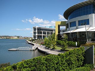
Bundall is a suburb in the City of Gold Coast, Queensland, Australia. In the 2016 census, Bundall had a population of 4,523 people.

<span class="mw-page-title-main">Molendinar, Queensland</span> Suburb of Gold Coast, Queensland, Australia

Molendinar is a mixed-use suburb in the City of Gold Coast, Queensland, Australia. In the 2016 census, Molendinar had a population of 6,375 people.

<span class="mw-page-title-main">Varsity Lakes</span> Suburb of Gold Coast, Queensland, Australia

Varsity Lakes is a suburb in the City of Gold Coast, Queensland, Australia. In the 2021 census, Varsity Lakes had a population of 16,493 people.

<span class="mw-page-title-main">Oxenford, Queensland</span> Suburb of Gold Coast, Queensland, Australia

Oxenford is a suburb in the City of Gold Coast, Queensland, Australia. In the 2016 census, Oxenford had a population of 11,842 people.

Pimpama is a northern suburb in the City of Gold Coast, Queensland, Australia. At the 2021 census, Pimpama had a population of 24,601. The name is of Aboriginal origin. The suburb contains numerous schools with the first opening in the 1870s.

<span class="mw-page-title-main">Numinbah Valley</span> Town in Queensland, Australia

Numinbah Valley is a rural locality in the City of Gold Coast, Queensland, Australia. In the 2016 census, Numinbah Valley had a population of 218 people.

<span class="mw-page-title-main">Pacific Pines, Queensland</span> Suburb of Gold Coast, Queensland, Australia

Pacific Pines is a northern suburb in the City of Gold Coast, Queensland, Australia. In the 2016 census, Pacific Pines had a population of 16,757 people.

<span class="mw-page-title-main">Advancetown, Queensland</span> Suburb of Gold Coast, Queensland, Australia

Advancetown is a rural outer locality in the City of Gold Coast, Queensland, Australia. In the 2016 census, Advancetown had a population of 482 people.

<span class="mw-page-title-main">Waterford, Queensland</span> Town in Queensland, Australia

Waterford is a town and suburb in the City of Logan, Queensland, Australia. In the 2021 census, the suburb of Waterford had a population of 5,796 people.

<span class="mw-page-title-main">Gilston, Queensland</span> Suburb of City of Gold Coast, Queensland, Australia

Gilston is a rural residential locality in the City of Gold Coast, Queensland, Australia. In the 2016 census, Gilston had a population of 2,459 people.

<span class="mw-page-title-main">Mount Nathan, Queensland</span> Suburb of City of Gold Coast, Queensland, Australia

Mount Nathan is a rural locality in the City of Gold Coast, Queensland, Australia. In the 2021 census, Mount Nathan had a population of 1,375 people.

References

  1. 1 2 3 Australian Bureau of Statistics (27 June 2017). "Ashmore (SSC)". 2016 Census QuickStats. Retrieved 20 October 2018. OOjs UI icon edit-ltr-progressive.svg
  2. 1 2 "Ashmore – suburb in City of Gold Coast (entry 46025)". Queensland Place Names. Queensland Government . Retrieved 7 July 2020.
  3. "Classified Advertising". The Queenslander . Vol. XXXII, no. 625. Queensland, Australia. 24 September 1887. p. 504. Archived from the original on 2 April 2021. Retrieved 30 July 2019 via National Library of Australia.
  4. "Benowa Estate and plantation". State Library of Queensland . Archived from the original on 7 May 2021. Retrieved 30 July 2019.
  5. "Ashmore history". Gold Coast City Council . Archived from the original on 24 July 2020. Retrieved 24 July 2020.
  6. 1 2 3 4 Queensland Family History Society (2010), Queensland schools past and present (Version 1.01 ed.), Queensland Family History Society, ISBN   978-1-921171-26-0
  7. 1 2 "Queensland Globe". State of Queensland . Retrieved 24 July 2020.
  8. "The Trinity Journey". Trinity Lutheran College. 24 July 2020. Archived from the original on 24 July 2020. Retrieved 24 July 2020.
  9. 1 2 Australian Bureau of Statistics (31 October 2012). "Ashmore (State Suburb)". 2011 Census QuickStats. Retrieved 6 February 2018. OOjs UI icon edit-ltr-progressive.svg
  10. 1 2 3 4 5 6 "State and non-state school details". Queensland Government. 9 July 2018. Archived from the original on 21 November 2018. Retrieved 21 November 2018.
  11. "Ashmore State School". Archived from the original on 3 March 2021. Retrieved 26 March 2021.
  12. 1 2 3 "ACARA School Profile 2018". Australian Curriculum, Assessment and Reporting Authority. Archived from the original on 27 August 2020. Retrieved 28 January 2020.
  13. "Bellevue Park State School". Archived from the original on 5 April 2021. Retrieved 26 March 2021.
  14. 1 2 "Trinity Lutheran College". Archived from the original on 7 December 2018. Retrieved 21 November 2018.
  15. "Mobile Library 2018 timetable" (PDF). Gold Coast City Council . Archived from the original (PDF) on 30 January 2018. Retrieved 30 January 2018.
  16. "Ashmore Uniting Church". Ashmore Uniting Church. Archived from the original on 7 May 2021. Retrieved 7 May 2021.
  17. Google (7 May 2021). "Ashmore Uniting Church" (Map). Google Maps . Google. Retrieved 7 May 2021.
  18. "Find a church". Uniting Church in Australia, Queensland Synod. Archived from the original on 24 October 2020. Retrieved 6 May 2021.