Coolangatta is a coastal suburb in the City of Gold Coast, Queensland, Australia. It is the Gold Coast's southernmost suburb and it borders New South Wales. In the 2016 census, Coolangatta had a population of 5,948 people.

Palm Beach is a coastal suburb in the City of Gold Coast, Queensland, Australia. In the 2016 census, Palm Beach had a population of 14,654 people.
Miami is a coastal suburb in the City of Gold Coast, Queensland, Australia. At the 2021 census, Miami had a population of 7,445 people.

Moreton Island is the largest locality on the island Moreton Island within the City of Brisbane, Queensland, Australia. In the 2021 census, Moreton Island had a population of 180 people.

Bilinga is a southern coastal suburb in the City of Gold Coast, Queensland, Australia. It is on the border with New South Wales. In the 2021 census, Bilinga had a population of 1,883 people.

Coolum Beach is a beachside town and coastal suburb in the Sunshine Coast Region, Queensland, Australia.In the 2021 census, the suburb of Coolum Beach had a population of 9,152 people.
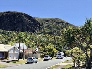
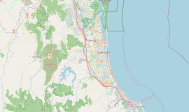
Mount Coolum is a coastal suburb in the Sunshine Coast Region, Queensland, Australia. In the 2016 census, Mount Coolum had a population of 4,265 people.

Beechmont is a rural town and locality in the Scenic Rim Region, Queensland, Australia. In the 2016 census, the locality of Beechmont had a population of 842 people.

The Gold Coast hinterland is an area of South East Queensland, Australia that comprises the Tweed Range, Nimmel Range, Tamborine Mountain, Numinbah Valley, eastern parts of the McPherson Range and western parts of suburban Gold Coast, such as Mudgeeraba. This undefined unit of area is known for its tourist attractions including resorts, rainforest, lookouts, national parks, its diversity of fauna and flora and as a green backdrop to the coastal strip. It overlaps part of the Scenic Rim and is part of both the City of Gold Coast and Scenic Rim Region and includes Springbrook, Binna Burra and O'Reilly.

Tallebudgera is a suburb in the City of Gold Coast, Queensland, Australia. In the 2021 census, Tallebudgera had a population of 3,826 people.

Springbrook is a rural town and locality in the City of Gold Coast, Queensland, Australia. In the 2016 census, the locality of Springbrook had a population of 659 people.
Glenview is a rural locality in the Sunshine Coast Region, Queensland, Australia. In the 2016 census, Glenview had a population of 1,187 people.
Advancetown is a rural outer locality in the City of Gold Coast, Queensland, Australia. In the 2021 census, Advancetown had a population of 528 people.

Currumbin Valley is a rural locality in the City of Gold Coast, Queensland, Australia. It borders New South Wales. In the 2021 census, Currumbin Valley had a population of 2,084 people.

Nindooinbah is a rural locality in the Scenic Rim Region, Queensland, Australia. In the 2016 census, Nindooinbah had a population of 80 people.
Seventy Mile is a rural locality in the Charters Towers Region, Queensland, Australia. In the 2021 census, Seventy Mile had a population of 204 people.
Lynam is a rural locality in the City of Townsville, Queensland, Australia. In the 2021 census, Lynam had a population of 8 people.
Burnett Creek is a rural locality in the Scenic Rim Region, Queensland, Australia. In the 2016 census, Burnett Creek had a population of 11 people. It borders New South Wales to the south.
Southern Lamington is a rural locality in the Scenic Rim Region, Queensland, Australia. It borders New South Wales. In the 2016 census, Southern Lamington had no population.
Lumholtz is a rural locality in the Cassowary Coast Region, Queensland, Australia. In the 2021 census, Lumholtz had a population of 0 people.