Broadbeach Waters, Queensland

Last updated

Map all coordinates using: OpenStreetMap
Broadbeach Waters
Gold Coast,  Queensland
Goldcoast Queensland Australia aerial view.jpg
Residential canals on the Gold Coast, including Broadbeach Waters
Gold Coast locator map.svg
Red pog.svg
Broadbeach Waters
Broadbeach Waters, Queensland
Coordinates 28°01′35″S153°25′02″E / 28.0263°S 153.4172°E / -28.0263; 153.4172 (Broadbeach Waters (centre of suburb))
Population8,164 (SAL 2021) [1]
Postcode(s) 4218
Elevation4 m (13 ft)
Area5.3 km2 (2.0 sq mi)
Time zone AEST (UTC+10:00)
Location
LGA(s) Gold Coast City
State electorate(s) Surfers Paradise
Federal division(s) Moncrieff
Suburbs around Broadbeach Waters:
Benowa Bundall Surfers Paradise
Carrara Broadbeach Waters Broadbeach
Clear Island Waters Mermaid Waters Broadbeach

Broadbeach Waters is a suburb in the City of Gold Coast, Queensland, Australia. [2] In the 2021 census, Broadbeach Waters had a population of 8,164 people. [3]

Contents

Geography

Pacific Fair Shopping Centre Pacific Fair Shopping Centre, Gold Coast, Australia 13.jpg
Pacific Fair Shopping Centre

The northern boundary of Broadbeach Waters follows the Nerang River. The suburb is almost completed residential with most properties adjacent to or very close to man-made canals. Pacific Fair Shopping Centre is located in the south east corner of the suburb.

There are a number of neighbourhoods in the suburb:

History

The first canal estates on the Gold Coast were established in the 1950s in what is now Broadbeach Waters. These were Miami Keys and Rio Vista. Developers were influenced by Florida and commenced construction after visiting there. [10]

In the 2016 census, Broadbeach Waters recorded a population of 7,779 people. [11] The median age of the Broadbeach Waters population was 43 years, 5 years above the national median of 38. 65.2% of people were born in Australia. The most common countries of birth were New Zealand 7.3% and England 5.0%. 81.5% of people spoke only English at home. Other languages spoken at home included Mandarin at 1.7%. The most common responses for religion were No Religion 29.9%, Catholic 26.3% and Anglican 17.8%. [11]

In the 2021 census, Broadbeach Waters had a population of 8,164 people. [3]

Education

There are no schools in Broadbeach Waters. The nearest government primary schools are Broadbeach State School in neighbouring Broadbeach to the south-east and Surfers Paradise State School in neighbouring Surfers Paradise to the north-east. The nearest government secondary school is Merrimac State High School in neighbouring Mermaid Waters to the south. [12]

Amenities

There are a number of parks in the suburb, including:

Attractions

Pacific Fair, the largest shopping centre on the Gold Coast is located on Hooker Boulevard in Broadbeach Waters, not far from the intersection on the Gold Coast Highway. As a result of several redevelopments over the years Pacific Fair boasts over 400 specialty stores, five anchor department stores, two supermarkets, two food courts and a multi cinema complex. In January 2014 work began on re-developing and re-branding the shopping centre. $670 million is being spent on expanding the centre to cater for a 120 new specialty stores, making the centre the fourth largest in the nation and second in Queensland, only Westfield Chermside in Brisbane is larger.

See also

Related Research Articles

<span class="mw-page-title-main">Surfers Paradise, Queensland</span> Suburb of Gold Coast City, Queensland, Australia

Surfers Paradise is a suburb in the City of Gold Coast, Queensland, Australia. In the 2021 census, Surfers Paradise had a population of 26,412 people.

<span class="mw-page-title-main">Broadbeach, Queensland</span> Suburb of Gold Coast, Queensland, Australia

Broadbeach is a suburb in the City of Gold Coast, Queensland, Australia. In the 2021 census, Broadbeach had a population of 6,786 people.

<span class="mw-page-title-main">Burleigh Heads, Queensland</span> Suburb of Gold Coast, Queensland, Australia

Burleigh Heads is a suburb in the City of Gold Coast, Queensland, Australia. In the 2016 census, Burleigh Heads had a population of 10,077 people.

Miami is a coastal suburb in the City of Gold Coast, Queensland, Australia. At the 2021 census, Miami had a population of 7,445 people.

<span class="mw-page-title-main">Helensvale, Queensland</span> Suburb of Gold Coast, Queensland, Australia

Helensvale is a suburb of the City of Gold Coast in Queensland, Australia. In the 2016 census, Helensvale had a population of 16,862 people.

<span class="mw-page-title-main">Carrara, Queensland</span> Suburb of Gold Coast, Queensland, Australia

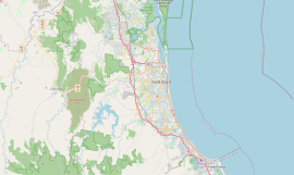
Carrara is a suburb in the City of Gold Coast, Queensland, Australia. In the 2016 census, Carrara had a population of 12,060 people.

<span class="mw-page-title-main">Fitzgibbon, Queensland</span> Suburb of Brisbane, Queensland, Australia

Fitzgibbon is a northern suburb of the City of Brisbane, Queensland, Australia. In the 2016 census, Fitzgibbon had a population of 5,656 people.

Benowa is a suburb in the City of Gold Coast, Queensland, Australia. In the 2016 census, Benowa had a population of 8,741 people.

<span class="mw-page-title-main">Biggera Waters, Queensland</span> Suburb of Gold Coast, Queensland, Australia

Biggera Waters is a coastal suburb in the City of Gold Coast, Queensland, Australia. In the 2016 census, Biggera Waters had a population of 8,534 people.

<span class="mw-page-title-main">Tugun, Queensland</span> Suburb of Gold Coast, Queensland, Australia

Tugun is a beach-side coastal suburb in the City of Gold Coast, Queensland, Australia. In the 2016 census, Tugun had a population of 6,588 people.

<span class="mw-page-title-main">Varsity Lakes</span> Suburb of Gold Coast, Queensland, Australia

Varsity Lakes is a suburb in the City of Gold Coast, Queensland, Australia. In the 2021 census, Varsity Lakes had a population of 16,493 people.

<span class="mw-page-title-main">Mermaid Beach, Queensland</span> Suburb of Gold Coast, Queensland, Australia

Mermaid Beach is a coastal suburb of the City of Gold Coast in Queensland, Australia. In the 2021 census, Mermaid Beach had a population of 7,329.

Diddillibah is a semi-rural locality in the Sunshine Coast Region, Queensland, Australia. In the 2016 census, Diddillibah had a population of 1,403 people. In the 2021 census, Diddillibah had a population of 1,703 people.

Kuluin is a suburb of Maroochydore in the Sunshine Coast Region, Queensland, Australia. Kuluin had a population of 2,363 people in the 2016 census and 2,700 in the 2021 census.

<span class="mw-page-title-main">Parkwood, Queensland</span> Suburb of Gold Coast, Queensland, Australia

Parkwood is a suburb in the City of Gold Coast, Queensland, Australia. In the 2016 census, Parkwood had a population of 8,702 people.

<span class="mw-page-title-main">Mermaid Waters, Queensland</span> Suburb of Gold Coast, Queensland, Australia

Mermaid Waters is a suburb in the City of Gold Coast, Queensland, Australia. In the 2016 census, Mermaid Waters had a population of 12,045 people.

<span class="mw-page-title-main">Clear Island Waters, Queensland</span> Suburb of Gold Coast, Queensland, Australia

Clear Island Waters is a suburb of the City of Gold Coast in Queensland, Australia. In the 2016 census, Clear Island Waters had a population of 4,120 people.

Runaway Bay is a coastal suburb in the City of Gold Coast, Queensland, Australia. In the 2016 census, Runaway Bay had a population of 9,068 people.

<span class="mw-page-title-main">Clagiraba, Queensland</span> Suburb of Gold Coast, Queensland, Australia

Clagiraba is a rural locality in the City of Gold Coast, Queensland, Australia. In the 2021 census, Clagiraba had a population of 651 people.

Kombumerri Park is a multi-sports venue in Mermaid Waters, a suburb in the Gold Coast, Australia. It includes an Australian Rules Football and Cricket ground.

References

  1. Australian Bureau of Statistics (28 June 2022). "Broadbeach Waters (suburb and locality)". Australian Census 2021 QuickStats. Retrieved 28 June 2022.  OOjs UI icon edit-ltr-progressive.svg
  2. "Broadbeach Waters – suburb in City of Gold Coast (entry 46032)". Queensland Place Names. Queensland Government . Retrieved 27 December 2020.
  3. 1 2 Australian Bureau of Statistics (28 June 2022). "Broadbeach Waters (SAL)". 2021 Census QuickStats. Retrieved 28 February 2023. OOjs UI icon edit-ltr-progressive.svg
  4. "Cypress Gardens – locality unbounded in City of Gold Coast (entry 9143)". Queensland Place Names. Queensland Government . Retrieved 27 December 2020.
  5. "Florida Gardens – locality unbounded in City of Gold Coast (entry 12814)". Queensland Place Names. Queensland Government . Retrieved 27 December 2020.
  6. "Miami Keys – locality unbounded in City of Gold Coast (entry 39195)". Queensland Place Names. Queensland Government . Retrieved 27 December 2020.
  7. "Moana – locality unbounded in City of Gold Coast (entry 22407)". Queensland Place Names. Queensland Government . Retrieved 27 December 2020.
  8. "Rialto – locality unbounded in City of Gold Coast (entry 28416)". Queensland Place Names. Queensland Government . Retrieved 27 December 2020.
  9. "Rio Vista – locality unbounded in City of Gold Coast (entry 28511)". Queensland Place Names. Queensland Government . Retrieved 27 December 2020.
  10. "Broadbeach". Queensland Places. University of Queensland. Retrieved 19 November 2023.
  11. 1 2 Australian Bureau of Statistics (27 June 2017). "Broadbeach Waters (SSC)". 2016 Census QuickStats. Retrieved 20 October 2018. OOjs UI icon edit-ltr-progressive.svg
  12. "Queensland Globe". State of Queensland . Retrieved 7 April 2021.
  13. 1 2 3 4 5 6 7 8 9 10 11 12 13 14 15 16 17 18 19 20 21 22 23 24 25 26 27 28 29 30 31 32 33 "Land for public recreation - Queensland". Queensland Open Data. Queensland Government. 20 November 2020. Archived from the original on 22 November 2020. Retrieved 22 November 2020.