Coombabah

Last updated

Map all coordinates using: OpenStreetMap  
Download coordinates as: KML
Coombabah
Gold Coast,  Queensland
The sun setting in Coombabah Lake Conservation Park.jpg
The sun setting in Coombabah Lake Conservation Park, 2018
Australia Queensland location map.svg
Red pog.svg
Coombabah
Coordinates 27°54′35″S153°22′16″E / 27.9097°S 153.3711°E / -27.9097; 153.3711 Coordinates: 27°54′35″S153°22′16″E / 27.9097°S 153.3711°E / -27.9097; 153.3711
Population10,388 (2016 census) [1]
 • Density787.0/km2 (2,038/sq mi)
Postcode(s) 4216
Elevation6 m (20 ft)
Area13.2 km2 (5.1 sq mi)
Time zone AEST (UTC+10:00)
Location
LGA(s) City of Gold Coast
State electorate(s)
Federal division(s) Fadden
Suburbs around Coombabah:
Helensvale Helensvale Paradise Point
Hollywell
Helensvale Coombabah Runaway Bay
Arundel Biggera Waters Biggera Waters

Coombabah is a suburb in the City of Gold Coast, Queensland, Australia. [2] In the 2016 census, Coombabah had a population of 10,388 people. [1]

Contents

Geography

Surrounding Coombabah is Paradise Point and Hope Island to the north, Arundel to the south, Runaway Bay and Biggera Waters to the east and Helensvale to the west and the Coombabah State High School. The minor arterial road servicing Coombabah is Oxley Drive.

History

The suburb takes its name from Coombabah Lake and Coombabah Creek, which in turn are named using Bundjalung language, Ngaraangbal dialect words meaning place of the wood grubs, from the word goombo meaning teredo worm, which was a deliberately cultivated food source by the Indigenous people. [2] [3] [4]

Coombabah Provisional School opened circa July 1887 as a special school for the children of parents who were employed in Public Works in the area. The school was moved to Acrobat Creek and re-opened on 10 Jan 1889 as Acrobat Creek Provisional School for the children of workers building railways in the area. It closed in September 1890. [5]

In August 1920, another Coombabah Provisional School opened as a half-time provisional school in conjunction with Pine Ridge Provisional School (meaning the schools shared the teacher). closed on April-24. In JUly 1922 it closed due to low student number, but later that year re-opened as a full-time previsional school (having its own teacher). It closed permanently in April 1924. [5]

Coombabah State School opened on 27 January 1981. [5]

Coombabah State High School opened on 28 January 1986. [5]

In the 2006 census, Coombabah had a population of 9,303. It grew to 9,774 by the 2011 census . [6]

In the 2011 census, Coombabah recorded a population of 9,774 people, 54.1% female and 45.9% male. [6] The median age of the Coombabah population was 45 years, 8 years above the national median of 37. 61.6% of people living in Coombabah were born in Australia. The other top responses for country of birth were New Zealand 10.6%, England 8.8%, Scotland 1.2%, South Africa 1.1%, Philippines 1%. 87% of people spoke only English at home; the next most common languages were 0.5% Tagalog, 0.5% French, 0.5% Japanese, 0.5% Italian, 0.5% Mandarin. [6]

In the 2016 census, Coombabah had a population of 10,388 people. [1]

Coombabah Conservation Area

Koala in Coombabah Lake Conservation Park, 2018 Koala in Coombabah Lake Conservation Park.jpg
Koala in Coombabah Lake Conservation Park, 2018

Sometimes called Coombabah Lake, the Coombabah Lakelands is one of only five sites in Queensland included in the Ramsar international convention for significant wetlands. The conservation area is surrounded by homes, roads and businesses. The land was bought by Council in the 1980s as a buffer zone for a sewerage plant. In 1994 that Council declared the Coombabah Lakeland Conservation Area. [7] The integrity of the conservation and animal habitat is overseen by several Authorities. There are ten kilometres worth of dirt tracks, gravel and boardwalks for access by the public. For marine habitat the area is a protected fish habitat under the Queensland Fisheries Act and a protected marine conservation and habitat zone under the Moreton Bay Marine Park Zoning plan. [8] [9] Guided bush walks day and night are run by the council's Natural Areas Management Unit. [10] Three is a carpark on Rain Tree Glen for access to tracks.

Birds

Eurasian curlew Eurasian Curlew From The Crossley ID Guide Eastern Birds.jpg
Eurasian curlew

Griffith University's Healthy Rivers Institute conduct ongoing research in the area. Over 150 bird species use the area, so conservation of the wetlands aims to ensure migratory birds can use the area, and will continue to come. Coombabah is also part of migratory bird agreements with China and Japan. The threatened migratory eastern curlew rests at Coombabah on its way to Russia or north-eastern China breeding grounds. A bird hide is accessed off Shelter Road. Brisbane/Gold Coast branch of Bird Observation and Conservation Australia organise guided bird watching visits. [11]

Education

Coombabah State School is a government primary (Prep-6) school for boys and girls at 164-172 Oxley Drive ( 27°53′39″S153°23′19″E / 27.8942°S 153.3885°E / -27.8942; 153.3885 (Coombabah State School) ). [12] [13] In 2017, the school had an enrolment of 734 students with 53 teachers (46 full-time equivalent) and 25 non-teaching staff (17 full-time equivalent). [14] It includes a special education program. [12] [15]

Coombabah State High School is a government secondary (7-12) school for boys and girls at Pine Ridge Road ( 27°55′27″S153°22′42″E / 27.9243°S 153.3783°E / -27.9243; 153.3783 (Coombabah State High School) ). [12] [16] In 2017, the school had an enrolment of 1100 students with 92 teachers (88 full-time equivalent) and 41 non-teaching staff (32 full-time equivalent). [14] It includes a special education program. [12] [17]

Notable residents

Related Research Articles

<span class="mw-page-title-main">Burleigh Heads, Queensland</span> Suburb of Gold Coast, Queensland, Australia

Burleigh Heads is a suburb in the City of Gold Coast, Queensland, Australia. In the 2016 census, Burleigh Heads had a population of 10,077 people.

<span class="mw-page-title-main">Currumbin, Queensland</span> Suburb of Gold Coast, Queensland, Australia

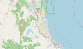
Currumbin is a coastal suburb in the City of Gold Coast, Queensland, Australia. In the 2016 census, Currumbin had a population of 2,920 people.

<span class="mw-page-title-main">Cornubia, Queensland</span> Suburb of Logan City, Queensland, Australia

Cornubia is a suburb in the City of Logan, Queensland, Australia. In the 2016 census, Cornubia had a population of 7,317 people.

<span class="mw-page-title-main">Helensvale, Queensland</span> Suburb of Gold Coast, Queensland, Australia

Helensvale is a suburb of the City of Gold Coast in Queensland, Australia. In the 2016 census, Helensvale had a population of 16,862 people.

<span class="mw-page-title-main">Ashmore, Queensland</span> Suburb of Gold Coast, Queensland, Australia

Ashmore is an inner city suburb in the City of Gold Coast, Queensland, Australia. In the 2016 census, Ashmore had a population of 11,910 people.

<span class="mw-page-title-main">Biggera Waters, Queensland</span> Suburb of Gold Coast, Queensland, Australia

Biggera Waters is a coastal suburb in the City of Gold Coast, Queensland, Australia. In the 2016 census, Biggera Waters had a population of 8,534 people.

<span class="mw-page-title-main">Hope Island, Queensland</span> Suburb of Gold Coast, Queensland, Australia

Hope Island is a suburb in the City of Gold Coast, Queensland, Australia. In the 2016 census, Hope Island had a population of 11,186 people.

<span class="mw-page-title-main">Molendinar, Queensland</span> Suburb of Gold Coast, Queensland, Australia

Molendinar is a mixed-use suburb in the City of Gold Coast, Queensland, Australia. In the 2016 census, Molendinar had a population of 6,375 people.

<span class="mw-page-title-main">Ormeau, Queensland</span> Suburb of Gold Coast, Queensland, Australia

Ormeau is a hinterland town and suburb in the City of Gold Coast, Queensland, Australia. In the 2016 census, the suburb of Ormeau had a population of 14,460 people.

<span class="mw-page-title-main">Twin Waters, Queensland</span> Suburb of Maroochydore, Queensland, Australia

Twin Waters is a coastal suburb of Maroochydore in the Sunshine Coast Region, Queensland, Australia. In the 2016 census, Twin Waters had a population of 2,687 people.

<span class="mw-page-title-main">Parkwood, Queensland</span> Suburb of Gold Coast, Queensland, Australia

Parkwood is a suburb in the City of Gold Coast, Queensland, Australia. In the 2016 census, Parkwood had a population of 8,702 people.

Pimpama is a northern suburb in the City of Gold Coast, Queensland, Australia. In the 2016 census, Pimpama had a population of 9,396 people. The name is of Aboriginal origin. The suburb contains numerous schools with the first opening in the 1870s.

Runaway Bay is a coastal suburb in the City of Gold Coast, Queensland, Australia. In the 2016 census, Runaway Bay had a population of 9,068 people.

<span class="mw-page-title-main">Arundel, Queensland</span> Suburb of Gold Coast, Queensland, Australia

Arundel is a suburb in the City of Gold Coast, Queensland, Australia. In the 2016 census, Arundel had a population of 10,246 people.

The Coombabah Lake Conservation Park is a conservation park that is an Important Wetland in Australia, located in the Gold Coast region of South East Queensland, Australia. Part of the Coomera River catchment, Lake Coombabah is a tidal lake at the mouth of Coombabah Creek. The Coombabah wetlands are significant because they are the most southerly lake and coastal swampland representatives in the bioregion, and because the area provides significant wildlife value and refuge habitat. The conservation area includes tidal marshlands and mangroves along part of the lakes edge. The Melaleuca boardwalk allows viewing of the wildlife. The mangroves are home to frogs, crabs and fish that attract native and migratory birds. There are guided bushwalking and canoeing activities as part of community conservation and environmental workshops to promote local conservation.

<span class="mw-page-title-main">Paradise Point, Queensland</span> Suburb of Gold Coast, Queensland, Australia

Paradise Point is a coastal suburb in the City of Gold Coast, Queensland, Australia. In the 2016 census, Paradise Point had a population of 6,536 people.

<span class="mw-page-title-main">Pacific Pines, Queensland</span> Suburb of Gold Coast, Queensland, Australia

Pacific Pines is a northern suburb in the City of Gold Coast, Queensland, Australia. In the 2016 census, Pacific Pines had a population of 16,757 people.

<span class="mw-page-title-main">Maudsland, Queensland</span> Suburb of City of Gold Coast, Queensland, Australia

Maudsland is a rural-residential locality in the north of the City of Gold Coast, Queensland, Australia. In the 2016 census, Maudsland had a population of 5,568 people.

Hollywell is a coastal suburb in the City of Gold Coast, Queensland, Australia. In the 2016 census, Hollywell had a population of 2,865 people.

<span class="mw-page-title-main">Neranwood, Queensland</span> Suburb of City of Gold Coast, Queensland, Australia

Neranwood is a suburb in the City of Gold Coast, Queensland, Australia. In the 2016 census Neranwood had a population of 67 people.

References

  1. 1 2 3 Australian Bureau of Statistics (27 June 2017). "Coombabah (SSC)". 2016 Census QuickStats. Retrieved 20 October 2018. OOjs UI icon edit-ltr-progressive.svg
  2. 1 2 "Coombabah – suburb in City of Gold Coast (entry 46041)". Queensland Place Names. Queensland Government . Retrieved 26 January 2020.
  3. "Coombabah Creek – watercourse in Gold Coast City (entry 8164)". Queensland Place Names. Queensland Government . Retrieved 5 March 2020.
  4. "Coombabah Lake – lake in Gold Coast City (entry 8165)". Queensland Place Names. Queensland Government . Retrieved 5 March 2020.
  5. 1 2 3 4 Queensland Family History Society (2010), Queensland schools past and present (Version 1.01 ed.), Queensland Family History Society, ISBN   978-1-921171-26-0
  6. 1 2 3 Australian Bureau of Statistics (31 October 2012). "Coombabah (State Suburb)". 2011 Census QuickStats. Retrieved 16 October 2011. OOjs UI icon edit-ltr-progressive.svg
  7. Skjonnemand, Ursula. "Coombabah's natural wonderland". ABC Radio 29 August 2008. Archived from the original on 7 December 2013. Retrieved 23 October 2013.
  8. "Coombabah Lakes Conservation Area". Gold Coast City Council – Gold Coast Parks. Archived from the original on 13 November 2013. Retrieved 23 October 2013.
  9. "Special Lecture tackles river health". Griffith University The Australian Rivers Institute. Archived from the original on 18 July 2013. Retrieved 23 October 2013.
  10. "Coombabah Catchment". City of Gold Coast. Archived from the original on 13 November 2013. Retrieved 23 October 2013.
  11. "trails at Coombabah Lakelands (PDF 1.10MB)". Gold Coast City Council – Gold Coast Parks. Archived from the original on 13 November 2013. Retrieved 23 October 2013.
  12. 1 2 3 4 "State and non-state school details". Queensland Government. 9 July 2018. Archived from the original on 21 November 2018. Retrieved 21 November 2018.
  13. "Coombabah State School". Archived from the original on 3 August 2019. Retrieved 21 November 2018.
  14. 1 2 "ACARA School Profile 2017". Archived from the original on 22 November 2018. Retrieved 22 November 2018.
  15. "Coombabah SS – Special Education Program". Archived from the original on 3 August 2019. Retrieved 21 November 2018.
  16. "Coombabah State High School". Archived from the original on 20 September 2020. Retrieved 21 November 2018.
  17. "Coombabah SHS – Special Education Program". Archived from the original on 20 September 2020. Retrieved 21 November 2018.

Sources