Tallai, Queensland

Last updated

Tallai
Gold Coast City,  Queensland
Gold Coast Hinterland - panoramio.jpg
Looking south from Grandview Road, Tallai, 2013
Gold Coast locator map.svg
Red pog.svg
Tallai
Tallai, Queensland
Coordinates 28°04′04″S153°19′49″E / 28.0677°S 153.3302°E / -28.0677; 153.3302 (Tallai (centre of suburb))
Population4,465 (2021 census) [1]
 • Density343.5/km2 (890/sq mi)
Postcode(s) 4213
Area13.0 km2 (5.0 sq mi)
Time zone AEST (UTC+10:00)
Location
LGA(s) City of Gold Coast
State electorate(s) Mudgeeraba
Federal division(s) Wright
Suburbs around Tallai:
Gilston Worongary Worongary
Advancetown Tallai Mudgeeraba
Advancetown Mudgeeraba Mudgeeraba

Tallai is a suburb in the City of Gold Coast, Queensland, Australia. [2] In the 2021 census, Tallai had a population of 4,465 people. [1]

Contents

Geography

Tallai is situated in the Gold Coast hinterland. [3]

Demographics

In the 2011 census, the population of Tallai was 3,765 people, 51.8% female and 48.2% male. The median age of the Tallai population was 43 years, 6 years above the national median of 37. 65.8% of people living in Tallai were born in Australia. The other top responses for country of birth were England 8.3%, New Zealand 7.2%, South Africa 2.1%, Scotland 1.1%, Germany 0.7%. 86.9% of people spoke only English at home; the next most common languages were 1% German, 0.8% Italian, 0.6% French, 0.6% Japanese, 0.5% Spanish. [4]

In the 2016 census, Tallai had a population of 4,150 people. [5]

In the 2021 census, Tallai had a population of 4,465 people. [1]

Education

There are no schools in Tallai. The nearest government primary schools are Mudgeeraba State School in neighbouring Mudgeeraba to the east, Mudgeeraba Creek State School in neighbouring Mudgeeraba to the south, and Gilston State School in neighbouring Gilston to the north-west. The nearest government secondary schools are Robina State High School in Robina to the east and Nerang State High School in Nerang to the north. [3]

Amenities

Tallai Country Golf Club has a 9-hole golf course at 22 The Panorama ( 28°03′26″S153°19′43″E / 28.0571°S 153.3285°E / -28.0571; 153.3285 (Tallai Country Golf Club) ). [6] [7]

Mudgeeraba Lodge is an aged care facility at 21-25 Old Coach Road ( 28°04′22″S153°21′09″E / 28.0727°S 153.3525°E / -28.0727; 153.3525 (Mudgeeraba Lodge) ). [6] [8]

Parks

There are a number of parks in the area:

Related Research Articles

<span class="mw-page-title-main">Mudgeeraba, Queensland</span> Town in Queensland, Australia

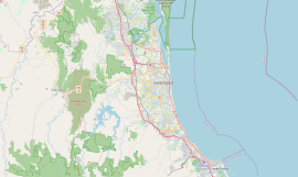
Mudgeeraba is a town and suburb in the City of Gold Coast, Queensland, Australia. In the 2021 census, the suburb of Mudgeeraba had a population of 14,578 people. Mudgeeraba's essential character remains one of a nineteenth-century village.

Miami is a coastal suburb in the City of Gold Coast, Queensland, Australia. In the 2021 census, Miami had a population of 7,445 people.

<span class="mw-page-title-main">Carrara, Queensland</span> Suburb of Gold Coast, Queensland, Australia

Carrara is a suburb in the City of Gold Coast, Queensland, Australia. In the 2021 census, Carrara had a population of 13,138 people.

Benowa is a suburb in the City of Gold Coast, Queensland, Australia. In the 2021 census, Benowa had a population of 9,889 people.

<span class="mw-page-title-main">Diddillibah, Queensland</span> Suburb of Sunshine Coast Region, Queensland, Australia

Diddillibah is a semi-rural locality in the Sunshine Coast Region, Queensland, Australia. In the 2021 census, Diddillibah had a population of 1,703 people.

<span class="mw-page-title-main">Twin Waters, Queensland</span> Suburb of Maroochydore, Queensland, Australia

Twin Waters is a coastal suburb of Maroochydore in the Sunshine Coast Region, Queensland, Australia. In the 2021 census, Twin Waters had a population of 2,966 people.

Kunda Park is an industrial suburb of Buderim in the Sunshine Coast Region, Queensland, Australia. In the 2021 census, Kunda Park had a population of 22 people.

<span class="mw-page-title-main">Yaroomba, Queensland</span> Suburb of Sunshine Coast, Queensland, Australia

Yaroomba is a coastal suburb in the Sunshine Coast Region, Queensland, Australia. In the 2021 census, Yaroomba had a population of 2,043 people.

<span class="mw-page-title-main">Parkwood, Queensland</span> Suburb of Gold Coast, Queensland, Australia

Parkwood is a suburb in the City of Gold Coast, Queensland, Australia. In the 2021 census, Parkwood had a population of 8,837 people.

Kiels Mountain is a rural locality in the Sunshine Coast Region, Queensland, Australia. In the 2021 census, Kiels Mountain had a population of 714 people.

<span class="mw-page-title-main">Numinbah Valley</span> Suburb of Gold Coast, Queensland, Australia

Numinbah Valley is a rural locality in the City of Gold Coast, Queensland, Australia. In the 2021 census, Numinbah Valley had a population of 212 people.

<span class="mw-page-title-main">Beechmont, Queensland</span> Town in Queensland, Australia

Beechmont is a rural town and locality in the Scenic Rim Region, Queensland, Australia. In the 2016 census, the locality of Beechmont had a population of 842 people.

<span class="mw-page-title-main">Clagiraba, Queensland</span> Suburb of Gold Coast, Queensland, Australia

Clagiraba is a rural locality in the City of Gold Coast, Queensland, Australia. In the 2021 census, Clagiraba had a population of 651 people.

<span class="mw-page-title-main">Springbrook, Queensland</span> Town in Queensland, Australia

Springbrook is a rural town and locality in the City of Gold Coast, Queensland, Australia. The locality borders New South Wales.

<span class="mw-page-title-main">Advancetown, Queensland</span> Suburb of City of Gold Coast, Queensland, Australia

Advancetown is a rural outer locality in the City of Gold Coast, Queensland, Australia. In the 2021 census, Advancetown had a population of 528 people.

<span class="mw-page-title-main">Gilston, Queensland</span> Suburb of City of Gold Coast, Queensland, Australia

Gilston is a rural residential locality in the City of Gold Coast, Queensland, Australia. In the 2021 census, Gilston had a population of 2,669 people.

Meldale is a coastal rural locality in the City of Moreton Bay, Queensland, Australia. In the 2021 census, Meldale had a population of 230 people.

<span class="mw-page-title-main">Steiglitz, Queensland</span> Town in Queensland, Australia

Steiglitz is a rural coastal town and locality in the City of Gold Coast, Queensland, Australia. In the 2021 census, Steiglitz had a population of 682 people.

<span class="mw-page-title-main">Neranwood, Queensland</span> Suburb of City of Gold Coast, Queensland, Australia

Neranwood is a suburb in the City of Gold Coast, Queensland, Australia. In the 2021 census, Neranwood had a population of 79 people.

<span class="mw-page-title-main">Worongary</span> Suburb of Gold Coast City, Queensland, Australia

Worongary is a suburb in the City of Gold Coast, Queensland, Australia. In the 2021 census, Worongary had a population of 6,021 people.

References

  1. 1 2 3 Australian Bureau of Statistics (28 June 2022). "Tallai (SAL)". 2021 Census QuickStats. Retrieved 28 February 2023. OOjs UI icon edit-ltr-progressive.svg
  2. "Tallai – suburb in City of Gold Coast (entry 46089)". Queensland Place Names. Queensland Government . Retrieved 13 February 2022.
  3. 1 2 "Queensland Globe". State of Queensland . Retrieved 3 March 2022.
  4. Australian Bureau of Statistics (31 October 2012). "Tallai (State Suburb)". 2011 Census QuickStats. Retrieved 6 February 2018. OOjs UI icon edit-ltr-progressive.svg
  5. Australian Bureau of Statistics (27 June 2017). "Tallai (SSC)". 2016 Census QuickStats. Retrieved 20 October 2018. OOjs UI icon edit-ltr-progressive.svg
  6. 1 2 "Building points - Queensland". Queensland Open Data. Queensland Government. 17 November 2020. Archived from the original on 25 November 2020. Retrieved 25 November 2020.
  7. "Tallai Country Golf Club". Tallai Country Golf Club. Archived from the original on 11 May 2021. Retrieved 3 March 2022.
  8. "Mudgeeraba". Estia Health. 14 December 2021. Archived from the original on 3 March 2022. Retrieved 3 March 2022.
  9. 1 2 3 4 5 6 7 8 9 10 11 12 13 14 15 16 17 18 "Land for public recreation - Queensland". Queensland Open Data. Queensland Government. 20 November 2020. Archived from the original on 22 November 2020. Retrieved 22 November 2020.