Worongary

Last updated

Map all coordinates using: OpenStreetMap
Worongary
Gold Coast City,  Queensland
Image 2023 03 30T08 12 50 626Z (1).png
Worongary Creek
Gold Coast locator map.svg
Red pog.svg
Worongary
Coordinates 28°02′30″S153°20′16″E / 28.0416°S 153.3377°E / -28.0416; 153.3377 (Worongary (centre of suburb))
Population5,613 (2016 census) [1]
 • Density398.1/km2 (1,031/sq mi)
Postcode(s) 4213
Area14.1 km2 (5.4 sq mi)
Time zone AEST (UTC+10:00)
Location
LGA(s) City of Gold Coast
State electorate(s) Mudgeeraba
Federal division(s) Wright
Suburbs around Worongary:
Gilston Highland Park Carrara
Gilston Worongary Merrimac
Tallai Tallai Mudgeeraba

Worongary is a suburb in the City of Gold Coast, Queensland, Australia. [2] In the 2016 census, Worongary had a population of 5,613 people. [1]

Contents

Geography

Most of the eastern boundary of Worongary follows the Pacific Motorway. [3]

There is a large area of production forestry in the north-west of the suburb. The north-eastern part of the suburb is predominantly residential at suburb densities. The middle and south of the suburb is mostly rural residential with larger blocks of land, typically 4,000 to 5,000 square metres (0.99 to 1.24 acres). [3]

History

The name Worongary is derived from an Aboriginal word Whorrongary, meaning vine or flight of a pigeon. [4]

The Worongary State School opened on 1 February 1993. [5]

Hinterland Baptist Church was established in 1995. [6] Its timber church building was relocated from another site. [7]

In the 2016 census, Worongary had a population of 5,613 people. [1]

Heritage listings

Schmidt Farmhouse, 2016 Schmidt Farmhouse 2, Worongary, Queensland.jpg
Schmidt Farmhouse, 2016

Worongary has a number of heritage-listed sites, including:

Education

Sports field, Worongary State School, circa 2022 School grounds, Worongary State School, circa 2022 01.jpg
Sports field, Worongary State School, circa 2022

Worongary State School is a government primary (Prep-6) school for boys and girls at Delta Cove Drive ( 28°01′22″S153°20′31″E / 28.0227°S 153.3419°E / -28.0227; 153.3419 (Worongary State School) ). [10] [11] In 2018, the school had an enrolment of 699 students with 49 teachers (43 full-time equivalent) and 29 non-teaching staff (18 full-time equivalent). [12] It includes a special education program. [10]

There are no secondary schools in Worongary. The nearest government secondary schools are Nerang State High School in Nerang to the north and Robina State High School in Robina to the south-east. [3]

Amenities

Despite the name, Mudgeeraba Showgrounds are at 115 Mudgeeraba Road in Worongary ( 28°03′38″S153°21′17″E / 28.0606°S 153.3547°E / -28.0606; 153.3547 (Mudgeeraba Showgrounds) ). [13]

The Springbrook Mudgeeraba branch of the Queensland Country Women's Association meets at the Bill Deacon Pavilion at the Mudgeeraba Showgrounds. [14]

Hinterland Baptist Church is at 405 Hinkler Drive ( 28°02′22″S153°21′08″E / 28.0395°S 153.3521°E / -28.0395; 153.3521 (Hinterland Baptist Church) ). [15]

The Church of Jesus Christ of Latter Day Saints is at 74 Mudgeeraba Road ( 28°03′26″S153°21′25″E / 28.0572°S 153.35689°E / -28.0572; 153.35689 (Church of Jesus Christ of Latter Day Saints) ). [16]

Parks

There are a number of parks in the area:

Events

The Mudgeeraba Show Society runs an annual agricultural show known as the Mudgeeraba Show at the Showgrounds. It is held in June. [18]

Attractions

Gold Coast Light Horse Education Museum is at 8 Worongary Road ( 28°03′42″S153°21′15″E / 28.0616°S 153.3542°E / -28.0616; 153.3542 (Gold Coast Light Horse Education Museum) ) beside the Mudgeeraba Showgrounds. The museum has information about the Australian Light Horse who served in the Second Boer War and World War I. It also has information on national service in Australia. [19]

Related Research Articles

<span class="mw-page-title-main">Burleigh Heads, Queensland</span> Suburb of Gold Coast, Queensland, Australia

Burleigh Heads is a suburb in the City of Gold Coast, Queensland, Australia. In the 2016 census, Burleigh Heads had a population of 10,077 people.

<span class="mw-page-title-main">Mudgeeraba, Queensland</span> Town in Queensland, Australia

Mudgeeraba is a town and suburb in the City of Gold Coast, Queensland, Australia. In the 2021 census, the suburb of Mudgeeraba had a population of 14,578 people. Mudgeeraba's essential character remains one of a nineteenth-century village.

<span class="mw-page-title-main">Nerang, Queensland</span> Suburb of Gold Coast, Queensland, Australia

Nerang is a town and suburb in the City of Gold Coast, Queensland, Australia. In the 2016 census, Nerang had a population of 16,864 people.

<span class="mw-page-title-main">Southport, Queensland</span> Suburb of Gold Coast, Queensland, Australia

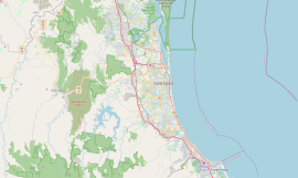
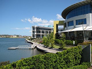
Southport is a coastal town and suburb in the City of Gold Coast in Queensland, Australia. It contains the Gold Coast central business district. In the 2021 census, Southport had a population of 36,786 people.

<span class="mw-page-title-main">Broadbeach Waters, Queensland</span> Suburb of Gold Coast, Queensland, Australia

Broadbeach Waters is a suburb in the City of Gold Coast, Queensland, Australia. In the 2021 census, Broadbeach Waters had a population of 8,164 people.

<span class="mw-page-title-main">Carrara, Queensland</span> Suburb of Gold Coast, Queensland, Australia

Carrara is a suburb in the City of Gold Coast, Queensland, Australia. In the 2016 census, Carrara had a population of 12,060 people.

Benowa is a suburb in the City of Gold Coast, Queensland, Australia. In the 2016 census, Benowa had a population of 8,741 people.

<span class="mw-page-title-main">Biggera Waters, Queensland</span> Suburb of Gold Coast, Queensland, Australia

Biggera Waters is a coastal suburb in the City of Gold Coast, Queensland, Australia. In the 2016 census, Biggera Waters had a population of 8,534 people.

<span class="mw-page-title-main">Tugun, Queensland</span> Suburb of Gold Coast, Queensland, Australia

Tugun is a beach-side coastal suburb in the City of Gold Coast, Queensland, Australia. In the 2016 census, Tugun had a population of 6,588 people.

<span class="mw-page-title-main">Varsity Lakes</span> Suburb of Gold Coast, Queensland, Australia

Varsity Lakes is a suburb in the City of Gold Coast, Queensland, Australia. In the 2021 census, Varsity Lakes had a population of 16,493 people.

Runaway Bay is a coastal suburb in the City of Gold Coast, Queensland, Australia. In the 2016 census, Runaway Bay had a population of 9,068 people.

<span class="mw-page-title-main">Reedy Creek, Queensland</span> Suburb of Gold Coast, Queensland, Australia

Reedy Creek is a suburb in the City of Gold Coast, Queensland, Australia. In the 2016 census, Reedy Creek had a population of 6,659 people.

<span class="mw-page-title-main">Yatala, Queensland</span> Suburb of Gold Coast City, Queensland, Australia

Yatala (is a suburb in the City of Gold Coast, Queensland, Australia. In the 2016 census, Yatala had a population of 1,312 people.

<span class="mw-page-title-main">Clagiraba, Queensland</span> Suburb of Gold Coast, Queensland, Australia

Clagiraba is a rural locality in the City of Gold Coast, Queensland, Australia. In the 2021 census, Clagiraba had a population of 651 people.

<span class="mw-page-title-main">Springbrook, Queensland</span> Town in Queensland, Australia

Springbrook is a rural town and locality in the City of Gold Coast, Queensland, Australia. In the 2016 census, the locality of Springbrook had a population of 659 people.

<span class="mw-page-title-main">Advancetown, Queensland</span> Suburb of Gold Coast, Queensland, Australia

Advancetown is a rural outer locality in the City of Gold Coast, Queensland, Australia. In the 2016 census, Advancetown had a population of 482 people.

<span class="mw-page-title-main">Gilston, Queensland</span> Suburb of City of Gold Coast, Queensland, Australia

Gilston is a rural residential locality in the City of Gold Coast, Queensland, Australia. In the 2016 census, Gilston had a population of 2,459 people.

<span class="mw-page-title-main">Tallai, Queensland</span> Suburb of Gold Coast City, Queensland, Australia

Tallai is a suburb in the City of Gold Coast, Queensland, Australia. In the 2016 census, Tallai had a population of 4,150 people.

<span class="mw-page-title-main">Willow Vale, Queensland</span> Suburb of Gold Coast City, Queensland, Australia

Willow Vale is a rural locality in the City of Gold Coast, Queensland, Australia. In the 2016 census, Willow Vale had a population of 2,096 people.

<span class="mw-page-title-main">Neranwood, Queensland</span> Suburb of City of Gold Coast, Queensland, Australia

Neranwood is a suburb in the City of Gold Coast, Queensland, Australia. In the 2016 census Neranwood had a population of 67 people.

References

  1. 1 2 3 Australian Bureau of Statistics (27 June 2017). "Worongary (SSC)". 2016 Census QuickStats. Retrieved 20 October 2018. OOjs UI icon edit-ltr-progressive.svg
  2. "Worongary – suburb in City of Gold Coast (entry 46097)". Queensland Place Names. Queensland Government . Retrieved 7 March 2022.
  3. 1 2 3 "Queensland Globe". State of Queensland . Retrieved 16 March 2022.
  4. "Worongary". Queensland Places. Centre for the Government of Queensland, University of Queensland. Retrieved 23 April 2019.
  5. "Opening and closing dates of Queensland Schools". Queensland Government . Retrieved 18 April 2014.
  6. "Hinterland Baptist Church". Facebook . Archived from the original on 16 March 2022. Retrieved 16 March 2022.
  7. Blake, Thom. "Hinterland Baptist Church". Queensland religious places database. Archived from the original on 16 March 2022. Retrieved 16 March 2022.
  8. "Schmidt Farmhouse & Outbuildings (former) (entry 601889)". Queensland Heritage Register . Queensland Heritage Council. Retrieved 16 November 2014.
  9. Gold Coast Local Heritage Register - N to Z, pp. 111-112
  10. 1 2 "State and non-state school details". Queensland Government. 9 July 2018. Archived from the original on 21 November 2018. Retrieved 21 November 2018.
  11. "Worongary State School". Worongary State School. 6 April 2020. Archived from the original on 25 October 2020. Retrieved 16 March 2022.
  12. "ACARA School Profile 2018". Australian Curriculum, Assessment and Reporting Authority. Archived from the original on 27 August 2020. Retrieved 28 January 2020.
  13. "Mudgeeraba Showgrounds". Gold Coast City Council . Archived from the original on 16 March 2022. Retrieved 16 March 2022.
  14. "Branch Locations". Queensland Country Women's Association. Archived from the original on 26 December 2018. Retrieved 26 December 2018.
  15. "Hinterland Baptist Church". Churches Australia. Archived from the original on 16 March 2022. Retrieved 16 March 2022.
  16. Blake, Thom. "Church of Jesus Christ of Latter Day Saints". Queensland religious places database. Archived from the original on 16 March 2022. Retrieved 16 March 2022.
  17. 1 2 3 4 5 6 7 8 9 10 11 12 13 14 15 16 17 18 19 20 21 22 23 24 25 26 27 28 29 "Land for public recreation - Queensland". Queensland Open Data. Queensland Government. 20 November 2020. Archived from the original on 22 November 2020. Retrieved 22 November 2020.
  18. "The Mudgeeraba Showgrounds". Mudgeeraba Show Society. Archived from the original on 12 March 2022. Retrieved 16 March 2022.
  19. "Gold Coast Light Horse Education Museum". Facebook . Archived from the original on 16 March 2022. Retrieved 16 March 2022.

Sources