Coomera, Queensland

Last updated

Coomera
Gold Coast,  Queensland
Coomera Railway Station, Queensland, July 2012.JPG
Coomera Railway Station
Gold Coast locator map.svg
Red pog.svg
Coomera
Coordinates 27°52′20″S153°18′53″E / 27.8722°S 153.3147°E / -27.8722; 153.3147 (Coomera (town centre))
Population13,305 (2016 census) [1]
 • Density540.9/km2 (1,400.8/sq mi)
Postcode(s) 4209
Area24.6 km2 (9.5 sq mi)
Time zone AEST (UTC+10:00)
Location
LGA(s) City of Gold Coast
State electorate(s)
Federal division(s) Fadden
Localities around Coomera:
Pimpama Pimpama Southern Moreton Bay Islands
Upper Coomera Coomera Hope Island
Oxenford Helensvale Hope Island

Coomera is a town and suburb in the City of Gold Coast, Queensland, Australia. [2] [3] In the 2016 census, Coomera had a population of 13,305 people. [1]

Contents

Geography

Located next to the Pacific Motorway, Coomera is close to Pimpama, Helensvale, Willow Vale, Oxenford, and Upper Coomera. The southern boundary of Coomera is aligned with the Coomera River. Coomera is situated slightly inland from the coast line and is also near the Gold Coast hinterland.

History

Yugembah (also known as Yugumbir, Jugambel, Jugambeir, Jugumbir, Jukam, Jukamba) is one of the Australian Aboriginal languages in areas that include the Beenleigh, Beaudesert, Gold Coast, Logan, Scenic Rim, Albert River, Coolangatta, Coomera, Logan River, Pimpama, Tamborine and Tweed River Valley, within the local government boundaries of the City of Gold Coast, City of Logan, Scenic Rim Regional Council and the Tweed River Valley. [4]

The town takes its name from the Coomera River, which in turn takes its name comes from the Yugambeh word kumera, a species of wattle. The bark of this tree was used by Aboriginal people to stupefy fish. [5] [1]

Coomera Provisional School opened on 11 July 1873. On 20 June 1874, it became Coomera State School. From 1877, it was known as Coomera Lower State School (sometimes Lower Coomera State School) until 1899 when it returned to the name Coomera State School. [6]

Coomera Wesleyan Methodist Church opened on Sunday 17 May 1874. [7] When the Methodist Church amalgamated into the Uniting Church in Australia in 1977, it became the Coomera Uniting Church. On 11 November 2017, the Uniting North Church decided to amalgamate with the Coomera Church creating the Uniting North Coomera Church. [8]

Coomera was briefly home to a theme park and wildlife park called Koala Town which closed in the early 1990s. The site is currently occupied by residential land on Koala Town Road.[ citation needed ]

Coomera Rivers State School opened on 1 January 2011; it was originally proposed to call it Coomera East State School. [9]

In the 2016 census, Coomera had a population of 13,305 people. [1]

Picnic Creek State School opened in 2018. [10]

Westfield Coomera opened on 11 October 2018. [11]

St Joseph's College was established in January 2019 by the Brisbane Catholic Education Office with 250 students enrolled in Years Prep-4 and Year 7. [12]

Foxwell State Secondary College opened in January 2020. [9]

Coomera State Special School opened in February 2020. [13] [14]

Saint stevens college or SSC opened in 1995.

Urban growth

Aerial view of Dreamworld, 2011 Dreamworld and WhiteWater World aerial July 2011.jpg
Aerial view of Dreamworld, 2011

Coomera has long been earmarked as a new satellite growth suburb, similar in many ways to Robina. With Australia's biggest theme park, Dreamworld and location of the Big Brother Australia house, and plans for a TAFE, a university campus and Queensland's biggest shopping centre around the existing station, Coomera has been predicted to grow considerably beyond its present size.

Coomera has seen significant residential development including Coomera Waters which is a masterplanned community encompassing a 2,500 lot harbour, canal and dry land estate over 375 hectares of land located on the northern side of the north arm of the Coomera River, directly opposite Sanctuary Cove on Hope Island.

Other residential developments currently under construction include Beacon Heights, Big Sky, Coomera Downs, Coomera Parklands Stage II, Coomera Waters, Genesis, Lily Rise and Nautical Edge. [15]

Current real estate developments under construction or in the pipeline for the Coomera district at the beginning of 2011 have increased year on year by $400 million to total $5.9 billion. [16]

Heritage listings

Coomera has a heritage site:

Population

According to the 2016 Census of Population, there were 13,305 people in Coomera

Education

Coomera State School is a government primary (Early Childhood-6) school for boys and girls at Dreamworld Parkway ( 27°52′07″S153°18′55″E / 27.8686°S 153.3152°E / -27.8686; 153.3152 (Coomera State School) ). [18] [19] In 2017, the school had an enrolment of 775 students with 65 teachers (58 full-time equivalent) and 31 non-teaching staff (22 full-time equivalent). [20] It includes a special education program. [21] The school has run the Australian Primary Schools Film Festival since 2001. [22]

Coomera Rivers State School is a government primary (Prep-6) school for boys and girls at 81-87 Finnegan Way ( 27°50′44″S153°19′39″E / 27.8455°S 153.3276°E / -27.8455; 153.3276 (Coomera Rivers State School) ). [18] [23] In 2017, the school had an enrolment of 1372 students with 86 teachers (82 full-time equivalent) and 48 non-teaching staff (33 full-time equivalent). [20] It includes a special education program. [18]

Picnic Creek State School is a government primary (Prep-6) school at 25 Edwardson Drive ( 27°50′24″S153°20′19″E / 27.8399°S 153.3387°E / -27.8399; 153.3387 (Picnic Creek State School) ). [18] [24] It includes a special education program. [18]

Coomera State Special School is a special government primary and secondary (P-12) school at 9 Galaxy Drive ( 27°50′55″S153°20′30″E / 27.8485°S 153.3416°E / -27.8485; 153.3416 (Coomera State Special School) ). It opened in February 2020. [13] [14]

St Joseph's College is a Catholic primary and secondary school (Prep to Year 12). [25]

Foxwell State Secondary College is a government secondary school, which opened in 2020. [26]

Amenities

The Gold Coast City Council operates a fortnightly mobile library service which visits Ragamuffin Drive near Sandy Bay. [27]

The Coomera branch of the Queensland Country Women's Association meets at the 161 Maudsland Road in Oxenford. [28]

Uniting North Coomera Church is at 6-8 Esplanade ( 27°52′32″S153°18′58″E / 27.8756°S 153.3162°E / -27.8756; 153.3162 (Uniting North Coomera Church) ). [29] [30]

Coomera station runs through the town and there are many bus stations and private operators for schools or clubs

Sport and recreation

A number of well-known sporting teams represent the local area, including the Coomera Cutters is the local rugby league club who play home games at Coomera Sports Park and the Coomera Colts Soccer Club and Coomera Magpies Australian Football Club.

The Coomera Sport and Leisure Centre, one of the Venues of the 2018 Commonwealth Games.

Climate

Coomera has a humid subtropical climate (Cfa) with hot, humid summers and mild to cool dry winters. Due to its inland location, it is slightly cooler than the coastal area of Gold Coast.

Climate data for Logan City (23 km north)
MonthJanFebMarAprMayJunJulAugSepOctNovDecYear
Record high °C (°F)41.9
(107.4)
41.0
(105.8)
38.9
(102.0)
33.4
(92.1)
31.1
(88.0)
29.3
(84.7)
29.3
(84.7)
34.3
(93.7)
38.4
(101.1)
37.7
(99.9)
40.7
(105.3)
40.1
(104.2)
41.9
(107.4)
Mean daily maximum °C (°F)29.9
(85.8)
29.5
(85.1)
28.5
(83.3)
26.4
(79.5)
24.1
(75.4)
21.6
(70.9)
21.5
(70.7)
22.8
(73.0)
25.1
(77.2)
26.5
(79.7)
27.9
(82.2)
29.1
(84.4)
26.1
(79.0)
Mean daily minimum °C (°F)20.6
(69.1)
20.5
(68.9)
19.2
(66.6)
16.1
(61.0)
12.6
(54.7)
10.2
(50.4)
8.8
(47.8)
9.4
(48.9)
12.5
(54.5)
15.0
(59.0)
17.4
(63.3)
19.3
(66.7)
15.1
(59.2)
Record low °C (°F)13.4
(56.1)
15.0
(59.0)
12.4
(54.3)
7.8
(46.0)
2.5
(36.5)
2.0
(35.6)
−0.5
(31.1)
0.8
(33.4)
4.4
(39.9)
7.8
(46.0)
8.5
(47.3)
11.8
(53.2)
−0.5
(31.1)
Average precipitation mm (inches)126.4
(4.98)
153.1
(6.03)
134.3
(5.29)
80.2
(3.16)
99.3
(3.91)
74.8
(2.94)
34.0
(1.34)
44.8
(1.76)
40.1
(1.58)
69.3
(2.73)
102.3
(4.03)
122.1
(4.81)
1,086.5
(42.78)
Average precipitation days13.114.515.211.910.79.68.27.38.29.211.812.0131.7
Average relative humidity (%)64656361595753525257616159
Source: [31]

Related Research Articles

<span class="mw-page-title-main">Coolangatta</span> Suburb of Gold Coast, Queensland, Australia

Coolangatta is a coastal suburb in the City of Gold Coast, Queensland, Australia. It is the Gold Coast's southernmost suburb and it borders New South Wales. In the 2016 census, Coolangatta had a population of 5,948 people.

<span class="mw-page-title-main">Beenleigh, Queensland</span> Suburb of City of Logan, Queensland, Australia

Beenleigh is a town and suburb in the City of Logan, Queensland, Australia. In the 2016 census, the suburb of Beenleigh had a population of 8,252 people.

<span class="mw-page-title-main">Southport, Queensland</span> Suburb of Gold Coast, Queensland, Australia

Southport is a coastal town and suburb in the City of Gold Coast in Queensland, Australia. It contains the Gold Coast central business district. In the 2021 census, Southport had a population of 36,786 people.

<span class="mw-page-title-main">Coomera railway station</span> Railway station on the Gold Coast railway line

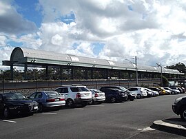
Coomera railway station is located on the Gold Coast line in Queensland, Australia. It serves the Gold Coast suburb of Coomera.

<span class="mw-page-title-main">City of Gold Coast</span> Local government area in Queensland, Australia

The City of Gold Coast is the local government area spanning the Gold Coast, Queensland, Australia and surrounding areas. With a population of 606,774, it is the second most populous local government area in the State of Queensland. Its council maintains a staff of over 2,500. It was established in 1948, but has existed in its present form since 2008. It is on the border with New South Wales with the Tweed Shire to the south in New South Wales.

<span class="mw-page-title-main">Helensvale, Queensland</span> Suburb of Gold Coast, Queensland, Australia

Helensvale is a suburb of the City of Gold Coast in Queensland, Australia. In the 2016 census, Helensvale had a population of 16,862 people.

<span class="mw-page-title-main">Ashmore, Queensland</span> Suburb of Gold Coast, Queensland, Australia

Ashmore is a suburb of the City of Gold Coast, Queensland, Australia. In the 2016 census, Ashmore had a population of 11,910 people.

<span class="mw-page-title-main">Coomera River</span> River in Queensland, Australia

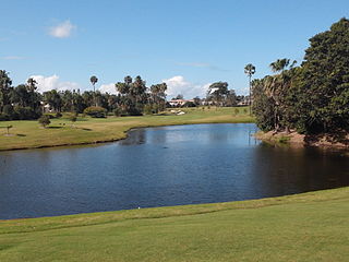
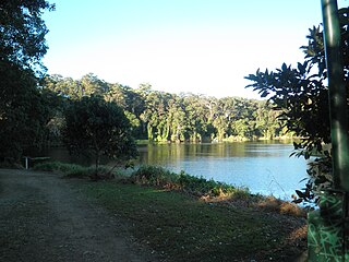
The Coomera River is a perennial river in the South East region of Queensland, Australia. Its catchment lies within the Gold Coast and Scenic Rim Region local government areas and covers an area of 489 square kilometres (189 sq mi).

<span class="mw-page-title-main">Hope Island, Queensland</span> Suburb of Gold Coast, Queensland, Australia

Hope Island is a suburb in the City of Gold Coast, Queensland, Australia. In the 2016 census, Hope Island had a population of 11,186 people.

<span class="mw-page-title-main">Oxenford, Queensland</span> Suburb of Gold Coast, Queensland, Australia

Oxenford is a suburb in the City of Gold Coast, Queensland, Australia. In the 2016 census, Oxenford had a population of 11,842 people.

<span class="mw-page-title-main">Ormeau, Queensland</span> Suburb of Gold Coast, Queensland, Australia

Ormeau is a hinterland town and suburb in the City of Gold Coast, Queensland, Australia. In the 2016 census, the suburb of Ormeau had a population of 14,460 people.

<span class="mw-page-title-main">Upper Coomera, Queensland</span> Suburb of Gold Coast, Queensland, Australia

Upper Coomera is a suburb in the City of Gold Coast, Queensland, Australia. In the 2021 census, Upper Coomera had a population of 27,180 people.

<span class="mw-page-title-main">Elanora, Queensland</span> Suburb of Gold Coast, Queensland, Australia

Elanora is a suburb of the City of Gold Coast in Queensland, Australia. In the 2016 census, Elanora had a population of 12,145 people.

Pimpama is a northern suburb in the City of Gold Coast, Queensland, Australia. At the 2021 census, Pimpama had a population of 24,601. The name is of Aboriginal origin. The suburb contains numerous schools with the first opening in the 1870s.

<span class="mw-page-title-main">Pacific Pines, Queensland</span> Suburb of Gold Coast, Queensland, Australia

Pacific Pines is a northern suburb in the City of Gold Coast, Queensland, Australia. In the 2016 census, Pacific Pines had a population of 16,757 people.

<span class="mw-page-title-main">Jacobs Well, Queensland</span> Suburb of Gold Coast, Queensland, Australia

Jacobs Well is a coastal suburb in the City of Gold Coast, Queensland, Australia. In the 2016 census, Jacobs Well had a population of 1,839 people.

<span class="mw-page-title-main">Willow Vale, Queensland</span> Suburb of Gold Coast City, Queensland, Australia

Willow Vale is a rural locality in the City of Gold Coast, Queensland, Australia. In the 2016 census, Willow Vale had a population of 2,096 people.

<span class="mw-page-title-main">Norwell, Queensland</span> Suburb of Gold Coast, Queensland, Australia

Norwell is a rural locality in the City of Gold Coast, Queensland, Australia. In the 2021 census, Norwell had a population of 189 people.

<span class="mw-page-title-main">Woongoolba, Queensland</span> Suburb of Gold Coast, Queensland, Australia

Woongoolba is a coastal rural locality in the northern part of City of Gold Coast, Queensland, Australia. In the 2016 census, Woongoolba had a population of 280 people.

<span class="mw-page-title-main">Gilberton, Queensland (Gold Coast)</span> Suburb of City of Gold Coast, Queensland, Australia

Gilberton is a rural locality in the City of Gold Coast, Queensland, Australia. In the 2021 census, Gilberton had a population of 31 people.

References

  1. 1 2 3 4 5 Australian Bureau of Statistics (27 June 2017). "Coomera (SSC)". 2016 Census QuickStats. Retrieved 20 October 2018. OOjs UI icon edit-ltr-progressive.svg
  2. "Coomera – town in City of Gold Coast (entry 8178)". Queensland Place Names. Queensland Government . Retrieved 26 January 2020.
  3. "Coomera – suburb in City of Gold Coast (entry 46042)". Queensland Place Names. Queensland Government . Retrieved 26 January 2020.
  4. CC BY icon-80x15.png This Wikipedia article incorporates CC-BY-4.0 licensed text from: "Yugembah". Queensland Aboriginal and Torres Strait Islander languages map. State Library of Queensland . Retrieved 28 January 2020.
  5. "Indigenous Language Resources: South-East Qld Placenames" (PDF). State Library of Queensland. Archived from the original (PDF) on 6 August 2016. Retrieved 7 July 2016.
  6. Queensland Family History Society (2010), Queensland schools past and present (Version 1.01 ed.), Queensland Family History Society, ISBN   978-1-921171-26-0
  7. "Pimpama". The Queenslander . Vol. IX, no. 18. Queensland, Australia. 6 June 1874. p. 10. Archived from the original on 12 September 2021. Retrieved 12 September 2021 via National Library of Australia.
  8. "Who We Are". Uniting North Coomera Church. Archived from the original on 12 September 2021. Retrieved 12 September 2021.
  9. 1 2 "Opening and closing dates of Queensland Schools". Queensland Government . Retrieved 5 March 2020.
  10. "Four new state schools to open their doors in 2018". Government of Queensland. 22 January 2018. Archived from the original on 22 January 2018. Retrieved 22 January 2018.
  11. "Westfield Coomera opens to spectacular Gold Coast crowds – Shopping Centre News". 11 October 2018. Archived from the original on 26 November 2020. Retrieved 26 November 2020.
  12. "Opening Mass". St Joseph's College, Coomera. Archived from the original on 5 March 2020. Retrieved 5 March 2020.
  13. 1 2 "Our school". Coomera State Special School. 18 May 2021. Archived from the original on 7 March 2022. Retrieved 16 March 2022.
  14. 1 2 "New state special school for Coomera". Department of Education. 24 March 2021. Archived from the original on 4 March 2022. Retrieved 16 March 2022.
  15. Current Coomera and Upper Coomera Developments Archived 11 January 2011 at the Wayback Machine
  16. "Coomera Real Estate Developments Under Construction and in the Pipeline February 2011". 16 February 2011. Archived from the original on 21 February 2011. Retrieved 26 February 2011.
  17. "Coomera River Bridge (1930)" (PDF). Gold Coast Local Heritage Register . 5 June 2018. Archived (PDF) from the original on 27 August 2020. Retrieved 27 August 2020.
  18. 1 2 3 4 5 "State and non-state school details". Queensland Government. 9 July 2018. Archived from the original on 21 November 2018. Retrieved 21 November 2018.
  19. "Coomera State School". Archived from the original on 4 August 2012. Retrieved 21 November 2018.
  20. 1 2 "ACARA School Profile 2017". Archived from the original on 22 November 2018. Retrieved 22 November 2018.
  21. "Coomera SS - Special Education Program". Archived from the original on 4 August 2012. Retrieved 21 November 2018.
  22. "Coomera State School". Department of Education, Training and the Arts. Archived from the original on 13 August 2011. Retrieved 16 July 2011.
  23. "Coomera Rivers State School". Archived from the original on 23 January 2019. Retrieved 21 November 2018.
  24. "Picnic Creek State School". Archived from the original on 26 November 2020. Retrieved 21 November 2018.
  25. "New Schools". Brisbane Catholic Education . Archived from the original on 4 December 2019. Retrieved 4 December 2019.
  26. "Foxwell State Secondary College officially opened". Archived from the original on 10 December 2020. Retrieved 29 November 2020.
  27. "Mobile Library 2018 timetable" (PDF). Gold Coast City Council . Archived from the original (PDF) on 30 January 2018. Retrieved 30 January 2018.
  28. "Branch Locations". Queensland Country Women's Association. Archived from the original on 26 December 2018. Retrieved 26 December 2018.
  29. "Find a Church". Uniting Church in Australia, Queensland Synod. Archived from the original on 24 October 2020. Retrieved 22 November 2020.
  30. "Uniting North". Uniting North. Archived from the original on 12 September 2021. Retrieved 12 September 2021.
  31. "Climate statistics for Logan City Water Treatment Plant". Bureau of Meteorology. Archived from the original on 30 July 2019. Retrieved 30 July 2019.

Further reading