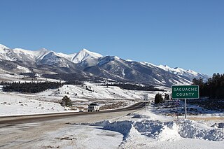
Saguache County is a county located in the U.S. state of Colorado. As of the 2020 census, the population was 6,368. The county seat is Saguache.

Gunnison County is a county located in the U.S. state of Colorado. As of the 2020 census, the population was 16,918. The county seat is Gunnison. The county was named for John W. Gunnison, a United States Army officer and captain in the Army Topographical Engineers, who surveyed for the transcontinental railroad in 1853.
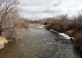
The Uncompahgre River is a tributary of the Gunnison River, approximately 75 mi (121 km) long, in southwestern Colorado in the United States. Lake Como at 12,215 ft (3723m) in northern San Juan County, in the Uncompahgre National Forest in the northwestern San Juan Mountains is the headwaters of the river. It flows northwest past Ouray, Ridgway, Montrose, and Olathe and joins the Gunnison at Confluence Park in Delta.
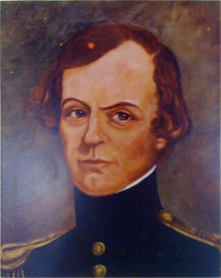
John Williams Gunnison was an American military officer and explorer.

Ferdinand Vandeveer Hayden was an American geologist noted for his pioneering surveying expeditions of the Rocky Mountains in the late 19th century. He was also a physician who served with the Union Army during the Civil War.

Uncompahgre Peak is the sixth highest summit of the Rocky Mountains of North America and the U.S. state of Colorado. The prominent 14,321-foot (4365.0 m) fourteener is the highest summit of the San Juan Mountains and the highest point in the drainage basin of the Colorado River and the Gulf of California. It is located in the Uncompahgre Wilderness in the northern San Juans, in northern Hinsdale County approximately 7 miles (11 km) west of the town of Lake City.
The Powderhorn Wilderness is a 62,050-acre (251.1 km2) wilderness area in Hinsdale and Gunnison counties, Colorado, United States, located 5 miles (8.0 km) northeast of Lake City.

The Uncompahgre Plateau in western Colorado is a distinctive large uplift part of the Colorado Plateau. Uncompahgre is a Ute word that describes the water: "Dirty Water" or "Rocks that make Water Red".

Unaweep Canyon is a geologically unique canyon that cuts across the Uncompahgre Plateau, Mesa County, in western Colorado. It is unique because two creeks, East Creek and West Creek, flow out of opposite ends of the canyon, separated by the almost imperceptible Unaweep Divide. State Highway 141 runs inside Unaweep Canyon between Whitewater and Gateway, one segment of the Colorado-designated Unaweep/Tabeguache Scenic Byway. The Unaweep Divide, elevation 7,048 ft (2,148 m), is near mile marker 135 on SH 141.

The Ute Mountain Ute Tribe is one of three federally recognized tribes of the Ute Nation, and are mostly descendants of the historic Weeminuche Band who moved to the Southern Ute reservation in 1897. Their reservation is headquartered at Towaoc, Colorado on the Ute Mountain Ute Indian Reservation in southwestern Colorado, northwestern New Mexico and small sections of Utah.

Spring Creek Pass, elevation 10,898 ft (3,322 m), is a mountain pass on the Continental Divide in the San Juan Mountains of Colorado. The pass is traversed by State Highway 149, and the Continental Divide Trail and Colorado Trail follow the divide and cross the highway here. Somewhat unusually for a pass on the Continental Divide, it is not the highest point on the highway in the vicinity; heading north from the pass, the road climbs over the considerably higher Slumgullion Summit before descending toward Lake City.
Sapinero is an unincorporated community located on U.S. Route 50, along the shore of Blue Mesa Reservoir in the Curecanti National Recreation Area in Gunnison County, Colorado, United States.

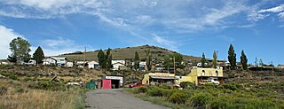
Cathedral is a census-designated place (CDP) located in and governed by Hinsdale County, Colorado, United States. The population of the Cathedral CDP was 15 at the United States Census 2020. The Powderhorn post office serves the area.

Ohio Pass is a mountain pass in Gunnison County, Colorado, located one mile southeast of Kebler Pass. Gunnison County Road 730 traverses the pass, which is a gap between Mount Axtell and Ohio Peak in the Anthracite Range, part of the West Elk Mountains. The pass divides the waters of Ruby Anthracite Creek to the north and Ohio Creek to the south.

Treasure Mountain, elevation 13,535 ft (4,125 m), is a summit in the Elk Mountains of western Colorado. The mountain is in the Raggeds Wilderness southeast of Marble. The massif has been the site of marble mining and a legend of lost French gold.

Whetstone Mountain, elevation 12,527 ft (3,818 m), is a summit in the Gunnison National Forest of western Colorado. The mountain is located 3 mi (4.8 km) south of Crested Butte in Gunnison County. Whetstone Mountain is one of several prominent laccoliths found in the West Elk Mountains.
Iola is an extinct town located in Gunnison County, Colorado, United States. The community was inundated and destroyed by the creation of Blue Mesa Reservoir.
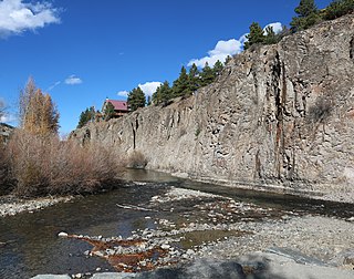
Henson Creek is a stream in Hinsdale County, Colorado, United States. It rises near Sunshine Mountain in the San Juan Mountains. It merges with Lake Fork Gunnison River in the town of Lake City.

Los Pinos Pass is a mountain pass in Saguache County of south-central Colorado. It is located in the northern San Juan Mountains, a sub-range of the Rocky Mountains, and divides the waters of Cebolla Creek to the west and Los Pinos Creek to the east. Los Pinos Pass is traversed by Forest Road 788.
