Cedar, Iowa | |
|---|---|
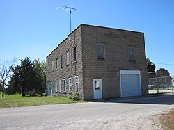 Cedar Hall | |
 Cedar  Cedar | |
| Coordinates: 41°12′44″N92°31′33″W / 41.21222°N 92.52583°W | |
| Country | United States |
| State | Iowa |
| County | Mahaska |
| Elevation | 814 ft (248 m) |
| Time zone | UTC-6 (Central (CST)) |
| • Summer (DST) | UTC-5 (CDT) |
| ZIP code | 52543 [1] |
| Area code | 641 |
| GNIS feature ID | 455220 [2] |
Cedar is an unincorporated community in southeastern Mahaska County, Iowa, United States. It lies along Iowa Highway 23 southeast of the city of Oskaloosa, the county seat of Mahaska County. [3]
Cedar has a Methodist church, Christian Reformed church, and a grain elevator.
