
Interstate 86 (I-86) is an east–west intrastate Interstate Highway located entirely within the state of Idaho. It runs approximately 63 miles (101 km) from an intersection with I-84 east of Declo in rural Cassia County, to an intersection with I-15 in Chubbuck, just north of Pocatello. The highway is part of the main route from Boise and Twin Falls to Idaho Falls and the upper Snake River region.
Rogerson is an unincorporated community in Twin Falls County, Idaho, United States. It is located approximately 18 miles north of the Nevada border on U.S. Route 93, about seven miles east of Salmon Falls Dam. Rogerson had a post office 1910-1961.

Interstate 84 (I-84) in the U.S. state of Idaho is a major Interstate Highway that traverses the state from the Oregon state line in the northwest to Utah state line in the southeast. It primarily follows the Snake River across a plain that includes the cities of Boise, Mountain Home, and Twin Falls. The highway is one of the busiest in Idaho and is designated as the Vietnam Veterans Memorial Highway.

Interstate 90 (I-90) is a transcontinental Interstate Highway that runs east–west across the northern United States. Within the state of Idaho, the freeway travels for 74 miles (119 km) from the Washington border near Spokane to Coeur d'Alene and the panhandle region at the north end of the state. After traveling through the Silver Valley along the Coeur d'Alene River in the Bitterroot Range, I-90 crosses into Montana at Lookout Pass.

U.S. Route 30 (US 30) runs northwest–southeast across the southern half of lower Idaho for 455.481 miles (733.026 km). US 30 enters the state from Oregon across the Snake River in Fruitland and exits into Wyoming east of Dingle. US 26 runs through the large population centers of Boise, Twin Falls, and Pocatello, as well as a plethora of smaller communities from Fruitland to Montpelier. The Thousand Springs Scenic Byway is a picturesque section of US 30 in southern Idaho between the towns of Bliss and Buhl, dipping down into the Hagerman Valley and a canyon of the Snake River.
State Highway 74 (SH-74) is a short state highway that travels between U.S. Route 93 and U.S. Route 30 in downtown Twin Falls. The road is located entirely in Twin Falls County.

Twin Falls is a waterfall in the western United States, on the Snake River in the Snake River Canyon of south-central Idaho. The falls are located on the border of Jerome and Twin Falls counties, a few miles east of its namesake city, Twin Falls. They are upstream (east) of Pillar Falls and Shoshone Falls and just downstream from Milner Dam.
State Highway 46 (SH-46) is a 57.222-mile-long (92.090 km) state highway in southern Idaho that runs north–south across the Magic Valley region. It connects U.S. Route 30 (US-30) in Buhl to Interstate 84 (I-84) in Wendell, US-26 in Gooding, and US-20 east of Fairfield.
State Highway 50 (SH-50) is a 8.092-mile-long (13.023 km) state highway in the U.S. State of Idaho. SH-50 starts at U.S. Route 30 (US-30) before connecting to Interstate 84 (I-84) and ending at SH-25. It provides eastern access to the city of Twin Falls from I-84.
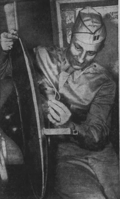
The Twin Falls saucer hoax was a hoaxed flying disc discovered in Twin Falls, Idaho, United States, on July 11, 1947. Amid a nationwide wave of alleged "flying disc" sightings, residents of Twin Falls reported recovering a 30 in (76 cm) "disc". FBI and Army officials took possession of the disc and quickly proclaimed the object to be a hoax. Press reported that local teenagers admitted to perpetrating the hoax.
Godwin is an unincorporated community in Twin Falls County, Idaho, United States, roughly 6 miles (9.7 km) southwest of Twin Falls. Godwin is located at the junction of U.S. Route 93 and Idaho State Highway 74.
Amsterdam is an unincorporated community in Twin Falls County, Idaho, United States, roughly 19 miles (31 km) south-southwest of Twin Falls. Amsterdam is located along U.S. Route 93. Amsterdam had a post office 1912–1954.
Curry is an unincorporated community in Twin Falls County, Idaho, United States, roughly 5 miles (8.0 km) west of Twin Falls. Curry is located along U.S. Route 30.
Deep Creek is an unincorporated community in Twin Falls County, Idaho, United States, roughly 4 miles (6.4 km) west of Buhl. Deep Creek had a post office 1909–1913.
Fairview is an unincorporated community in Twin Falls County, Idaho, United States, roughly 4.5 miles (7.2 km) south-southwest of Buhl.
Rock Creek is an unincorporated community in Twin Falls County, Idaho, United States, roughly 12 miles (19 km) southeast of Twin Falls. Rock Creek had a post office 1871–1975.
Knull is an unincorporated community in Twin Falls County, Idaho, United States, roughly 7.75 miles (12.47 km) southwest of Twin Falls.
Clover is an unincorporated community in Twin Falls County, Idaho, United States, roughly 6 miles (9.7 km) south-southwest of Filer.
Peavey is an unincorporated community in Twin Falls County, Idaho, United States, roughly 2.5 miles (4.0 km) west-northwest of Filer. Peavey had a post office from 1907–1909. Pevey is located along U.S. Route 30.
Artesian City is an unincorporated community in Twin Falls and Cassia counties in Idaho, United States, roughly 2.5 miles (4.0 km) west-northwest of Filer. Artesian City had a post office from 1907–1909.


