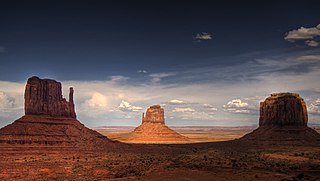
In geomorphology, a butte is an isolated hill with steep, often vertical sides and a small, relatively flat top; buttes are smaller landforms than mesas, plateaus, and tablelands. The word butte comes from the French word butte, meaning knoll ; its use is prevalent in the Western United States, including the southwest where mesa is used for the larger landform. Due to their distinctive shapes, buttes are frequently landmarks in plains and mountainous areas. To differentiate the two landforms, geographers use the rule of thumb that a mesa has a top that is wider than its height, while a butte has a top that is narrower than its height.

The Issaquah Alps is the unofficial name for the highlands near Issaquah, Washington, a suburb of Seattle, including Cougar Mountain, Squak Mountain, Tiger Mountain, Taylor Mountain, Rattlesnake Ridge, Rattlesnake Mountain, and Grand Ridge. The term was invented in 1977 by noted nature author Harvey Manning within the pages of his trail guidebook Footsore 1, elevating their status from foothills to "Alps" to advocate preservation. Manning himself lived on a developed section of Cougar Mountain in his "200 meter hut".

Cedar Creek is a tributary of the Cannonball River in southwestern North Dakota in the United States.

Fields Spring State Park is a 828-acre (3.35 km2) public recreation area in the northwest United States, located in southeastern Washington on State Route 129, four miles (6 km), south of Anatone.

Steptoe Butte is a quartzite island jutting out of the silty loess of the Palouse hills in Whitman County, Washington, in the northwest United States. The 3,612-foot (1,101 m) butte is preserved as Steptoe Butte State Park, a publicly owned 150-acre (61 ha) recreation area located 12 miles (19 km) north of Colfax.
Stamford Bridge may refer to:

Powell Butte is an extinct cinder cone butte in Portland, Oregon, United States. It is part of the Boring Lava Field, which includes more than 80 small volcanic edifices and lava flows in the Portland–Vancouver metropolitan area. The region around Powell Butte has a cool climate, and the butte and its surroundings feature meadows, rivers, and mixed forests. Powell Butte hosts the Powell Butte Nature Park, which includes about 612 acres (2.48 km2) of trails for biking, hiking, and horseback riding.
The Red Buttes Wilderness is a wilderness area in the Klamath and Rogue River national forests in the U.S. states of Oregon and California. It comprises 19,940 acres (8,070 ha), approximately 16,190 acres (6,550 ha) of which is located in California, and 3,750 acres (1,520 ha) in Oregon. It was established by the California Wilderness Act of 1984 and the Oregon Wilderness Act of 1984.

The Salmon–Huckleberry Wilderness is a wilderness area located on the southern side of Mount Hood in the northwestern Cascades of Oregon, in the United States. It lies within the Mount Hood National Forest and comprises 62,061 acres (25,115 ha) of land. The United States Congress designated the area Wilderness in 1984.

McCroskey State Park—officially Mary Minerva McCroskey State Park—is a public recreation area in the Pacific Northwest of the United States, located in the Palouse region of northern Idaho. The park's 5,300 acres stretch along a ridge in Latah and Benewah Counties, along the border with Washington.

Mount Washington is a small mountain in the US state of Washington roughly 30 miles (48 km) east-southeast of Seattle, Washington along Interstate 90. It lies on the western margin of the Cascade Range just above the coastal plains around Puget Sound, and is southeast of nearby town of North Bend.

Santiam State Forest is one of six state forests managed by the Oregon Department of Forestry. The forest is located approximately 25 miles (40 km) southeast of Salem, Oregon, and includes 47,871 acres (193.73 km2) on the western slope of the Cascade Mountains in three Oregon counties: Clackamas, Linn, and Marion. It is bounded on the east by the Willamette National Forest and Mount Hood National Forest. Silver Falls State Park is located west of the forest. The rest of the land surrounding the forest belongs to the Bureau of Land Management or is privately owned. The forest is managed as part of the Department of Forestry's North Cascade District.
Phlaocyonini is an extinct clade or tribe of hypocarnivorous borophagines. They were endemic to North America and from the Oligocene epoch to the Miocene living ~33.3–5.3 Ma, existing for approximately 28 million years.
East Adams is an unorganized territory in Adams County, North Dakota, United States. As of the 2010 census it had a population of 161. East Adams comprises the territory of the former townships of Cedar Butte, Dakota, Kansas City, Spring Butte, and North Lemmon.
The following low-power television stations broadcast on digital or analog channel 5 in the United States:
The following television stations operate on virtual channel 2 in the United States:
Cedar Butte is an unincorporated community in Mellette County, in the U.S. state of South Dakota.
Cedar Butte may refer to:
The 1940 United States presidential election in Nebraska took place on November 5, 1940, as part of the 1940 United States presidential election. Voters chose seven representatives, or electors, to the Electoral College, who voted for president and vice president.

