In 1861 the Llynvi Valley Railway was opened in Glamorganshire, Wales, to convey mineral products to the Bristol Channel at Porthcawl. It adopted an earlier tramroad, the Duffryn Llynvi and Porthcawl Railway. The Llynvi and Ogmore Railway was opened in 1865, and the two companies amalgamated to form the Llynvi and Ogmore Railway in 1866. At first Porthcawl harbour was an important destination for onward transport, but this soon declined.
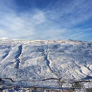
The geology of Wales is complex and varied; its study has been of considerable historical significance in the development of geology as a science. All geological periods from the Cryogenian to the Jurassic are represented at outcrops, whilst younger sedimentary rocks occur beneath the seas immediately off the Welsh coast. The effects of two mountain-building episodes have left their mark in the faulting and folding of much of the Palaeozoic rock sequence. Superficial deposits and landforms created during the present Quaternary period by water and ice are also plentiful and contribute to a remarkably diverse landscape of mountains, hills and coastal plains.

Fan Fawr is a mountain in the Fforest Fawr section of the Brecon Beacons National Park, in Powys, Wales and over 734 m (2,408 ft) high.

Fan Nedd is a mountain in the Fforest Fawr area of the Brecon Beacons National Park in Wales. In common with the rest of the Fforest Fawr uplands it is within the county of Powys.

Fan Llia is a subsidiary summit of Fan Fawr in the Fforest Fawr section of the Brecon Beacons National Park, Wales. In common with other peaks in the Fforest Fawr uplands it lies within the county of Powys.
Fan Bwlch Chwyth is a peak in the Fforest Fawr section of the Brecon Beacons National Park and within the county of Powys.
Cefn Llechid is a small area of unenclosed land in the Brecon Beacons National Park east of Sennybridge in the county of Powys, Wales. It lies within Fforest Fawr Geopark. Its plateau-like summit surface peaks at 400m where it is marked by a trig point. A couple of small bodies of water lie in a hollow on the plateau. The hill is owned and managed by the Brecon Beacons National Park Authority.
Cefn Cul is a hill in the Fforest Fawr sector of the Brecon Beacons National Park in Powys, southern Wales. It is a broad north-northeast to south-southwest aligned ridge whose summit reaches a height of 562 m above sea level. The hill is bounded to the west by the upper valley of the River Tawe though which the old Trecastle road runs whilst to the east is the pass of Bwlch Bryn-rhudd over which the A4067 road runs from the Crai valley south to that of the Tawe.
Cadair Fawr is a hill in the northern corner of the county borough of Rhondda Cynon Taf, Wales. It lies within the Brecon Beacons National Park and Fforest Fawr Geopark. The 485m high summit at OS grid ref SN 978123 is marked by a trig point. Cadair Fawr is the highest point of a broad ridge known as Cefn Cadlan which forms the northern edge of Cwm Cadlan, a valley which itself runs east-northeastwards from the village of Penderyn. The name Cadair Fawr signifies the 'big chair' whilst Cefn Cadlan signifies the 'ridge of the battlefield'.
Mynydd Carn-y-cefn is the name given to the broad ridge of high ground between the Ebbw Vale and the valley of the Ebbw Fach in the Valleys region of South Wales. It lies within the unitary area of Blaenau Gwent, formerly Monmouthshire.
Cefn Manmoel is the name given to the broad ridge of high ground between the Sirhowy Valley and Ebbw Vale in the Valleys region of South Wales. It straddles the boundary between the unitary areas of Caerphilly and Blaenau Gwent.

Mynydd Cilfach-yr-encil attains a height of 445m at OS grid reference SO 079033 making it the high point of the broad ridge of high ground between Taff Vale and Cwm Bargod in the Valleys region of South Wales. It lies within the unitary area of Merthyr Tydfil.
Cefn y Brithdir is the name given to the broad ridge of high ground between the Rhymney Valley and Cwm Darran in the Valleys region of South Wales. It lies within the unitary area of Caerphilly.

The Sherwood Sandstone Group is a Triassic lithostratigraphic group which is widespread in Britain, especially in the English Midlands. The name is derived from Sherwood Forest in Nottinghamshire which is underlain by rocks of this age. It has economic importance as the reservoir of the Morecambe Bay gas field, the second largest gas field in the UK.

Coity Higher is a community in Bridgend County Borough, south Wales. It contains the north western suburbs of Bridgend which includes the villages of Litchard and Coity. The southern boundary of the community adjoins the community of Brackla, while the northern border is defined by the M4 motorway. Notable buildings and landmarks within the community include Coity Castle, Parc Prison, the 14th century Church of St Mary, Pendre Hospital, Ty Mawr house and a burial chamber. At the 2001 census, the community's population was 835, being re-measured at 6,078 t the 2011 Census.
Mynydd Llangeinwyr is the highest hill in the county borough of Bridgend in the coalfield of South Wales. It forms a long north-south ridge between the valleys of Cwm Garw to the west and Cwm Ogwr Fawr to the east. The highest point of the ridge is the 568-metre flat dome known as Werfa which is crowned by a trig point and prominent masts. A secondary trig point is sited at a height of 530 m near to the ancient cairn of Carn-yr-hyrddod. The hill is named from the village of Llangeinor below its southern tip.
Cefn Eglwysilan is a hill in South Wales, the twin 382m summits of which lie 2 km east of Pontypridd in Rhondda Cynon Taf county borough. Its eastern side lies within the community of Aber Valley in Caerphilly county borough. Like neighbouring Mynydd Eglwysilan, the hill is named after the hamlet of Eglwysilan, the church here being dedicated to an obscure saint Ilan. A wireless transmission station is sited on the more northerly of the two summits. The southerly one is crowned by a trig point.
Mynydd y Gaer is a 295-metre-high hill in Bridgend County Borough in South Wales. The summit is crowned by a trig point.
Cefn Gwyngul is a long broad ridge to the east of the Rhondda Fach valley in Rhondda Cynon Taf County Borough in South Wales. Its 470m high summit is marked by an ancient cairn known as Carn-y-Pigwn, on which is a more recent trig point. Much of the hill is cloaked by modern forestry plantations though its southwestern flank between Porth and Ferndale has not been coniferised. The earthworks of a Roman camp remain on the ridge at OS grid ref ST 002982.

Mynydd William Meyrick is a 535-metre-high hill straddling the boundary of Bridgend and Rhondda Cynon Taf county boroughs between the valley of the Rhondda Fawr and Ogmore Valley in South Wales. It takes the form of a broad northwest-southeast ridge with numerous broad shoulders extending to the east, south and west, each of which have different names and some of which constitute minor tops. Listed clockwise from the north these are; Mynydd Maendy, Mynydd Ton, Mynydd Bwllfa, Mynydd Pwllyrhebog, Mynydd Maes-teg, Mynydd y Gwair and Mynydd yr Aber. The summit of the entire massif is often referred to as Mynydd Ton. Its western sides are open moorland whilst its eastern sides have been afforested by the Forestry Commission.