Chachapoyas | |
|---|---|
 | |
 | |
| Country | Peru |
| Region | Amazonas |
| Province | Chachapoyas |
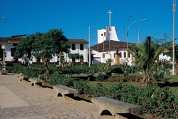
| Capital | Chachapoyas, Peru |
| Government | |
| • Mayor | Víctor Raúl Culqui Puerta (2019-2022) |
| Area | |
• Total | 153.78 km2 (59.37 sq mi) |
| Elevation | 2,335 m (7,661 ft) |
| Population (2017) | |
• Total | 32,589 |
| • Density | 210/km2 (550/sq mi) |
| Time zone | UTC-5 (PET) |
| UBIGEO | 010101 |
Chachapoyas District is one of twenty-one districts of Chachapoyas Province in Peru. [1]