Cocabamba Kukapampa | |
|---|---|
 | |
| Coordinates: 6°36′50″S78°0′18″W / 6.61389°S 78.00500°W | |
| Country | |
| Region | Amazonas |
| Province | Luya |
| Founded | February 5, 1861 |
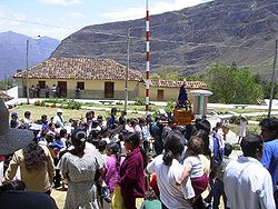
| Capital | Cocabamba |
| Government | |
| • Mayor | Juan Carlos Regalado Saldaña |
| Area | |
• Total | 355.85 km2 (137.39 sq mi) |
| Elevation | 2,500 m (8,200 ft) |
| Population | |
• Total | 2,133 |
| • Density | 6.0/km2 (16/sq mi) |
| Time zone | UTC-5 (PET) |
| UBIGEO | 010503 |
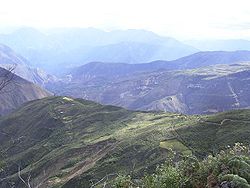
Cocabamba is a district of the province of Luya in the Amazonas Region of Peru.