Krishna district is a district in the coastal Andhra Region in Indian state of Andhra Pradesh, with Machilipatnam as its administrative headquarters. It is surrounded on the East by Bay of Bengal, West by Guntur, Bapatla and North by Eluru and NTR districts and South again by Bay of Bengal.

East Godavari is a district in the Coastal Andhra region of Andhra Pradesh, India. Its district headquarters is at Rajamahendravaram.

The West Godavari district is a coastal district in the Indian state of Andhra Pradesh with an administrative headquarters in Bhimavaram. As of the 2011 Census of India, the district has an area of 2,178 km2 (841 sq mi) and a population of 1,779,935. It is bounded by the Krishna district and Bay of Bengal to the south, East Godavari district to the east, and Eluru district, Kolleru Lake and Upputeru Drain to the northwest.

Perambalur is one of the 38 districts in the state of Tamil Nadu, India. The district headquarters is located at Perambalur. The district occupies an area of 1,752 km2 and had a population of 565,223 with a sex-ratio of 1,003 females for every 1,000 males in 2011.

Kovvur is a town in the East Godavari district of the Indian state of Andhra Pradesh. It is a municipality and the mandal headquarters of Kovvur mandal in Kovvur revenue division.

Etah district is one of the districts of Uttar Pradesh, India, since 1854. Etah City is the district headquarters. Etah district is a part of Aligarh Division.

Nidadavole is a town in East Godavari district of the Indian state of Andhra Pradesh. It is a municipality and the mandal headquarters of Nidadavole mandal in Kovvur revenue division.
Vuyyuru is a town in Krishna district of the Indian state of Andhra Pradesh. It is a Nagar panchayat and the headquarters of Vuyyuru Mandal. It is emerging as neighbourhood of Vijayawada, India situated 30 km away.

Anaparthi is a Town located in Anaparthy mandal, in East Godavari district of the Indian state of Andhra Pradesh. The town was named after King Anapotha Reddy(1353 AD–1364 AD) of the Rajamahendravaram Dynasty(1325 AD - 1448 AD). Almost all the residents of this Town are of the same social Forward open community Reddy,.

Achanta is a Town in Achanta mandal of West Godavari district in the Indian state of Andhra Pradesh.
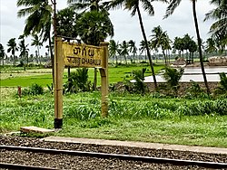
Marteru is a village in Penumantra Mandal, West Godavari district, Andhra Pradesh, India. The village is famous for rice research center, established by the Government of India to conduct research on paddy crops. The center developed many new varieties of rice seeds. The nearest railway station is Chinta Parru Halt (CTPR) located at a distance of 10.51 Km.
Brahmanagudem is a village in East Godavari district of the Indian state of Andhra Pradesh. It is located in Chagallu mandal. Brahmanagudem (BMGM) has its own railway station.
Kalavalapalli is a village in Chagallu mandal in West Godavari district in Andhra Pradesh state in India. Brahmanagudem Railway Station and Chagallu Railway Station are the nearest railway stations.
Markondapadu is a village near by a town Nidadavole (South-West) and Kovvur (North-East) in Chagallu mandal, West Godavari District, Andhra Pradesh State, India. This village is a bramin agharam since hundred of years who are the owners of thousands of aches of land. The vast water body which gets its water from the near by Kovvada stream which is dug during the time of Kakatiya kings of Nidadavolu, which is the in law's town of the mighty queen Rudhrama Devi.
Duvva is a village in West Godavari district of the Indian state of Andhra Pradesh. It is located in Tanuku mandal of Kovvur revenue division. The nearest railway station is Satyavada (STVA) located at a distance of 5.77 Km from Duvva.
Other uses, see Madhavaram (disambiguation)
Kovvur mandal is one of the 19 mandals in East Godavari district of the Indian state of Andhra Pradesh. Its headquarters are located in the town of Kovvur. The mandal is bounded by Nidadavole, Chagallu, Devarapalle, Tallapaudi mandals and on the east by the Godavari River.
Prakasaraopalem is a village in Nallajerla mandal, West Godavari district, Andhra Pradesh, India.

Biccavolu mandal is one of the 19 mandals in East Godavari district of the Indian state of Andhra Pradesh. It is under the administration of Rajahmundry revenue division and the headquarters are located at Biccavolu village. Biccavolu Mandal is bounded by Rayavaram Mandal towards South, Pedapudi Mandal towards East, Anaparthy Mandal towards west, Ramachandrapuram Mandal towards north. It is located ata distance of 41 kilometres from Rajahhmundry.
Unguturu mandal is one of 28 mandals in the Eluru district of the Indian state of Andhra Pradesh. The headquarters are located at Unguturu. The mandal is bordered by Tadepalligudem mandal and Pentapadu mandal to the north, Nallajerla mandal to the west, Nidamarru mandal to the east, and by Dwaraka Tirumala mandal and Bhimadole mandal to the south