
The Nansei Islands subtropical evergreen forests is a terrestrial ecoregion of the Ryukyu Islands, also known as the Nansei Islands, in Japan. The Nansei Islands are an island arc that stretches southwest from Kyushu towards Taiwan. The larger islands are mostly volcanic islands and the smaller ones mostly coral. The largest is Okinawa Island. The highest point is Mount Miyanoura on Yakushima Island at 1,936 metres.

The East Siberian taiga ecoregion, in the Taiga and boreal forests biome, is a very large biogeographic region in eastern Russia.

The Western Great Lakes forests is a terrestrial ecoregion as defined by the World Wildlife Fund. It is within the temperate broadleaf and mixed forests biome of North America. It is found in northern areas of the United States' states of Michigan, Wisconsin and Minnesota, and in southern areas of the Canadian province of Manitoba and northwestern areas of the province of Ontario.

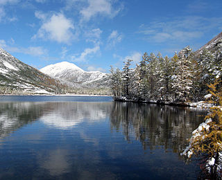
Sokhondo Nature Reserve is a Russian 'zapovednik' in the south of Eastern Siberia, 25 km north of the border with Mongolia. It is the farthest source of the Amur River, and is centered on the Sokhondo Mountain massif, in the highest sector of the Khentei-Chikoy Highlands in the Khentei Range mountain range. The Sokhondo massif has two peaks, and is an ancient volcano. Also within the borders are many lakes of glacial origin. In 1985, Sokhondo was named a UNESCO MAB Biosphere Reserve. The reserve is situated in the Chita district of Chita Oblast.
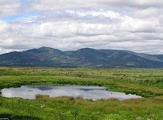
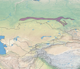
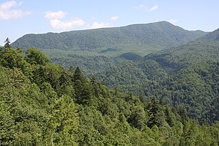
The Transbaikal conifer forests ecoregion covers a 1,000 km by 1,000 km region of mountainous southern taiga stretching east and south from the shores of Lake Baikal in the Southern Siberia region of Russia, and including part of northern Mongolia. Historically, the area has been called "Dauria", or Transbaikal. It is in the Palearctic realm, and mostly in the boreal forests/taiga biome with a subarctic, humid climate. It covers 200,465 km2 (77,400 sq mi).

The Northeast Siberian taiga ecoregion is an area of "sparse taiga forest" between the Lena River and the Kolyma River in northeastern Siberia, Russia. The ecoregion's internal borders form a patchwork of territory constituting the southern part of the East Siberian Lowland, as well as lowlands around the East Siberian Mountains, including the ridges and peaks of the Verkhoyansk Range and the Chersky Range. On the southern border of the ecoregion is the north coast of the Sea of Okhotsk, giving the region maritime boreal forests as well as the continental forests situated inland. The ecoregion is one of the largest tracts of virgin boreal forest in the world, due to the very sparse population and difficult access. It is mostly in the Sakha Republic.
The Okhotsk-Manchurian taiga ecoregion is an area of coniferous forests in the Russian Far East, covering the Amur River delta, the west coast of the Okhotsk Sea, and the rugged extension of the northern Sikhote-Alin Mountains that run southwest-to-northeast through the Primorsky and Khabarovsk regions. It is the southernmost taiga forest in Eurasia. The ecoregion is distinguished from surrounding ecoregions by the slightly warmer climate due to the maritime influence and the shield of the mountains to the west, and by the mixing of flora and fauna species from Okhotsk-Kamchatka communities to the north and Manchurian species from the south. The forest at lower altitudes is "light taiga", and "dark taiga" at higher altitudes.
The West Siberian broadleaf and mixed forests, also known as the Western Siberian hemiboreal forests, is an ecoregion in Russia. It consists of a thin band of mixed forest along the southernmost edge of the West Siberian taiga in Western Siberia, and north of the forest steppe belt. The biodiversity of the zone is the highest in Siberia, due to its transitional position between many different ecoregions. The area acts as a long corridor for migration of animals along the east-west axis. The ecoregion is in the Palearctic realm, with a Humid Continental climate. It covers 223,516 km2 (86,300 sq mi).

The Ussuri broadleaf and mixed forests ecoregion covers a mountainous areas above the lower Amur River and Ussuri River in Primorsky Krai and Khabarovsk Krai in the Russian Far East. The ecoregion is in the Palearctic realm, with a Humid Continental climate. It covers 187,357 km2 (72,339 sq mi).
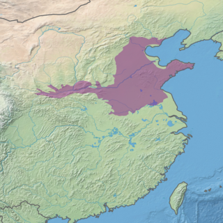
The Huang He Plain mixed forests ecoregion covers the flat lower ranges of the Yellow River. This area is generally known as the North China Plain. While there is some forest habitat, the region has mostly been converted to agriculture, being one of the most populous areas in the world.

The Helanshan montane conifer forests ecoregion covers an isolated, forested mountain range surrounded by desert and semi-arid basins. As such, it has been called a "mountain island in the sky", and supports endemic species of plants and animals. The region supports the endangered Helan Shan pika.
The Manchurian mixed forests ecoregion covers the forested hills surrounding the river plains of northern China, Russia, North Korea, and South Korea. The ecoregion supports a number of rare species due to the relative isolation, the diversity of habitat, with mixed forests of deciduous Mongolian oak and conifers of Korean pine. Because mountains rise above the region on three sides, with plains and wetlands below, the area supports high biodiversity as a transition zone.

The Carpathian montane conifer forests, also known as Carpathian montane forests, is a temperate coniferous forests ecoregion in the Carpathian Mountains of the Czech Republic, Poland, Slovakia, Romania, and Ukraine.
The Central Korean deciduous forests is a temperate broadleaf and mixed forests ecoregion on the Korean Peninsula, covering portions of South Korea and North Korea.

The Hokkaidō deciduous forests ecoregion covers the northern and southern coasts of the island of Hokkaido, the northernmost of the main islands of Japan. The region sits in the transition zone between the colder subarctic forests to the north and the more temperate forests to the south. Characteristic trees include Mongolian oak, Basswood, and Ash trees.
The Hokkaido montane conifer forests ecoregion covers the mountainous central regions of Hokkaido Island, the northernmost of Japan's main islands. Forests of spruce and fir thrive in the subalpine, cool climate. On the northeastern edge of the island, the conifer forests extend down to the sea under the influence of the cold Oyashio Current coming down from the north, although logging in recent years has put pressure on these stands.

