Changdeva Temple

Last updated
Changdeva temple
Changdeva Mandir
Stone carved Idols of Hindu deities lying at Changdev Temple Muktainagar Dist. Jalgaon Maharashtra India (2).JPG
Stone carved Idols of Hindu deities lying at Changdev Temple Muktainagar Dist. Jalgaon Maharashtra India (7).JPG
Architchture on the Changdev Temple walls Muktainagar Dist Jalgaon P1220210 (22).JPG
TempleArchitecture.JPG
Changdev Temple Muktainagar Dist Jalgaon P1220210 (3).JPG
Clockwise - Idols found in Archeological Survey of India's excavation : Ganpati idol, Lord Vishnu's idol, stone sculpture of Hanuman, wide view of Changdeva temple from South side of the temple, external wall sculptures of Apsaras on Changdeva temple.
Changdeva temple near Muktainagar, India
Religion
Affiliation Hinduism
DistrictJalgaon
Deity Changdeva Maharaj
Festival Mahashivratri
StatusActive
Location
LocationChangdeva, Muktainagar taluka, Jalgaon district, Maharashtra, India.
StateMaharashtra
CountryIndia
Geographic coordinates 21°05′31″N76°00′22″E / 21.09194°N 76.00611°E / 21.09194; 76.00611
Architecture
Architect(s) Unknown
Style Hemadpanthi
FounderUnknown
Date establishedUnknown
Specifications
Length31 meter
Width11 meter
Height (max)31 feet (Approximately)
Temple(s)3
InscriptionsNo inscription found so far
Materials Black rock, chalk, and in repair somewhere in couple of decades back, flat bricks used
Elevation219 m (719 ft)

Changdeva temple (also referred as Changdev Maharaj Temple) is an ancient[ specify ] Hindu temple situated in Muktainagar taluka of Jalgaon district in the state of Maharashtra, India. It is located near its namesake, Changdeva village. The temple is on the shore of the Purna river. [1] It is dedicated to the 12th century Yogi Saint Changdeva Maharaj.

Contents

History

Legend - According to a legend associated with this temple. This temple was built in between the time, When six months long night experienced. [2]

In the year of 2008, Archeological Survey of India (ASI) carried out excavations near the West and South sides of the temple. Where they discovered foundations of stone temples. ASI also found Ganpati idols made of black rock. Throughout the following years, they carried out ad-hoc excavations near this temple and revealed the veranda, foundations of ancient temples, steps, the Garbahgriha, and a large Shiva linga. [1] According to the Maharashtra Times's article of December 2013, the temple's original kadas collapsed in the flood of 1837. [3]

Architecture

Changdeva temple is situated near Purna river. The temple is built in black rock in the Hemadpanthi architecture style. The people who built this temple used only dove-tailed black rocks and chalk in construction. The walls of the temple are adorned with stone-carved sculptures of women in various graceful poses. They appear wearing Indian attire like Apsaras, probably these women statues on the external walls are of Apsaras. The temple has a stone idol of Changdeva Maharaj in its Garbhagruh . Idols discovered during excavations by the ASI are displayed in the open air near the temple. The temple has its main gate on the North side, with a large mandap in front without a roof. The temple is 10 meters long by 9 meters wide. [4] Mahadeva and Shani Dev temples are located just a few feet away from this temple. [5] This temple is under the custody of the Archaeological department of Aurangabad. It is a protected monument. [6]

Annual fair

Every year in the month of February, on the auspicious occasion of Mahashivaratri , a big fair is held here. People from all around North Maharashtra visit the temple to receive the blessings of Changdeva Maharaj. [4] Hundreds of thousands of devotees visit this temple during this annual fair. [5] This fair is one of the well-known fairs of North Maharashtra. [7] Over the years, it has developed as a tourist destination. The temple is located at the confluence of the Tapi and Purna rivers. The Tapi river arrives from Madhya Pradesh, and the Purna flows from Muktainagar taluka. During the fair, devotees enjoy boat rides in this river. Because of the Hatnur dam the river here and at Muktainagar taluka has full water throughout the year. The panoramic view of the Purna river here is a popular sight for tourists. [6] People of the varkari samparaday annually comes here on Mahashivaratri. [8]

Related Research Articles

<span class="mw-page-title-main">Buldhana district</span> District of Maharashtra in India

Buldhana district is located in the Amravati division of Maharashtra, India. It is situated at the western border of Vidarbha region and is 500 km away from the state capital, Mumbai. The district has towns and cities like Shegaon, Jalgaon Jamod, Malkapur, Khamgaon, Lonar, Mehkar, and Chikhli. It is surrounded by Madhya Pradesh in the north, Akola, Washim, and Amravati districts on the east, Jalna district on the south, and Jalgaon and Aurangabad districts on the west. Malkapur is the largest city in the district.

Mehkar is a tabletop tehsil and a municipal council situated in Buldhana district of the Indian state of Maharashtra. Located at the bank of Painganga River, Mehkar falls in the Vidarbha region of Maharashtra.

<span class="mw-page-title-main">Amravati district</span> District of Maharashtra in India

Amravati district is a district of Maharashtra state in central India. It is the administrative headquarter of Amravati division, which is one of the two divisions in Vidarbha, out of total 6 regions in state of Maharashtra.

<span class="mw-page-title-main">Pratapgad</span> Fort in Satara district, Maharashtra

Pratapgad is a mountain fort located in Satara district, in the Western Indian state of Maharashtra.The fort is situated 24 kilometres from the Mahabaleshwar hill station. The fort is now a popular tourist destination.

<span class="mw-page-title-main">Purna River (tributary of Tapti)</span> River in Maharashtra, India

The Purna River is a river of Western India. It is one of the chief tributaries of the Tapti river and empties into it at Changdev in Jalgaon, Maharashtra.

Wai is a town in Satara district of Maharashtra state in India. Located on the Krishna River, Wai was a prominent town during the Peshwa era. Two important Marathi Brahmin from ruling families had their origins here: Rani Lakshmibai of Jhansi and Gopikabai, wife of Nanasaheb Peshwa.

Akkalkot is a City and a municipal council in Solapur district in the Indian state of Maharashtra. It is situated 38 km southeast of Solapur and close to the border of Karnataka state.

<span class="mw-page-title-main">Chiplun</span> City in Maharashtra, India

Chiplun is a city in Ratnagiri district in the state of Maharashtra, India. It is the financial and commercial Hub of Ratnagiri, and the headquarters of Chiplun taluka. It is about 320 km south of Mumbai in the Konkan region of Maharashtra, on the Mumbai–Goa highway (NH-66). It has a long history and a strong cultural background. Recent decades have seen much industrial development in it and its and surrounding areas.

Changdev is situated in Muktainagar taluka in Jalgaon district of Maharashtra, India. The town got its name from yogi Changdev Maharaj, a saint who is believed to have stayed here for 1400 years. The town is situated about of 5 km from National Highway 6 and Hartala intersection.

Varangaon is a town in Jalgaon district of Maharashtra in India. It is situated in Bhusawal taluka.

<span class="mw-page-title-main">Parli Vaijnath</span> City in Maharashtra, India

Parli Vaijnath is a city and a municipal council in Beed district in the Indian state of Maharashtra. It is the headquarters of the Parli taluka of Beed district. It is a holy city of sacred importance where many historical places still exist.

<span class="mw-page-title-main">Changdev Maharaj</span> Indian mystic

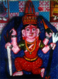
Changdev Maharaj was a mystical yogi turned saint who is believed to have lived in the village of Vateshwar along the banks of the Tapti River for 1,400 years. Per popular belief, Changdev Maharaj achieved Bhuta Siddhi based on his yogic powers and used these powers to perform various supernatural acts. Even though Changdev Maharaj himself is believed to have had held godly status and followers, his current following is mostly amongst Varkaris due to his association with Dnyaneshwar and Muktabai.

Nrusinhawadi commonly known as Narsobawadi or Narsobachi Wadi is a small town in Shirol Tahasil in Kolhapur district, Maharashtra. Narsobawadi gets its name from the presence of 'Shri Nrusinha Saraswati', the Purna Avatar of Lord Dattatreya.

Kukarmunda is one of seven Tehsils of Tapi district in South Gujarat. Originally Kukarmunda was a village and its tehsil Nizar but when the government separated Tapi district from Surat in the year 2007, Kukarmunda became a tehsil. The distance between Kukarmunda and Vyara is about 110 km and Surat is about 178 km. Kukarmunda shares a border with Akkalkuwa Taloda and Shahada tehsil of Nandurbar district of Maharashtra.Total area of Kukarmunda Town is 0.82 KM²

Sakri is a Town/tehsil in Sakri Taluka of Dhule District of Maharashtra state in India. Headquarters for the taluka is the town of Sakri. In Sakri Taluka there is a large town named Pimpalner that has historical importance. Pimpalner hosts a religious fair in the name of Khandoji Maharaj, every year during the time of the Ganesh Festival in the month of Bhadra. Pimpalner is located alongside the Panzara River, which is the lifeline of Dhule District.

<span class="mw-page-title-main">Padmalaya</span> Hindu temple in Erandol, India

Padmalaya is a village in Erandol taluka of Jalgaon district, Maharashtra, India. It lies 10 km from Erandol and 31.5 km from the district headquarters of Jalgaon. The village is known for the Ganesha temple. A pond is located near this temple.

Maruti Temple of Shirsada village, also known as Shirsada's Hanuman Temple, is a Hindu temple located in the village of Shirsada in Bodwad taluka in Maharashtra's Jalgaon district. Its deity is Hanuman.

North Maharashtra is a geographical region in the Maharashtra state of India. It comprises the Nashik, Dhule, Nandurbar, and Jalgaon districts. It borders the state of Gujarat to the northwest, Paschim Maharashtra to the south, Konkan to the west, and Vidarbha and Marathwada regions of Maharashtra to the east.

Dolarkheda is a village in the Muktainagar taluka of Jalgaon district in Maharashtra, India. It is situated in the foothills of the Satpura Mountains and is located in a reserved forest.

<span class="mw-page-title-main">Dhandai Devi</span> Hindu Temple

ShreeKulswamini Dhandai Devi Mandir is a Hindu temple located at Mhasdi near Sakri Taluka in Maharashtra, India. Here, the worship of the goddess Kulswamini Dhandai Devi is carried on right next to the Dhandai Plane, once a center of Hinduism.

References

  1. 1 2 "Need research for Changed temple". Divya Marathi.[ dead link ]
  2. "तापी पूर्णा नद्यांचा अफाट जलसागर पर्यटकांना खुणावतोय". 10 November 2020.
  3. "चांगदेवचे हेमाडपंती मंदिर". Maharashtra Times (in Marathi). Retrieved 2021-07-19.
  4. 1 2 "चांगदेवचे हेमाडपंती मंदिर". Maharashtra Times.
  5. 1 2 "चांगदेव मुक्ताईचा परिसर सुना सुना; यात्रोत्सव प्रथमच खंडित". eSakal - Marathi Newspaper.
  6. 1 2 "The vast body of water of the Tapi Purna River attracts tourists | तापी पूर्णा नद्यांचा अफाट जलसागर पर्यटकांना खुणावतोय | Lokmat.com". LOKMAT. November 10, 2020.
  7. "चांगदेव मुक्ताईचा परिसर सुना सुना; यात्रोत्सव प्रथमच खंडित". eSakal - Marathi Newspaper (in Marathi). Retrieved 2021-07-16.
  8. "तापी पूर्णा नद्यांचा अफाट जलसागर पर्यटकांना खुणावतोय". Lokmat (in Marathi). 2020-11-10. Retrieved 2021-07-19.