Charing Cross, New South Wales

Last updated

Charing Cross
Sydney,  New South Wales
Charing Cross Sydney 1.JPG
Robin Hood Hotel, an example of the Art Deco style
Charing Cross Sydney 3.JPG
Charing Cross Hotel, also in the Art Deco style
Location map Australia Sydney.png
Red pog.svg
Charing Cross
Coordinates 33°54′01″S151°15′13″E / 33.900233°S 151.253576°E / -33.900233; 151.253576
Localities around Charing Cross:
Centennial Park Bondi Junction Bondi
Queens Park Charing Cross Bronte
Randwick Coogee Waverley

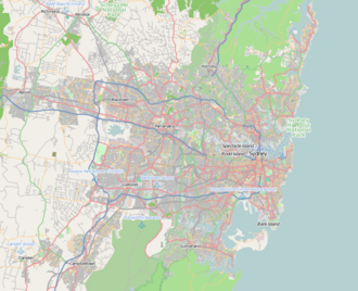
Charing Cross is a precinct in the suburb of Waverley, Sydney, Australia. It is used to describe the intersection of Bronte Road and Carrington Road and the short shopping strip extending to the east along Bronte Road, and is used as a reference point for the homes and schools located around it.

Contents

Brief History

The locality originally called Madden's Corner, was named after Charing Cross, London, England by Waverley Council on 6 September 1859. [1] [2]

Charing Cross was once planned by the council to be the commercial and retail centre of Waverley. It was a much more significant shopping area prior to the rise in importance of Bondi Junction. It fell into decline with shops closing. However, the recent increase of interest in Charing Cross is reflecting the gentrification of the area with the moving in of up-market clothing and gourmet food stores and restaurants.

Sport and recreation

Charing Cross is represented in one of the most popular sporting competitions across Australia, the National Rugby League competition, by the local team the Sydney Roosters. St Charles Junior Rugby League Club, one of the junior clubs in the Roosters Juniors, is also based near Charing Cross.

NSW Heritage items

Notable people

Related Research Articles

<span class="mw-page-title-main">Wollongong</span> City in New South Wales, Australia

Wollongong, colloquially referred to as The Gong, is a city located in the Illawarra region of New South Wales, Australia. The name is believed to originate from the Dharawal language, meaning either 'five islands/clouds', 'ground near water' or 'sound of the sea'. Wollongong lies on the narrow coastal strip between the Illawarra Escarpment and the Pacific Ocean, 85 kilometres south of central Sydney. Wollongong had an estimated urban population of 302,739 at June 2018, making it the third-largest city in New South Wales after Sydney and Newcastle and the tenth-largest city in Australia by population. The city's current Lord Mayor is Gordon Bradbery AM who was elected in 2021.

<span class="mw-page-title-main">Bondi Junction</span> Suburb of Sydney, New South Wales, Australia

Bondi Junction is an eastern suburb of Sydney, in the state of New South Wales, Australia. It is 6 kilometres east of the Sydney central business district and is part of the local government area of Waverley.

<span class="mw-page-title-main">Bronte, New South Wales</span> Suburb of Sydney, New South Wales, Australia

Bronte is a beachside Eastern Suburb of Sydney, in the state of New South Wales, Australia. Bronte Beach is located 7 kilometres east of the Sydney central business district, in the Waverley Council local government area of the Eastern Suburbs.

<span class="mw-page-title-main">Randwick, New South Wales</span> Suburb of Sydney, New South Wales, Australia

Randwick is a suburb in the Eastern Suburbs of Sydney, in the state of New South Wales, Australia. Randwick is located 6 kilometres south-east of the Sydney central business district and is the administrative centre for the local government area of the City of Randwick. The postcode is 2031.

<span class="mw-page-title-main">Eastern Suburbs (Sydney)</span> Region in New South Wales, Australia

The Eastern Suburbs is the eastern metropolitan region of Sydney, New South Wales, Australia.

<span class="mw-page-title-main">North Sydney, New South Wales</span> Suburb of Sydney, New South Wales, Australia

North Sydney is a suburb and major commercial district on the Lower North Shore of Sydney, New South Wales, Australia. North Sydney is located three kilometres north of the Sydney central business district and is the administrative centre for the local government area of North Sydney Council.

<span class="mw-page-title-main">Neutral Bay</span> Suburb of Sydney, New South Wales, Australia

Neutral Bay is a suburb on the Lower North Shore of Sydney, New South Wales, Australia. Neutral Bay is around 1.5 kilometres north of the Sydney central business district, in the local government area of North Sydney Council.

<span class="mw-page-title-main">Coogee, New South Wales</span> Suburb of Sydney, Australia

Coogee is a beachside suburb in the Eastern Suburbs of Sydney, in the City of Randwick. Coogee is located 8 kilometres south-east of the Sydney central business district, in the state of New South Wales, Australia.

<span class="mw-page-title-main">Waverley, New South Wales</span> Suburb of Sydney, New South Wales, Australia

Waverley is a suburb in the Eastern suburbs of Sydney, in the state of New South Wales, Australia. Waverley is located 7 kilometres east of the Sydney central business district, in the local government area of Waverley Council.

<span class="mw-page-title-main">Double Bay</span> Suburb of Sydney, New South Wales, Australia

Double Bay is a harbourside eastern suburb of Sydney, in the state of New South Wales, Australia 4 kilometres east of the Sydney central business district. It is the administrative centre of the local government area of the Municipality of Woollahra.

<span class="mw-page-title-main">Alexandria, New South Wales</span> Suburb of Sydney, New South Wales, Australia

Alexandria is an inner southern suburb of Sydney, New South Wales, Australia. Alexandria is located 5 kilometres south of the Sydney central business district and is part of the local government area of the City of Sydney. The postcode is 2015.

<span class="mw-page-title-main">Waverley Council</span> Local government area in New South Wales, Australia

Waverley Council is a Local government area in the eastern suburbs of Sydney, in the state of New South Wales, Australia. First incorporated on 16 June 1859 as the Municipality of Waverley, it is one of the oldest-surviving local government areas in New South Wales. Waverley is bounded by the Tasman Sea to the east, the Municipality of Woollahra to the north, and the City of Randwick in the south and west. The administrative centre of Waverley Council is located on Bondi Road in Bondi Junction in the Council Chambers on the corner of Waverley Park.

<span class="mw-page-title-main">North Bondi</span> Suburb of Sydney, New South Wales, Australia

North Bondi is a coastal, eastern suburb of Sydney, in the state of New South Wales, Australia 7 kilometres east of the Sydney central business district, in the local government area of Waverley Council.

Bondi is a suburb of eastern Sydney, in the state of New South Wales, Australia, seven kilometres east of the Sydney central business district, in the local government area of Waverley Council.

<span class="mw-page-title-main">Clovelly, New South Wales</span> Suburb of Sydney, New South Wales, Australia

Clovelly is a small beach-side suburb in Sydney's Eastern Suburbs, in the state of New South Wales, Australia. Clovelly is located 8 kilometres south-east of the Sydney central business district, in the local government area of the City of Randwick, within the Federal Division of Wentworth.

The Sydney Roosters Juniors are officially known as the Eastern Suburbs District Junior Rugby League. It is an affiliation of junior clubs in the Eastern Suburbs area, covering the Woollahra and Waverley local government areas (LGAs), the northern parts of the Randwick LGA and the City of Sydney LGA, in Sydney, Australia.

<span class="mw-page-title-main">Charing Cross, Queens Park</span> Historic site in New South Wales, Australia

Charing Cross is a heritage-listed former homestead and former pre-school and now house and childcare centre at 11 Victoria Street, Queens Park, Waverley Municipality, New South Wales, Australia. It was built during 1860 and was added to the New South Wales State Heritage Register on 2 April 1999.

<span class="mw-page-title-main">Mary Immaculate Catholic Church, Waverley</span> Church in New South Wales, Australia

Mary Immaculate Church is a heritage-listed Roman Catholic church and friary at 45 Victoria Street, Waverley, in the Waverley Municipality of Sydney, New South Wales, Australia. It was designed by Sheerin & Hennessy and built from 1890 to 1929 by John Ptolomy and by W. J. Bolton (1929). It is also known as Mary Immaculate Group, St Charles Borromeo Church and Parish House and Minamurra Cottage (former). The property is owned by the Association of Franciscan Friars Bros. It was added to the New South Wales State Heritage Register on 2 April 1999.

Charles "Peter" Moscatt was an Australian rugby league footballer of the 1960s and 1970s. He played for Eastern Suburbs in the New South Wales Rugby League competition. Post-football he was an ardent and active local government councillor in the Waverley municipality in Sydney.

References

  1. "Charing Cross Hotel: a brief history" (PDF). Waverley Council. Archived from the original (PDF) on 9 April 2019. Retrieved 4 November 2015.
  2. Pollon, Frances; Healy, Gerald (1990). The Book of Sydney Suburbs. Angus & Robertson. p. 266. ISBN   978-0-207-14495-0.