Chattanooga, Ohio

Last updated

Chattanooga
Chatt
Unincorporated Community
USA Ohio location map.svg
Red pog.svg
Chattanooga
Location in Ohio
Usa edcp location map.svg
Red pog.svg
Chattanooga
Location in the United States
Coordinates: 40°38′13″N84°47′06″W / 40.63694°N 84.78500°W / 40.63694; -84.78500
CountryUnited States
State Ohio
County Mercer
Elevation
[1]
837 ft (255 m)
Population
  Total418
GNIS feature ID1039008 [1]

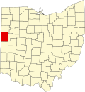
Chattanooga is an unincorporated community located in Mercer County, Ohio.

Contents

Demographics

Chattanooga has a population of 418, with approximately 49.51% males and 50.49% females.[ citation needed ]

Ohio Monument, Missionary Ridge, Chattanooga (10483930894) (1).jpg

History

A post office called Chattanooga was established in 1882, and remained in operation until 1905. [2] Chattanooga is derived from the Cherokee name for "crow's nest". [3] In 1907, Chattanooga had 100 inhabitants. [4] Cities near Chattanooga, Ohio are Celina, OH and New Haven, IN. [5]

Related Research Articles

<span class="mw-page-title-main">Chickasaw, Ohio</span> Village in Ohio, United States

Chickasaw is a village in Mercer County, Ohio, United States. The population was 358 at the 2020 census.

<span class="mw-page-title-main">Montezuma, Ohio</span> Village in Ohio, United States

Montezuma is a village in Mercer County, Ohio, United States. The population was 152 at the 2020 census.

<span class="mw-page-title-main">Dixie Highway</span> United States historic place

Dixie Highway was a United States auto trail first planned in 1914 to connect the Midwest with the South. It was part of a system and was expanded from an earlier Miami to Montreal highway. The final system is better understood as a network of connected paved roads, rather than one single highway. It was constructed and expanded from 1915 to 1929.

<span class="mw-page-title-main">Cranberry Prairie, Ohio</span> Unincorporated community in Ohio, U.S.

Cranberry Prairie is an unincorporated community in southern Granville Township, Mercer County, in the U.S. state of Ohio.

<span class="mw-page-title-main">Center Township, Mercer County, Ohio</span> Township in Ohio, United States

Center Township is one of the fourteen townships of Mercer County, Ohio, United States. The 2020 census found 1,099 people in the township.

<span class="mw-page-title-main">Jefferson Township, Mercer County, Ohio</span> Township in Ohio, United States

Jefferson Township is one of the fourteen townships of Mercer County, Ohio, United States. The 2020 census found 13,802 people in the township.

<span class="mw-page-title-main">Carthagena, Ohio</span> Unincorporated community in Ohio, U.S.

Carthagena is an unincorporated community in Mercer County, Ohio, United States. Established by African Americans, it was home to an agricultural and industrial boarding school for African American and Indian orphans. It located at 40°26′12″N84°33′36″W and has an elevation of 909 feet (277 m).
Plainview is an unincorporated community in Meade County, in the U.S. state of South Dakota.

Neptune is an unincorporated community in Mercer County, in the U.S. state of Ohio.

Mercer is an unincorporated community in Mercer County, in the U.S. state of Ohio.

Macedon is an unincorporated community in Mercer County, in the U.S. state of Ohio.

Erastus is an unincorporated community in Mercer County, in the U.S. state of Ohio.

Wabash is an unincorporated community in Mercer County, in the U.S. state of Ohio.

<span class="mw-page-title-main">Philothea, Ohio</span> Unincorporated community in Ohio, U.S.

Philothea is an unincorporated community in Mercer County, in the U.S. state of Ohio.

Monterey is an unincorporated community in Mercer County, in the U.S. state of Ohio. The elevation of Monterey is 922 feet (281 m). Monterey appears on the Fort Recovery U.S. Geological Survey Map. Mercer County is in the Eastern Time Zone (UTC-5).

<span class="mw-page-title-main">Saint Joseph, Mercer County, Ohio</span> Unincorporated community in Ohio, U.S.

Saint Joseph is an unincorporated community in Mercer County, in the U.S. state of Ohio.

<span class="mw-page-title-main">Sharpsburg, Mercer County, Ohio</span> Unincorporated community in Ohio, U.S.

Sharpsburg is an unincorporated community in Mercer County, in the U.S. state of Ohio.

<span class="mw-page-title-main">Wendelin, Ohio</span> Unincorporated community in Ohio, U.S.

Wendelin is an unincorporated community in Mercer County, in the U.S. state of Ohio.

<span class="mw-page-title-main">St. Rose, Ohio</span> Unincorporated community in Ohio, U.S.

St. Rose is an unincorporated community in Mercer County, in the U.S. state of Ohio.

Blackland is a town and near-ghost town in Rockwall County, Texas, United States. It is located approximately four miles southeast of Rockwall, the county seat on State Highway 276. The town had a population of 49 residents in the 1990 census. The Texas State Historical Association maintains an article on the town on their website.

References

  1. 1 2 U.S. Geological Survey Geographic Names Information System: Chattanooga, Ohio
  2. "Mercer County". Jim Forte Postal History. Retrieved December 18, 2015.
  3. Marsh, Carole (1995). Ohio Indian Dictionary for Kids!. Carole Marsh Books. p. 12. ISBN   9780793377503.
  4. Scranton, S. S. (1907). History of Mercer County, Ohio, and Representative Citizens. Biographical Publishing Company. p. 156.
  5. "Cities Near Me - Chattanooga, Ohio | Travelmath". www.travelmath.com. Retrieved February 23, 2024.